
Rinnthal
| coat of arms | Germany map | |
|---|---|---|

|
Coordinates: 49 ° 13 ' N , 7 ° 56' E |
|
| Basic data | ||
| State : | Rhineland-Palatinate | |
| County : | Southern Wine Route | |
| Association municipality : | Annweiler am Trifels | |
| Height : | 190 m above sea level NHN | |
| Area : | 13.81 km 2 | |
| Residents: | 685 (Dec. 31, 2019) | |
| Population density : | 50 inhabitants per km 2 | |
| Postal code : | 76857 | |
| Area code : | 06346 | |
| License plate : | SOUTH | |
| Community key : | 07 3 37 067 | |
| Association administration address: | Messplatz 1 76855 Annweiler am Trifels |
|
| Website : | ||
| Local Mayor : | Torsten Hertel | |
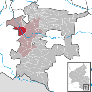
| Location of the local community Rinnthal in the southern Weinstrasse district | ||
  |
||


Rinnthal is a municipality in the Südliche Weinstrasse district in Rhineland-Palatinate . It belongs to the Verbandsgemeinde Annweiler am Trifels , within which it is the sixth smallest local community in terms of population.
geography
location
The municipality is located in the Palatinate Forest Nature Park on the northern edge of the Wasgau , as the southern part of the Palatinate Forest and the adjoining northern part of the Vosges are also called. In the far north-west of the district, the community also has a share in the Frankenweide . Neighboring communities - including exclaves - clockwise are Annweiler am Trifels , Birkweiler , Eusserthal , Annweiler am Trifels, Wernersberg , Spirkelbach and Wilgartswiesen .
Surveys
The 529.7 m high Kehrenkopf rises to the east on the border with Annweiler and Eußerthal, the 437 m high Rindsberg in the southwest on the border with Spirkelbach and the 422.1 m high Göckelberg and 419 m in the west on the border with Wilgartswiesen high on the head . Immediately to the northwest of the settlement area is the Schwerwoogkopf and to the east the 393.8 m high Dingentalkopf .
Waters
The Queich flows through the settlement area in a west-east direction. To the west of this, the Wellbach flows into the Queich, which previously received the Freischbach and Langenbächel . The Kaltenbach - also a tributary of the Wellbach - forms the north-western boundary to a forest enclave of Annweiler and its right tributary Modenbach in turn that to Wilgartswiesen.
history
By the end of the 18th century, the community formed a condominium because it belonged jointly to Zweibrücken and Leiningen .
From 1798 to 1814, when the Palatinate was part of the French Republic (until 1804) and then part of the Napoleonic Empire , Rinthal was - as the spelling at the time - incorporated into the canton of Annweiler and was subordinate to Mairie Wilgartswiesen . In 1815 the community had a total of 368 inhabitants. In the same year, Austria was struck. Just one year later, the place, like the entire Palatinate, changed to the Kingdom of Bavaria . From 1818 to 1862 Rinnthal was a member of the Bergzabern Land Commissioner ; from this the district office Bergzabern emerged. In 1849, in the course of the Palatinate uprising, the battle took place near Rinnthal .
From 1939 the place was part of the Bergzabern district . After the Second World War , Rinnthal became part of the then newly formed state of Rhineland-Palatinate within the French occupation zone . During the first Rhineland-Palatinate administrative reform changed the place on 7 June 1969 in the newly created district Landau-Bad Bergzabern, in 1978 in South County Wine Trail is renamed . 1972 Rinnthal was assigned to the also newly formed community of Annweiler am Trifels .
religion
Since the Reformation in the 16th century, Rinnthal, like Wilgartswiesen and Spirkelbach, has been evangelical. In 2007 around 75% of the population were Protestant and 10% Catholic. The remaining 15% belonged to another religion or were non-denominational.
politics
Municipal council
The council in Rinnthal consists of six council members, who in the local elections on May 26, 2019 in a majority vote were elected, and the honorary mayor as chairman. In 2014 the municipal council still consisted of twelve members.
mayor
Torsten Hertel became the mayor of Rinnthal in 1999. In the direct election on May 26, 2019, he was confirmed in office for a further five years with a share of 88.29% of the votes.
coat of arms
|
|
Blazon : "In silver, a stylized, gold-rooted green oak tree with golden acorns." |
Culture

Buildings
The town center forms a monument zone; there are also eight individual monuments . The center of the village is formed by the classicist village church designed by Joseph Daniel Ohlmüller under the influence of Leo von Klenze , which was inaugurated in 1834 after three years of construction.
Villa Steiner, which was built in 1896, is located in the southeast of the settlement area by the course of the Queich. After the renovation in 2003, it is again available for tourism.
nature
Rinnthal is part of the southern Palatinate climbing area . In addition, the Langenfelsen is located northwest of the settlement area . In the east of the district there is also the Ritterstein 184 , which is called the Grimmeisenpfad ; it points to a hiking trail that leads from Annweiler to the Taubensuhl forest house . It was named after Albert Grimmeisen, a co-founder of the Palatinate Forest Association , who had a fatal accident on a climbing tour in 1908.
media
The youth film Hit from 1984 was partly shot in the Rinnthal district.
Economy and Infrastructure
economy
The wood industry used to play a major role locally. In addition, Rinnthal was temporarily the location of a chair factory.
traffic
- rail
In 1875, Rinnthal was connected to the railway when the Landau – Zweibrücken railway was opened in full. The station was built on the eastern edge of the village and has since been dismantled as a stop. At the western edge of the settlement, the route passes the Schwerwoogkopf tunnel .

- Street
In Bavarian times, the state road 151 led from Landau in the Palatinate via Pirmasens and Zweibrücken through the town. After the completion of the bypass of the federal highways 10 and 48 running north of the development in this area , Rinnthal was freed from through traffic in 1997. The tunnels built for this purpose - including the local Kostenfels tunnel - are among the longest in Rhineland-Palatinate. Numerous houses were then renovated and the townscape was greatly enhanced. The B 10 leads west to Pirmasens and east to Landau; the B 48 connects Rinnthal with Bingen am Rhein and Bad Bergzabern . There are plans to expand the bypass to four lanes in this area, but the villagers are resisting. Since then, state road 490 , which leads from Niederschlettenbach to Queichhambach , has run through the town center .
tourism
The Queichtal cycle path and a hiking trail marked with a red dot lead through Rinnthal .
Personalities
- Moritz von Hirschfeld (1790-1859), Prussian infantry general, took part in the battle near Rinnthal in 1849
- Martin Schöneich (* 1955), sculptor, designed the gate object in 2003, which acts as a roadway divider on site
Web links
- Rinnthal
- Literature about Rinnthal in the Rhineland-Palatinate State Bibliography
Individual evidence
- ↑ State Statistical Office of Rhineland-Palatinate - population status 2019, districts, communities, association communities ( help on this ).
- ^ The Regional Returning Officer Rhineland-Palatinate: Local elections 2019, city and municipal council elections.
- ↑ Gerhard Sommer: On Case II: Which local chiefs in Trifelsland are running again. Die Rheinpfalz, September 14, 2018, accessed on April 17, 2020 .
- ↑ The Regional Returning Officer Rhineland-Palatinate: direct elections 2019. Retrieved on April 17, 2020 (see Annweiler am Trifels, Verbandsgemeinde, eighth line of results).
- ↑ General Directorate for Cultural Heritage Rhineland-Palatinate (ed.): Informational directory of cultural monuments - Southern Wine Route district. Mainz 2020, p. 82 f. (PDF; 10 MB).

Cities: Annweiler am Trifels | Bad Bergzabern | Edenkoben
Municipalities: Albersweiler | Altdorf (Palatinate) | Barbelroth | Cheapheim-Ingenheim | Birkenhördt | Birkweiler | Böbingen (Palatinate) | Böchingen | Böllenborn | Bornheim (Palatinate) | Burrweiler | Dernbach (Palatinate) | Dierbach | Dörrenbach | Edesheim | Eschbach (Palatinate) | Essingen (Palatinate) | Eusserthal | Flemlingen | Frankweiler | Freimersheim (Palatinate) | Gleisweiler | Gleiszellen-Gleishorbach | Goecklingen | Gommersheim | Gossersweiler-Stein | Großfischlingen | Hainfeld (Palatinate) | Hergersweiler | Herxheim near Landau / Pfalz | Herxheimweyher | Heuchelheim Blades | Hochstadt (Palatinate) | Ilbesheim near Landau in the Palatinate | Vaccinees | Insheim | Kapellen-Drusweiler | Kapsweyer | Kirrweiler (Palatinate) | Small fish | Klingenmünster | Knöringen | Leinsweiler | May Chamber | Münchweiler am Klingbach | Niederhorbach | Niederotterbach | Oberhausen (near Bad Bergzabern) | Oberotterbach | Oberschlettenbach | Offenbach an der Queich | Pleisweiler-Oberhofen | Ramberg (Palatinate) | Ranschbach | Rhodt under Rietburg | Rinnthal | Rohrbach (Palatinate) | Roschbach | Saint Martin (Palatinate) | Schweigen-Rechtenbach | Schweighofen | Siebeldingen | Silz | Steinfeld (Palatinate) | Venningen | Völkersweiler | Vorderweidenthal | Waldhambach | Waldrohrbach | Walsheim | Wernersberg | Weyher in the Palatinate