
Birkenhördt
| coat of arms | Germany map | |
|---|---|---|

|
Coordinates: 49 ° 7 ' N , 7 ° 56' E |
|
| Basic data | ||
| State : | Rhineland-Palatinate | |
| County : | Southern Wine Route | |
| Association municipality : | Bad Bergzabern | |
| Height : | 253 m above sea level NHN | |
| Area : | 8.58 km 2 | |
| Residents: | 632 (December 31, 2019) | |
| Population density : | 74 inhabitants per km 2 | |
| Postcodes : | 76889, 76887 (Gehlmühle) |
|
| Area code : | 06343 | |
| License plate : | SOUTH | |
| Community key : | 07 3 37 008 | |
| LOCODE : | DE 7BM | |
| Association administration address: | Königstrasse 61 76887 Bad Bergzabern |
|
| Website : | ||
| Local Mayor : | Matthias Ackermann ( CDU ) | |
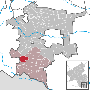
| Location of the local community Birkenhördt in the district of Südliche Weinstrasse | ||
  |
||


Birkenhördt is a municipality in the Südliche Weinstrasse district in Rhineland-Palatinate . It belongs to the Bad Bergzabern community .
geography
location
The place is located in Wasgau , which is formed by the southern part of the Palatinate Forest and the northern part of the Vosges . The Gehlmühle residential area also belongs to Birkenhördt . Neighboring communities are - clockwise - Silz , Bad Bergzabern , Dörrenbach , Böllenborn , Erlenbach bei Dahn and Vorderweidenthal .
Elevations and waters
The 431 meter high Hohe Kopf extends to the southwest on the boundary of Erlenbach . The Erlenbach rises in Birkenhördt . The Anbach , which flows into this from the left, forms the boundary to Bad Bergzabern in the east. In the southeast, the Böllenborn also grazes the municipal area of Birkenhördt for a short distance.
history
Up to the end of the 18th century Impflingen belonged to the Electoral Palatinate and within this to the Oberamt Germersheim . There she formed the Birkenhördt winery, which was also responsible for Böllenborn and Reisdorf .
From 1798 to 1814, when the Palatinate was part of the French Republic (until 1804) and then part of the Napoleonic Empire , Birkenhördt was incorporated into the canton of Annweiler and had its own Mairie , which also included Bellenborn , Reichsdorf and Blankenborn . In 1815 the community had a total of 464 inhabitants. In the same year, Austria was struck. Just one year later, the place changed to the Kingdom of Bavaria . From 1817 Birkenhördt belonged to the canton of Bergzabern . From 1818 to 1862 Birkenhördt was part of the Bergzabern Land Commissioner , which was then converted into a district office.
In 1928 Birkenhördt had 545 residents who lived in 112 residential buildings. The Catholics owned a local parish at that time, the Protestants to that of Dörrenbach. In 1939 the place was incorporated into the Bergzabern district. After the Second World War , the municipality within the French occupation zone became part of the then newly formed state of Rhineland-Palatinate. During the first Rhineland-Palatinate administrative reform changed the place on 7 June 1969 in the newly created district Landau-Bad Bergzabern, in 1978 in South County Wine Trail is renamed . In 1972, Birkenhördt was assigned to the also newly formed community of Bad Bergzabern .
religion

In 2012, 60.3 percent of the population were Catholic and 20.6 percent Protestant. The rest belonged to another religion or were non-denominational. The Catholics belong to the Diocese of Speyer , the Evangelicals to the Protestant Church of the Palatinate .
politics
In federal elections, the community has been part of the Südpfalz constituency since 1965 (until 1983: Landau constituency ) , before that until 1961 it was part of the Zweibrücken constituency . In state elections, Vorderweidenthal has been part of the Südliche Weinstrasse constituency since 1991 .
Municipal council
The council in Birkenhördt consists of twelve council members, who in the local elections on May 26, 2019 in a majority vote were elected, and the honorary mayor as chairman.
mayor
Matthias Ackermann (CDU) became the local mayor of Birkenhördt in 2004. In the direct election on May 26, 2019, he was confirmed in his office for another five years with a share of the vote of 66.76%.
coat of arms
|
|
Blazon : "Divided diagonally by black and gold, top right an upward striding left-turned, red-armored, tongued and crowned golden lion, bottom left a green birch branch with three green leaves." |
| Foundation for the coat of arms: It was approved in 1969 by the Neustadt district government . The Palatine Lion recalls the former belonging to the Palatinate and the birch branch refers talking on the place name. |
Culture and sights
Cultural monuments
In district of the municipality are a total of six objects under monument protection standing, including the Parish Church of St. Havel and a shrine, of the base with a five wounds Cross covers.
nature
The municipality is located in the Palatinate Forest Nature Park , which in turn belongs to the Palatinate Forest-Vosges du Nord biosphere reserve , which is protected by UNESCO . In the west lies the Mittelkopf natural forest reserve , which was designated in 1975 and covers 14 hectares.
Knight stones

In the west of the district are the knight stones 31, 32 and 199 . The former is called Neues Landlöchel and is located on the road to Lauterschwan . The one with the number 32 has the name Altes Landlöchel and lies at the apex of the road to Vorderweidenthal; the term "Landlöchel" is a slang term for "road breakthrough". Both are in the middle of a rock wall. 199 Birkenhördter Linde marks the location of a linden tree.
media
In 2017 an episode of the second season of the television series Stadt, Land, Lecker was filmed in Birkenhördt.
Economy and Infrastructure
traffic

Federal highway 427 runs through the center of the town . From this, the district road 11 branches off to Vorderweidenthal. Birkenhördt is connected to the local transport network via the bus lines 525 (Bad Bergzabern- Annweiler am Trifels ) and 548 (Bad Bergzabern- Dahn ) of the Rhein-Neckar transport association. The closest train station is the one in Bad Bergzabern .
tourism
In addition, the municipality is the most long-distance hiking Pirmasens-Belfort , which is marked with a yellow bar and the southern route of the Palatine Ways of St. James . One that is marked with a blue cross and that runs from Niederhausen to Sankt Germanshof runs through the northeast of the district . A path marked with a white and blue bar leads through the west of the municipality , which creates a connection with Bad Münster am Stein as well as Sankt Germanshof. In addition, Tour 9 of the Palatinate Forest Mountain Bike Park runs through the west of the district.
dish
The community belongs to the judicial district of the Landau district court and is looked after by its branch in Bad Bergzabern.
Personalities
Sons and daughters of the church
- Marie Luise Bruch b. Pauli (1730–1808), mother of the Protestant clergyman Christian Gottlieb Bruch
People who worked on site
- Balthasar Wegmann (1819–1893), emigrant, entrepreneur and father of the founder of the Wegmans supermarket chain
- Karl Albrecht von Ritter (1836–1917), Bavarian forest clerk, government director and founding chairman of the Palatinate Forest Association, was a local forester at times
Web links
- Internet presence of the local community Birkenhördt
- From the Birkenhördt Chronicle
- Literature about Birkenhördt in the Rhineland-Palatinate State Bibliography
Individual evidence
- ↑ State Statistical Office of Rhineland-Palatinate - population status 2019, districts, communities, association communities ( help on this ).
- ↑ State Statistical Office Rhineland-Palatinate (ed.): Official directory of the municipalities and parts of the municipality. Status: January 2019 [ Version 2020 is available. ] . S. 159 (PDF; 3 MB).
- ↑ daten.digitale-sammlungen.de: List of localities for the Free State of Bavaria . Retrieved July 28, 2018 .
- ↑ KommWis, as of December 31, 2012
- ^ The Regional Returning Officer Rhineland-Palatinate: Local elections 2019, city and municipal council elections.
- ↑ Gerhard Sommer: On Case II: Which local chiefs in the Bad Bergzabern community are running again. Die Rheinpfalz, October 1, 2018, accessed on April 19, 2020 .
- ^ The Regional Returning Officer Rhineland-Palatinate: direct elections 2019. see Bad Bergzabern, Verbandsgemeinde, fourth line of results. Retrieved April 19, 2020 .
- ^ Karl Heinz Debus: The great book of arms of the Palatinate. Neustadt an der Weinstrasse 1988, ISBN 3-9801574-2-3 .
- ↑ General Directorate for Cultural Heritage Rhineland-Palatinate (ed.): Informational directory of cultural monuments - Southern Wine Route district. Mainz 2020, p. 16 (PDF; 10 MB).

Cities: Annweiler am Trifels | Bad Bergzabern | Edenkoben
Municipalities: Albersweiler | Altdorf (Palatinate) | Barbelroth | Cheapheim-Ingenheim | Birkenhördt | Birkweiler | Böbingen (Palatinate) | Böchingen | Böllenborn | Bornheim (Palatinate) | Burrweiler | Dernbach (Palatinate) | Dierbach | Dörrenbach | Edesheim | Eschbach (Palatinate) | Essingen (Palatinate) | Eusserthal | Flemlingen | Frankweiler | Freimersheim (Palatinate) | Gleisweiler | Gleiszellen-Gleishorbach | Goecklingen | Gommersheim | Gossersweiler-Stein | Großfischlingen | Hainfeld (Palatinate) | Hergersweiler | Herxheim near Landau / Pfalz | Herxheimweyher | Heuchelheim Blades | Hochstadt (Palatinate) | Ilbesheim near Landau in the Palatinate | Vaccinees | Insheim | Kapellen-Drusweiler | Kapsweyer | Kirrweiler (Palatinate) | Small fish | Klingenmünster | Knöringen | Leinsweiler | May Chamber | Münchweiler am Klingbach | Niederhorbach | Niederotterbach | Oberhausen (near Bad Bergzabern) | Oberotterbach | Oberschlettenbach | Offenbach an der Queich | Pleisweiler-Oberhofen | Ramberg (Palatinate) | Ranschbach | Rhodt under Rietburg | Rinnthal | Rohrbach (Palatinate) | Roschbach | Saint Martin (Palatinate) | Schweigen-Rechtenbach | Schweighofen | Siebeldingen | Silz | Steinfeld (Palatinate) | Venningen | Völkersweiler | Vorderweidenthal | Waldhambach | Waldrohrbach | Walsheim | Wernersberg | Weyher in the Palatinate