
Venningen
| coat of arms | Germany map | |
|---|---|---|

|
Coordinates: 49 ° 17 ' N , 8 ° 11' E |
|
| Basic data | ||
| State : | Rhineland-Palatinate | |
| County : | Southern Wine Route | |
| Association municipality : | Edenkoben | |
| Height : | 134 m above sea level NHN | |
| Area : | 9.87 km 2 | |
| Residents: | 914 (Dec. 31, 2019) | |
| Population density : | 93 inhabitants per km 2 | |
| Postal code : | 67482 | |
| Area code : | 06323 | |
| License plate : | SOUTH | |
| Community key : | 07 3 37 077 | |
| LOCODE : | DE VNG | |
| Association administration address: | Poststrasse 23 67480 Edenkoben |
|
| Website : | ||
| Local Mayor : | Jürgen Leibfried | |
| Location of the local community of Venningen in the district of Südliche Weinstrasse | ||
  |
||


Venningen is a municipality in the Südliche Weinstrasse district in Rhineland-Palatinate . It belongs to the community of Edenkoben .
geography
location
The wine-growing location is three kilometers east of Edenkoben between the Palatinate Forest biosphere reserve and the Rhine and is in the middle of the Gäu . Venningen also has two exclaves in the Palatinate Forest . One is located southwest of Edenkoben and the other in the northwest of the Southern Wine Route district. Within the latter is the Helmbach forest settlement . Neighboring communities are - clockwise - Kirrweiler , Neustadt an der Weinstrasse , Altdorf , Großfischlingen , Edesheim and Edenkoben.
Elevations and waters
The exclave to the east is dominated by the Spitzbergel . The Triefenbach runs through the community itself on the southern edge of the settlement area in a west-east direction . The Leißelgraben - called Lachgraben in this area - largely forms the boundary to Großfischlingen. The exclave to the west is bounded by the Helmbach in the northwest and by the Kohlbach in the east . It also includes the south bank of the Helmbachweiher .
history
The place was first mentioned in a document in 859. Until the end of the 18th century, the place belonged to the Speyer monastery .
From 1798 to 1814, when the Palatinate was part of the French Republic (until 1804) and then part of the Napoleonic Empire , Venningen was incorporated into the canton of Edenkoben and had its own Mairie . In 1815 the place had a total of 980 inhabitants. In the same year it was added to Austria . Just one year later, the place, like the entire Palatinate, changed to the Kingdom of Bavaria . From 1818 to 1862 the community belonged to the Landau Landau commissioner ; from this the district office of Landau emerged.
From 1939 the place was part of the Landau district in the Palatinate . After the Second World War , Hainfeld became part of the then newly formed state of Rhineland-Palatinate within the French occupation zone . During the first Rhineland-Palatinate administrative reform changed the place on 7 June 1969 in the newly created district Landau-Bad Bergzabern, in 1978 in South County Wine Trail is renamed . 1972 Venningen was assigned to the also newly formed community of Edenkoben .
religion
In 2012, 64.8 percent of the population were Roman Catholic and 19.4 percent Protestant . The rest belonged to another religion or were non-denominational. The Catholics belong to the Diocese of Speyer , the Evangelicals to the Protestant Church of the Palatinate .
politics
Municipal council

The municipal council in Venningen consists of twelve council members, who were elected in the local elections on May 26, 2019 in a personalized proportional representation, and the honorary local mayor as chairman.
The distribution of seats in the municipal council:
| choice | CDU | Flat share | total |
|---|---|---|---|
| 2019 | 3 | 9 | 12 seats |
| 2014 | by majority vote | 12 seats | |
mayor
Jürgen Leibfried (independent) became mayor of Venningen in May 2017. In the direct election on May 26, 2019, he was confirmed in his office for a further five years with 81.98% of the votes. Since there was no candidate for the position of mayor in the 2014 local elections, Leibfried had been the first local mayor for almost three years before his election in 2017. His predecessors as local mayors were Michael Rohr and Roland Kuhn.
Culture
Cultural monuments
The town center and the Jewish cemetery are designated as monument zones.
In addition, there are numerous individual objects that are listed , including the former synagogue
nature
The only natural monument on the municipal marker is Am Spitzbergel .
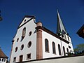
church


Economy and Infrastructure
economy
There are several wineries in the village itself. There is also the wine vinegar estate Doctorshof .
traffic
The closest train station is Edenkoben on the Palatinate Maximiliansbahn from Neustadt an der Weinstrasse to Wissembourg. Venningen is also served by the 539 bus.
Sons and daughters of the church
- Philipp Weindel (1900–1988), Catholic clergyman
- Petronia Steiner (1908–1995), Dominican, hymn poet
literature
- Norbert Gies ( V. i. S. d. P. ), Michael Kluger (Hrsg.): 1150 years Venningen , Festschrift, published by the local community Venningen, 2015, DNB 1073169316 .
Web links
- Internet presence of the local community Venningen
- Literature about Venningen in the Rhineland-Palatinate state bibliography
Individual evidence
- ↑ State Statistical Office of Rhineland-Palatinate - population status 2019, districts, communities, association communities ( help on this ).
- ↑ State Statistical Office Rhineland-Palatinate (ed.): Official directory of the municipalities and parts of the municipality. Status: January 2019 [ Version 2020 is available. ] . S. 161 (PDF; 3 MB).
- ↑ KommWis, as of December 31, 2012
- ^ The Regional Returning Officer Rhineland-Palatinate: Local elections 2019, city and municipal council elections
- ↑ a b Gerhard Sommer: Quite a few village chiefs undecided. Die Rheinpfalz, August 17, 2018, accessed on April 13, 2020 .
- ^ The Regional Returning Officer Rhineland-Palatinate: direct elections 2019. see Edenkoben, Verbandsgemeinde, penultimate line of results. Retrieved April 13, 2020 .

Cities: Annweiler am Trifels | Bad Bergzabern | Edenkoben
Municipalities: Albersweiler | Altdorf (Palatinate) | Barbelroth | Cheapheim-Ingenheim | Birkenhördt | Birkweiler | Böbingen (Palatinate) | Böchingen | Böllenborn | Bornheim (Palatinate) | Burrweiler | Dernbach (Palatinate) | Dierbach | Dörrenbach | Edesheim | Eschbach (Palatinate) | Essingen (Palatinate) | Eusserthal | Flemlingen | Frankweiler | Freimersheim (Palatinate) | Gleisweiler | Gleiszellen-Gleishorbach | Goecklingen | Gommersheim | Gossersweiler-Stein | Großfischlingen | Hainfeld (Palatinate) | Hergersweiler | Herxheim near Landau / Pfalz | Herxheimweyher | Heuchelheim Blades | Hochstadt (Palatinate) | Ilbesheim near Landau in the Palatinate | Vaccinees | Insheim | Kapellen-Drusweiler | Kapsweyer | Kirrweiler (Palatinate) | Small fish | Klingenmünster | Knöringen | Leinsweiler | May Chamber | Münchweiler am Klingbach | Niederhorbach | Niederotterbach | Oberhausen (near Bad Bergzabern) | Oberotterbach | Oberschlettenbach | Offenbach an der Queich | Pleisweiler-Oberhofen | Ramberg (Palatinate) | Ranschbach | Rhodt under Rietburg | Rinnthal | Rohrbach (Palatinate) | Roschbach | Saint Martin (Palatinate) | Schweigen-Rechtenbach | Schweighofen | Siebeldingen | Silz | Steinfeld (Palatinate) | Venningen | Völkersweiler | Vorderweidenthal | Waldhambach | Waldrohrbach | Walsheim | Wernersberg | Weyher in the Palatinate