Münchweiler am Klingbach
| coat of arms | Germany map | |
|---|---|---|

|
Coordinates: 49 ° 9 ' N , 7 ° 58' E |
|
| Basic data | ||
| State : | Rhineland-Palatinate | |
| County : | Southern Wine Route | |
| Association municipality : | Annweiler am Trifels | |
| Height : | 208 m above sea level NHN | |
| Area : | 2.14 km 2 | |
| Residents: | 201 (Dec. 31, 2019) | |
| Population density : | 94 inhabitants per km 2 | |
| Postal code : | 76857 | |
| Area code : | 06346 | |
| License plate : | SOUTH | |
| Community key : | 07 3 37 054 | |
| Association administration address: | Meßplatz 1 76855 Annweiler am Trifels |
|
| Website : | ||
| Local Mayor : | Hans-Peter Carius | |
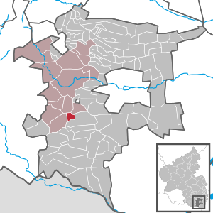
| Location of the local community Münchweiler am Klingbach in the district of Südliche Weinstrasse | ||
Münchweiler am Klingbach ( Palatine Minchwoiler or Mäichber ) is a municipality in the southern Weinstrasse district in Rhineland-Palatinate . It belongs to the Verbandsgemeinde Annweiler am Trifels , within which it is the smallest local community in terms of population.
Geographical location
The municipality is located in Wasgau , as the southern part of the Palatinate Forest and the adjoining northern part of the Vosges are also called, in the valley between Annweiler am Trifels and Bad Bergzabern . The Klingbach flows through the middle of the village in a west-east direction . Neighboring communities are - clockwise - Waldrohrbach , Waldhambach , Klingenmünster and Silz .
history
The name Münchweiler refers to settlement by monks.
Until the end of the 18th century, the community belonged to Pfalz-Zweibrücken and was subordinate to the Oberamt Guttenberg as an exclave of the upper rulership .
From 1798 to 1814, when the Palatinate was part of the French Republic (until 1804) and then part of the Napoleonic Empire , Münchwiller - as the place name was at the time - was incorporated into the canton of Kandel , within which the place was also an exclave. In 1815 the community had a total of 158 inhabitants. In the same year, Austria was struck. Just one year later, the place, like the entire Palatinate, changed to the Kingdom of Bavaria . From 1817 the place was part of the canton Annweiler . From 1818 to 1862 Münchweiler belonged to the Land Commissioner Bergzabern ; from this the district office Bergzabern emerged.
From 1939 the place was part of the Bergzabern district . After the Second World War , Münchweiler became part of the then newly formed state of Rhineland-Palatinate within the French occupation zone . During the first Rhineland-Palatinate administrative reform changed the place on 7 June 1969 in the newly created district Landau-Bad Bergzabern, in 1978 in South County Wine Trail is renamed . In 1972, Münchweiler was assigned to the newly formed community of Annweiler am Trifels .
politics
Municipal council
The municipal council in Münchweiler consists of six council members, who were elected by a majority vote in the local elections on May 26, 2019 , and the honorary local mayor as chairman.
mayor
Hans-Peter Carius became local mayor of Münchweiler on June 27, 2019. In the runoff election on June 16, 2019, he prevailed with a share of 53.73% of the vote, after none of the original three applicants had achieved a sufficient majority in the direct election on May 26, 2019. His predecessor Hermann Hahn did not take office again after 25 years in office.
coat of arms
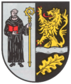
| Blazon : “Split in silver and black, on the right a monk in a black religious habit, in the right an open red book, in the left holding a golden abbot's staff, on the left over a lowered silver wavy bar, underneath a golden oak leaf, a growing red-armored and braced man golden lion. " | |
| Justification of the coat of arms: The monk makes it a "speaking coat of arms", the wavy bar symbolizes the Klingbach |
Culture
With a residential building and a crossroads, there are a total of two objects on site that are listed . A so-called Kerwe takes place on site every year .
Transport and infrastructure
State road 493 runs on the southern edge of the settlement of Münchweiler . The bus line 531 of the Rhein-Neckar transport association connects the community with Landau in the Palatinate and Annweiler am Trifels. The closest train station is Annweiler am Trifels . The so-called Wasgauhalle also exists on site . There is a cemetery on the southwestern edge of the village.
Sons and daughters of the church
- Jakob Bisson (1888–1963), Catholic priest and church historian
Web links
- Münchweiler am Klingbach
- Literature about Münchweiler am Klingbach in the Rhineland-Palatinate state bibliography
Individual evidence
- ↑ State Statistical Office of Rhineland-Palatinate - population status 2019, districts, communities, association communities ( help on this ).
- ^ The Regional Returning Officer Rhineland-Palatinate: Local elections 2019, city and municipal council elections.
- ↑ Agnes Fazekas: Münchweiler: Council members are on average 39 years old. Constituent municipal council meeting in 2019. The Rheinpfalz, June 28, 2019, accessed on April 16, 2020 .
- ^ The Regional Returning Officer Rhineland-Palatinate: direct elections 2019. see Annweiler am Trifels, Verbandsgemeinde, sixth line of results. Retrieved April 16, 2020 .
- ^ Jörg Petri: Hans-Peter Carius new local mayor in Münchweiler. Die Rheinpfalz, June 16, 2019, accessed on April 16, 2020 .
- ↑ General Directorate for Cultural Heritage Rhineland-Palatinate (ed.): Informational directory of cultural monuments - Southern Wine Route district. Mainz 2020, p. 71 (PDF; 10 MB).


