Klingbach
| Klingbach | ||
|
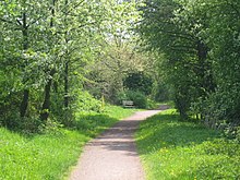
Course of the Klingbach (above) |
||
| Data | ||
| Water code | DE : 237546 | |
| location | Germany | |
| River system | Rhine | |
| Drain over | Michelsbach → Rhine → North Sea | |
| source | at Lindelbrunn Castle 49 ° 9 ′ 7 ″ N , 7 ° 54 ′ 21 ″ E |
|
| Source height | 350 m above sea level NHN | |
| muzzle | at Hördt from the left in the Michelsbach coordinates: 49 ° 10 '43 " N , 8 ° 20' 23" E 49 ° 10 '43 " N , 8 ° 20' 23" E |
|
| Mouth height | 99 m above sea level NHN | |
| Height difference | 251 m | |
| Bottom slope | 6.6 ‰ | |
| length | 37.8 km | |
| Catchment area | 130.241 km² | |
| Discharge at the Herxheim A Eo gauge : 102 km² Location: 11.6 km above the mouth |
NNQ (08/02/1964) MNQ 1960/2009 MQ 1960/2009 Mq 1960/2009 MHQ 1960/2009 HHQ (01/16/1968) |
20 l / s 146 l / s 606 l / s 5.9 l / (s km²) 4.26 m³ / s 7 m³ / s |
| Left tributaries | Silzer Bach, Kaiserbach , Quodbach | |
| Right tributaries | Sandwiesenbach | |
| Reservoirs flowed through | Lake Silzer | |
|
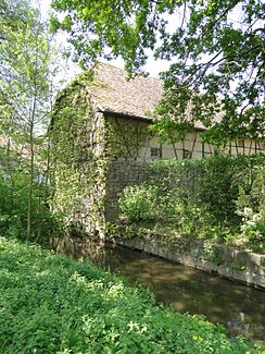
Klingbach with Altmühle in Herxheim |
||
The Klingbach is a 38 km long watercourse in the southern Palatinate ( Rhineland-Palatinate ) and a left tributary of the Michelsbach .
geography
course
The main source of Kling Bach in southern Pfälzerwald , the German part of the Wasgau , is about 350 m above sea level. NHN on the northeast slope of the castle hill of the Lindelbrunn ruins , a right, almost equally strong secondary spring 300 m south. The two source streams converge after about 1 km. The combined brook is dammed after about 2.5 km to a 300 m long pond , the Silzer See . 250 m further, north of the Südliche Weinstrasse wildlife and hiking park and at the entrance to Silz , the Klingbach joins the 2.7 km long Sandwiesenbach from the right, and the 1 km long Silzer Bach from the left in the center of the village . Then the Klingbach passes Münchweiler , always flowing along the state road 493 .
Between the nature reserve Haardtrand - Am Klingbach (right) and the Treutelsberg (left), the Klingbach leaves the low mountain range in an easterly direction, crosses under the German Wine Route in Klingenmünster and reaches the Upper Rhine Plain . It flows through the western half initially in an easterly direction, later more in a northeasterly direction. South of Rohrbach it takes up the 20 km long Kaiserbach from the left , above Herxheim also from the left the 8 km long Quodbach .
Until the first half of the 19th century, the Klingbach flowed east of Hördt from the left into a meander of the Upper Rhine . With the straightening of the Rhine , the mouth ( 99 m ) functionally became the Old Rhine ; Today the former loop of the river is run as a separate flowing water called Michelsbach, into which the Klingbach flows.
Local parishes on the Klingbach
- Silz
- Münchweiler am Klingbach
- Klingenmünster
- Heuchelheim blades
- Cheap home-Ingenheim
- Steinweiler
- Rohrbach
- Herxheim near Landau / Pfalz
- Herxheimweyher
- Rülzheim
- Heard
history
A section of the southern route of the Palatinate Way of St. James leads upwards on the Klingbach . The names of Klingen münster (monastery for monasteries ) and Münchweiler (Mönchweiler) indicate that monks ' settlements were responsible for founding villages. To distinguish it from other localities called Münster , the municipality of Klingenmünster was given the name of the stream.
Between 1892 and 1957 and 1968 the Klingbach Valley Railway ran along the Klingbach , which connected Rohrbach to the Palatinate Maximilians Railway with Klingenmünster.


