
Herxheimweyher
| coat of arms | Germany map | |
|---|---|---|

|
Coordinates: 49 ° 9 ' N , 8 ° 15' E |
|
| Basic data | ||
| State : | Rhineland-Palatinate | |
| County : | Southern Wine Route | |
| Association municipality : | Herxheim | |
| Height : | 118 m above sea level NHN | |
| Area : | 3.57 km 2 | |
| Residents: | 551 (Dec. 31, 2019) | |
| Population density : | 154 inhabitants per km 2 | |
| Postal code : | 76863 | |
| Area code : | 07276 | |
| License plate : | SOUTH | |
| Community key : | 07 3 37 039 | |
| Association administration address: | Obere Hauptstrasse 2 76863 Herxheim |
|
| Website : | ||
| Local Mayor : | Markus Müller ( CDU ) | |
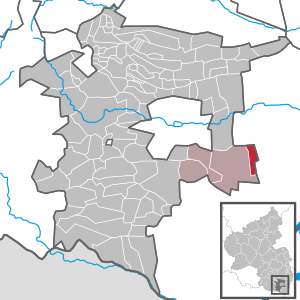
| Location of the local community Herxheimweyher in the district of Südliche Weinstrasse | ||
  |
||

Herxheimweyher is a municipality in the Südliche Weinstrasse district in Rhineland-Palatinate . It belongs to the Verbandsgemeinde Herxheim , within which it is the smallest local community in terms of population and which has its administrative seat in the municipality of Herxheim near Landau / Pfalz .
geography
Herxheimweyher is located in the Upper Rhine Plain in the east of the Southern Wine Route district. Neighboring communities are - clockwise - Knittelsheim , Rülzheim and Herxheim near Landau / Pfalz . The Klingbach grazes the southern edge of the settlement. In the south of the district there is a forest area in which the Rottenbach runs in a west-east direction . Immediately at the Herxheim district boundary, this takes up the Saugraben from the right . Most of the area is used for agriculture.
history
Herxheimweyher was first mentioned in a document in 1046. The name is not derived from a pond near Herxheim, but from a hamlet, i.e. a small settlement.
Until 1679 the place was under the Speyer bishopric and within this the Lauterburg Oberamt . With the peace of Nijmegen , Herxheimweyher and all the communities south of the Queich fell to France.
From 1798, when the Palatinate was part of the French Republic (until 1804) and then part of the Napoleonic Empire , Herxheimweyer was - as the spelling at the time - incorporated into the canton of Landau in the department of the Lower Rhine . In 1814 the community had a total of 377 inhabitants. In 1815 the place first belonged to Austria . A year later he moved to the Kingdom of Bavaria . From 1818 to 1862 "Herxheimweiher" belonged to the Landau commissioner ; from this the district office of Landau emerged. From 1854 to 1880 the community had lost its own administration to Herxheim.
From 1939 the place was part of the Landau district in the Palatinate . After the Second World War , Herxheimweyher became part of the then newly formed state of Rhineland-Palatinate within the French occupation zone . During the first Rhineland-Palatinate administrative reform changed the place on 7 June 1969 in the newly created district Landau-Bad Bergzabern, in 1978 in South County Wine Trail is renamed . 1972 Herxheimweyher was assigned to the also newly formed community of Herxheim .
religion
The Jews who once lived in the village were buried in Rülzheim . At the end of 2013, 63.9 percent of the population were Catholic and 18.1 percent Protestant. The rest belonged to another religion or were non-denominational.
politics
Municipal council
The council in Herxheimweyher consists of twelve council members, who in the local elections on May 26, 2019 in a majority vote were elected, and the honorary mayor as chairman. In the 2009 election, a personalized proportional representation took place.
The distribution of seats in the municipal council:
| choice | SPD | CDU | total |
|---|---|---|---|
| 2019 | by majority vote | 12 seats | |
| 2014 | by majority vote | 12 seats | |
| 2009 | 4th | 8th | 12 seats |
| 2004 | by majority vote | 12 seats | |

mayor
Markus Müller (CDU) became local mayor of Herxheimweyher on June 25, 2019. In the direct election on May 26, 2019, he was elected for five years with 77.58% of the vote. His predecessor was Bernhard Gadinger.
coat of arms
|
|
Blazon : "Split by blue and blue, on the right at the split half a silver lily, on the left a silver fish." |
| Justification for the coat of arms: The fish indicates the suffix -weyher |
Culture
There are a total of eleven objects on site that are listed . In 1821, today's St. Antonius Church was built in the classical style instead of a chapel. The parsonage was built in 1837 and the school and parish hall in 1845.
Infrastructure
economy
Tobacco was previously grown on site. Several tobacco drying sheds have been preserved in the municipality . In Herxheimweyher there is some viticulture; as such, the community belongs to the Palatinate wine-growing region . The single location Am Gaisberg is located on site . The Rülzheim-Herxheimweyher wind farm is partly within the boundaries of the local community.
traffic
State road 493 runs through Herxheimweyher and connects the town with Herxheim and Rülzheim, among others.
Personalities
- Thomas Hitschler (* 1982), politician (SPD), grew up there
Web links
- Website of the local community Herxheimweyher
- Literature about Herxheimweyher in the Rhineland-Palatinate state bibliography
Individual evidence
- ↑ State Statistical Office of Rhineland-Palatinate - population status 2019, districts, communities, association communities ( help on this ).
- ↑ Chronicle of the Herxheimweyher parish. Retrieved April 16, 2020 .
- ↑ KommWis, as of December 31, 2013
- ^ The Regional Returning Officer Rhineland-Palatinate: Local elections 2019, city and municipal council elections.
- ↑ The Regional Returning Officer Rhineland-Palatinate: Municipal elections 2014, city and municipal council elections:
- ^ The Regional Returning Officer Rhineland-Palatinate: Local elections 2009, city and municipal council elections.
- ^ The Regional Returning Officer Rhineland-Palatinate: Local elections 2004, local council elections.
- ↑ a b From the 1st public meeting of the OG Council Herxheimweyher on June 25th, 2019. In: Mitteilungsblatt - Official Journal of the Herxheim Association. Linus Wittich Medien GmbH, edition 27/2019, accessed on April 18, 2020 .
- ^ The Regional Returning Officer of Rhineland-Palatinate: direct elections 2019. see Herxheim, Verbandsgemeinde, third line of results. Retrieved April 18, 2020 .
- ↑ Description of the coat of arms. Herxheimweyher parish, accessed on July 27, 2018 .
- ↑ General Directorate for Cultural Heritage Rhineland-Palatinate (ed.): Informational directory of cultural monuments - Southern Wine Route district. Mainz 2020, p. 52 f. (PDF; 10 MB).

Cities: Annweiler am Trifels | Bad Bergzabern | Edenkoben
Municipalities: Albersweiler | Altdorf (Palatinate) | Barbelroth | Cheapheim-Ingenheim | Birkenhördt | Birkweiler | Böbingen (Palatinate) | Böchingen | Böllenborn | Bornheim (Palatinate) | Burrweiler | Dernbach (Palatinate) | Dierbach | Dörrenbach | Edesheim | Eschbach (Palatinate) | Essingen (Palatinate) | Eusserthal | Flemlingen | Frankweiler | Freimersheim (Palatinate) | Gleisweiler | Gleiszellen-Gleishorbach | Goecklingen | Gommersheim | Gossersweiler-Stein | Großfischlingen | Hainfeld (Palatinate) | Hergersweiler | Herxheim near Landau / Pfalz | Herxheimweyher | Heuchelheim Blades | Hochstadt (Palatinate) | Ilbesheim near Landau in the Palatinate | Vaccinees | Insheim | Kapellen-Drusweiler | Kapsweyer | Kirrweiler (Palatinate) | Small fish | Klingenmünster | Knöringen | Leinsweiler | May Chamber | Münchweiler am Klingbach | Niederhorbach | Niederotterbach | Oberhausen (near Bad Bergzabern) | Oberotterbach | Oberschlettenbach | Offenbach an der Queich | Pleisweiler-Oberhofen | Ramberg (Palatinate) | Ranschbach | Rhodt under Rietburg | Rinnthal | Rohrbach (Palatinate) | Roschbach | Saint Martin (Palatinate) | Schweigen-Rechtenbach | Schweighofen | Siebeldingen | Silz | Steinfeld (Palatinate) | Venningen | Völkersweiler | Vorderweidenthal | Waldhambach | Waldrohrbach | Walsheim | Wernersberg | Weyher in the Palatinate