
Dierbach
| coat of arms | Germany map | |
|---|---|---|

|
Coordinates: 49 ° 5 ' N , 8 ° 4' E |
|
| Basic data | ||
| State : | Rhineland-Palatinate | |
| County : | Southern Wine Route | |
| Association municipality : | Bad Bergzabern | |
| Height : | 146 m above sea level NHN | |
| Area : | 5.48 km 2 | |
| Residents: | 547 (Dec. 31, 2019) | |
| Population density : | 100 inhabitants per km 2 | |
| Postal code : | 76889 | |
| Area code : | 06340 | |
| License plate : | SOUTH | |
| Community key : | 07 3 37 018 | |
| Association administration address: | Königstrasse 61 76887 Bad Bergzabern |
|
| Website : | ||
| Local Mayor : | Manfred Huckle | |
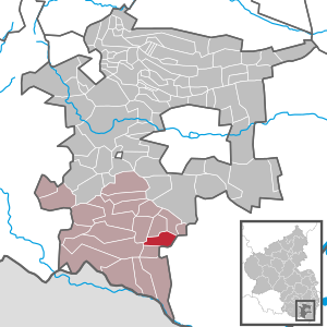
| Location of the local community Dierbach in the district of Südliche Weinstrasse | ||
  |
||

Dierbach is a municipality in the Südliche Weinstrasse district in Rhineland-Palatinate . It belongs to the Bad Bergzabern community .
geography
The community is located 6 km east of Bad Bergzabern on the German Wine Route between the Palatinate Forest biosphere reserve and the Rhine .
history
For the first time the place was in 1084 in a document from Pope Clement III. mentioned.
religion
At the end of 2013, 58.8 percent of the population were Protestant and 19 percent Catholic. The rest belonged to another religion or were non-denominational.
politics
Municipal council
The municipal council in Dierbach consists of twelve council members, who were elected by a majority vote in the local elections on May 26, 2019 , and the honorary local mayor as chairman.
mayor
Manfred Huckle became mayor of Dierbach in 2014. Since there was no candidate for the direct election on May 26, 2019, the upcoming election of the mayor was carried out by the council in accordance with the municipal regulations. This unanimously confirmed Huckle for another five years in his office. His predecessors were Heinz Stadler (term of office 1999–2014) and Gerhard Rinck (1984–1999).
coat of arms
|
|
Blazon : "Split by gold and red, in the lower half of the shield covered with a blue wavy bar, on the right a striding blue armored and tongued red lion, on the left a burning golden candle growing out of the wavy bar."
It was approved by the Mainz Interior Ministry in 1950 . |
Attractions
The landmark of the place is the Protestant village church St. Anna from 1502. The church was built between 1502 and 1513 by Hensel Ryel von Barbelroth and his housewife Margaretha in honor of St. Anna. The building is built in the late Gothic style of the Bavarian school. In 1606, after the church became Protestant in the 16th century, the nave windows were enlarged.
The choir of the simple church is provided with a net vault, the ribs of which grow over differently designed consoles. The late Gothic choir windows have rich tracery with different shapes.
The furnishings of the church from the Baroque period have been completely preserved.
See also: List of cultural monuments in Dierbach
traffic
Dierbach is connected to the local transport network via bus line 547, which connects the Kandel and Bad Bergzabern train stations .
Personalities
Honorary citizen
- Gerhard Rinck, mayor of Dierbach from 1984 to 1999
Sons and daughters of the church
- Heinrich Adam (1839–1905), architect
Web links
- Website of Dierbach
- Literature about Dierbach in the Rhineland-Palatinate state bibliography
Individual evidence
- ↑ State Statistical Office of Rhineland-Palatinate - population status 2019, districts, communities, association communities ( help on this ).
- ↑ KommWis, as of December 31, 2013
- ^ The Regional Returning Officer Rhineland-Palatinate: Local elections 2019, city and municipal council elections
- ↑ a b Huckle succeeds Stadler as local mayor. Die Rheinpfalz, July 9, 2014, accessed on April 20, 2020 .
- ↑ Vera Allmann-Stübinger: Manfred Huckle remains mayor of Dierbach. Die Rheinpfalz, June 14, 2019, accessed on April 20, 2020 .
- ↑ a b https://www.rheinpfalz.de/lokal/landau/artikel/ehrenbuerger-sagt-es-durch-die-blume/
- ^ Karl Heinz Debus: The great book of arms of the Palatinate. Neustadt an der Weinstrasse 1988, ISBN 3-9801574-2-3 .

Cities: Annweiler am Trifels | Bad Bergzabern | Edenkoben
Municipalities: Albersweiler | Altdorf (Palatinate) | Barbelroth | Cheapheim-Ingenheim | Birkenhördt | Birkweiler | Böbingen (Palatinate) | Böchingen | Böllenborn | Bornheim (Palatinate) | Burrweiler | Dernbach (Palatinate) | Dierbach | Dörrenbach | Edesheim | Eschbach (Palatinate) | Essingen (Palatinate) | Eusserthal | Flemlingen | Frankweiler | Freimersheim (Palatinate) | Gleisweiler | Gleiszellen-Gleishorbach | Goecklingen | Gommersheim | Gossersweiler-Stein | Großfischlingen | Hainfeld (Palatinate) | Hergersweiler | Herxheim near Landau / Pfalz | Herxheimweyher | Heuchelheim Blades | Hochstadt (Palatinate) | Ilbesheim near Landau in the Palatinate | Vaccinees | Insheim | Kapellen-Drusweiler | Kapsweyer | Kirrweiler (Palatinate) | Small fish | Klingenmünster | Knöringen | Leinsweiler | May Chamber | Münchweiler am Klingbach | Niederhorbach | Niederotterbach | Oberhausen (near Bad Bergzabern) | Oberotterbach | Oberschlettenbach | Offenbach an der Queich | Pleisweiler-Oberhofen | Ramberg (Palatinate) | Ranschbach | Rhodt under Rietburg | Rinnthal | Rohrbach (Palatinate) | Roschbach | Saint Martin (Palatinate) | Schweigen-Rechtenbach | Schweighofen | Siebeldingen | Silz | Steinfeld (Palatinate) | Venningen | Völkersweiler | Vorderweidenthal | Waldhambach | Waldrohrbach | Walsheim | Wernersberg | Weyher in the Palatinate