
Gommersheim
| coat of arms | Germany map | |
|---|---|---|

|
Coordinates: 49 ° 18 ' N , 8 ° 16' E |
|
| Basic data | ||
| State : | Rhineland-Palatinate | |
| County : | Southern Wine Route | |
| Association municipality : | Edenkoben | |
| Height : | 116 m above sea level NHN | |
| Area : | 11.29 km 2 | |
| Residents: | 1563 (Dec. 31, 2019) | |
| Population density : | 138 inhabitants per km 2 | |
| Postal code : | 67377 | |
| Area code : | 06327 | |
| License plate : | SOUTH | |
| Community key : | 07 3 37 032 | |
| Association administration address: | Poststrasse 23 67480 Edenkoben |
|
| Website : | ||
| Local Mayor : | Lothar Anton ( SPD ) | |
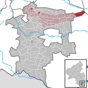
| Location of the community of Gommersheim in the district of Südliche Weinstrasse | ||
  |
||


Gommersheim is the easternmost municipality in the southern Weinstrasse district in Rhineland-Palatinate . It belongs to the community of Edenkoben , within which it is the third largest local community in terms of both number of inhabitants and area.
geography
location
The place is 9 km east of Edenkoben and 11 km west of Speyer between the Haardt and the Rhine in the middle of the Gäu and forms the eastern end of the southern wine route district. The Kindelsbrunnerhof residential area also belongs to Gommersheim . In the east of the district there is a forest area that is part of the Speyer Forest .
In addition, the municipality includes two exclaves in the Palatinate Forest , of which the one further to the east includes the mountain passes Benderplatz and Lolosruhe . Neighboring communities are - clockwise - Neustadt an der Weinstrasse , Harthausen , Schwegenheim , Weingarten , Freisbach and Böbingen . The eastern exclave borders on - exclaves in italics - Kirrweiler , Böbingen , Rhodt unter Rietburg , Edesheim , Edenkoben and Sankt Martin . The western exclave borders on Böbingen , Kirrweiler , Maikammer , Edenkoben and Venningen .
Elevations and waters
The Triefenbach flows north of the settlement area in a west-east direction; it rises within the forest dexclave to the east on the eastern slope of the 613.6 meter high Steigerkopf . In the south, the Lachgraben forms the southern boundary of the district, which is continued a short time later by the Modenbach . The Brühlgraben runs along the northern edge of the settlement before it flows into the Triefenbach from the right. The more westerly exclave is bounded in the west by the Kohlbach .
history
Gommersheim probably originated in the 6th century and was at 800 as Gunmareshaim first mentioned in documents as a Acbuto the monastery of Fulda here two serfs gave. In 1508 the imperial village of Gommersheim came under the protection and patronage of the Electoral Palatinate . From 1708 the place belonged to the Counts Degenfeldischen possessions, with which it fell in love until the end of the 18th century.
From 1798 to 1814, when the Palatinate was part of the French Republic (until 1804) and then part of the Napoleonic Empire , Gommersheim was incorporated into the canton of Landau . In 1814 the place had a total of 693 inhabitants. A year later it was added to Austria . Just one year later, the place, like the entire Palatinate, changed to the Kingdom of Bavaria . In 1817 the community moved to the canton of Edenkoben . From 1818 to 1862 the community belonged to the Landau Landau commissioner ; from this the district office of Landau emerged.

From 1939 the place was part of the Landau district in the Palatinate . After the Second World War , Gommersheim became part of the then newly formed state of Rhineland-Palatinate within the French occupation zone . During the first Rhineland-Palatinate administrative reform changed the community on June 7, 1969 in the newly created district Landau-Bad Bergzabern, in 1978 in South County Wine Trail is renamed . 1972 Gommersheim was assigned to the also newly formed community of Edenkoben .
population
Population development
The development of the population of Gommersheim, the values from 1871 to 1987 are based on censuses:
|
|
religion
Gommersheim is the seat of a Protestant parish office, which also includes the neighboring Freisbach.
There was once a Jewish community on site that owned a synagogue and whose deceased members were buried in Essingen . The last five Jewish residents were deported to the Gurs camp in southern France on October 22, 1940 as part of the Wagner-Bürckel campaign .
politics
Municipal council

The municipal council in Gommersheim consists of 16 council members, who were elected in the local elections on May 26, 2019 in a personalized proportional representation, and the honorary local mayor as chairman.
The distribution of seats in the municipal council:
| choice | SPD | CDU | BLG | total |
|---|---|---|---|---|
| 2019 | 7th | 2 | 7th | 16 seats |
| 2014 | 7th | 3 | 6th | 16 seats |
| 2009 | 8th | 2 | 6th | 16 seats |
| 2004 | 8th | 4th | 4th | 16 seats |
- BLG = Bürgerliste Gommersheim e. V.
mayor
Lothar Anton (SPD) became mayor of Gommersheim in 2004. In the runoff election on June 16, 2019, he was confirmed in office for a further five years with 55.37% of the vote, after none of the original three applicants had achieved a sufficient majority in the direct election on May 26, 2019.
coat of arms
|
|
Blazon : "A golden horseshoe with a horizontal line on a black background." |
Community partnerships
A partnership with the French municipality of Varennes-Saint-Sauveur has existed since 1975 .
Culture
Cultural monuments

The main street is designated as a monument zone . In addition, there are a total of 22 individual objects that are under monument protection , including the Schänzelturm , which is located within one forest enclave.
societies
The largest club in the local community, the sports club SV Gommersheim 1945 eV, is represented with its soccer team in the A-class Rhein-Mittelhaardt. There is also a local branch of the Palatinate Forest Association .
Infrastructure
economy
In the course of the Haingeraide , Gommersheim was involved in the so-called fourth Haingereiden , which was dissolved in the early modern period and which was partially subordinated to the community.
traffic

From 1905 Gommersheim owned a train station on the 1956 disused local line Speyer – Neustadt . The closest train station is Edenkoben on the Neustadt – Wissembourg railway line . The bus route 505 operated by PalatinaBus of the Rhein-Neckar transport association connects the town with Edenkoben.
State road 530 , which connects the town with Geinsheim and Freisbach, runs through the community in a north-south direction . From here, state road 538 branches off to Bellheim in an easterly direction and Kreisstraße 37 to the west . District road 6 leads through the eastern forest enclave .
tourism
The Waldhaus Auf den Steinen, inaugurated in 1982, is located in the east of the district . It is owned by the local group of the Palatinate Forest Association, but is leased.
education
There is a branch of the primary school Böbingen in Gommersheim.
Personalities
Sons and daughters of the church
- Otto Gauweiler (1910–1969), lawyer and politician (NSDAP)
People who worked on site
- Georg von Gemmingen (1458–1511), canon, was pastor in Gommersheim from 1480 to 1483
- Friedrich Gülch , 1792/93 member of the Rhine-German National Convention
- Horst-Dieter Spitz (* 1937/38, † August 13, 2013), from 2009 holder of the Order of Merit of the State of Rhineland-Palatinate , lived on site
Web links
- Website of the local community Gommersheim
- Literature about Gommersheim in the Rhineland-Palatinate state bibliography
Individual evidence
- ↑ a b State Statistical Office of Rhineland-Palatinate - population status 2019, districts, municipalities, association communities ( help on this ).
- ↑ State Statistical Office Rhineland-Palatinate (ed.): Official directory of the municipalities and parts of the municipality. Status: January 2019 [ Version 2020 is available. ] . S. 161 (PDF; 3 MB).
- ↑ Erhard Nietzschmann: The free in the country. Former German imperial villages and their coats of arms. Melchior, Wolfenbüttel 2013, ISBN 978-3-944289-16-8 , p. 38.
- ↑ State Statistical Office Rhineland-Palatinate - regional data
- ^ The synagogue in Gommersheim in: Alemannia Judaica
- ^ The Regional Returning Officer Rhineland-Palatinate: Local elections 2019, city and municipal council elections
- ^ Heike Dernberger: Gommersheim: Council elects aldermen. Constituent meeting of the Gommersheim Municipal Council in 2019. The Rheinpfalz, August 30, 2019, accessed on April 12, 2020 .
- ^ Andreas Schlick: Gommersheim: Lothar Anton remains local mayor. Die Rheinpfalz, June 16, 2019, accessed on April 12, 2020 .
- ↑ Horst-Dieter Spitz. † August 31, 2013. In: saarbruecker-zeitung.trauer.de. 2013, accessed February 17, 2020 .

Cities: Annweiler am Trifels | Bad Bergzabern | Edenkoben
Municipalities: Albersweiler | Altdorf (Palatinate) | Barbelroth | Cheapheim-Ingenheim | Birkenhördt | Birkweiler | Böbingen (Palatinate) | Böchingen | Böllenborn | Bornheim (Palatinate) | Burrweiler | Dernbach (Palatinate) | Dierbach | Dörrenbach | Edesheim | Eschbach (Palatinate) | Essingen (Palatinate) | Eusserthal | Flemlingen | Frankweiler | Freimersheim (Palatinate) | Gleisweiler | Gleiszellen-Gleishorbach | Goecklingen | Gommersheim | Gossersweiler-Stein | Großfischlingen | Hainfeld (Palatinate) | Hergersweiler | Herxheim near Landau / Pfalz | Herxheimweyher | Heuchelheim Blades | Hochstadt (Palatinate) | Ilbesheim near Landau in the Palatinate | Vaccinees | Insheim | Kapellen-Drusweiler | Kapsweyer | Kirrweiler (Palatinate) | Small fish | Klingenmünster | Knöringen | Leinsweiler | May Chamber | Münchweiler am Klingbach | Niederhorbach | Niederotterbach | Oberhausen (near Bad Bergzabern) | Oberotterbach | Oberschlettenbach | Offenbach an der Queich | Pleisweiler-Oberhofen | Ramberg (Palatinate) | Ranschbach | Rhodt under Rietburg | Rinnthal | Rohrbach (Palatinate) | Roschbach | Saint Martin (Palatinate) | Schweigen-Rechtenbach | Schweighofen | Siebeldingen | Silz | Steinfeld (Palatinate) | Venningen | Völkersweiler | Vorderweidenthal | Waldhambach | Waldrohrbach | Walsheim | Wernersberg | Weyher in the Palatinate