Benderplatz
| Benderplatz | |||
|---|---|---|---|
|
Benderplatz |
|||
| Compass direction | Northeast | southwest | |
| Pass height | 565.5 m above sea level NHN | ||
| Edenkoben valley | Modenbach Valley | ||
| Watershed | Triefenbach | Modenbach | |
| Valley locations | Edenkoben | Rhodt under Rietburg | |
| Mountains | Palatinate Forest | ||
| Map (Rhineland-Palatinate) | |||
|
|
|||
| Coordinates | 49 ° 17 ′ 33 " N , 8 ° 1 ′ 45" E | ||
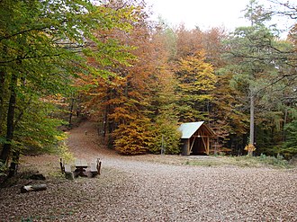
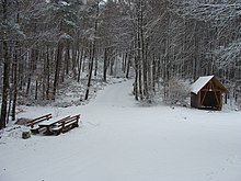
The Benderplatz is an approximately 565.5 m high mountain pass in the Middle Palatinate Forest , part of the low mountain range Palatinate Forest , in Rhineland-Palatinate . The pass lies on the border of the municipalities of Gommersheim (Gommersheimer Wald) and Rhodt unter Rietburg .
Geographical location
The Benderplatz is located in the Palatinate Forest-Vosges du Nord biosphere reserve and in the Palatinate Forest Nature Park . It forms the saddle between the Steigerkopf ( 613.6 m ) and the Sauhag ( 628 m ), a secondary peak of the Kesselberg ( 661.8 m ), which is the second highest mountain in the Palatinate Forest after the Kalmit ( 672.6 m ).
Flowing waters
The Triefenbach rises northeast of the Benderplatz and its first tributary is the Saulhag creek. In the southwest is the Küchental as a small side valley of the Modenbach valley . The Küchentalbach drains into the Modenbach .
history
The top of the pass is named after Friedrich Bender (1869–1932). He was one of the co-founders of the Edenkoben local association of the Palatinate Forest Association. A knight's stone on the edge of Benderplatz reminds of him .
Hiking and refuges
The Benderplatz is a central junction ( path spider ) in the Palatinate Forest Nature Park , which can be reached on hiking trails from the north from the Edenkobener Valley and from the south from the Modenbachtal. The closest peak can be climbed the Steigerkopf ( 613.6 m ) with the Schänzelturm . A hiking trail leads over the Sauhag to the summit of the Kesselberg. Hiking trails lead past the Kesselberg to Kohlplatz ( 465.9 m ) or past the Steigerkopf to Lolosruhe ( 573.8 m ). The Frankenberg ( 556.6 m ) with the remains of the Frankenburg on the Frankenfelsen can also be reached. The Amicitia Hut , the Nello Hut and the Edenkobener Hut at the Hüttenbrunnen are managed shelters by the Palatinate Forest Association . Other managed huts are the Naturfreundehaus on Steigerkopf and the forester's house Heldenstein .
Individual evidence
- ^ LANIS: Benderplatz. Retrieved January 13, 2019 (topographic map).
- ↑ GeoExplorer of the Rhineland-Palatinate Water Management Authority ( information )


