
Böllenborn
| coat of arms | Germany map | |
|---|---|---|

|
Coordinates: 49 ° 6 ' N , 7 ° 56' E |
|
| Basic data | ||
| State : | Rhineland-Palatinate | |
| County : | Southern Wine Route | |
| Association municipality : | Bad Bergzabern | |
| Height : | 269 m above sea level NHN | |
| Area : | 4.11 km 2 | |
| Residents: | 231 (Dec. 31, 2019) | |
| Population density : | 56 inhabitants per km 2 | |
| Postal code : | 76887 | |
| Area code : | 06343 | |
| License plate : | SOUTH | |
| Community key : | 07 3 37 013 | |
| LOCODE : | DE 24B | |
| Community structure: | 2 districts | |
| Association administration address: | Königstrasse 61 76887 Bad Bergzabern |
|
| Website : | ||
| Local Mayor : | Bärbel Drieß (FWG) | |
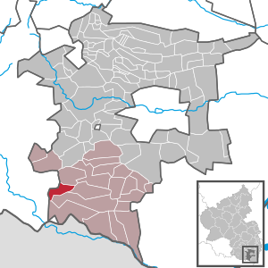
| Location of the local community of Böllenborn in the southern Weinstrasse district | ||
  |
||


Böllenborn is the third smallest municipality in terms of population in the southern Weinstrasse district in Rhineland-Palatinate . It belongs to the Bad Bergzabern community .
geography
location
The municipality is located in Wasgau , as the southern part of the Palatinate Forest and the adjoining northern part of the Vosges are also called. This area is also part of the Upper Mundat Forest . The hamlet of Reisdorf to the west of the core community is designated as a district.
Neighboring communities are - clockwise - Birkenhördt , Dörrenbach , Oberotterbach , Bobenthal and Erlenbach bei Dahn .
Elevations and waters
The western flank of the Hohe Derst , which measures 561 meters, is within the parish of the municipality . The Schulzenberg extends northeast of this . The Böllenborn rises on the eastern edge of the village . The Reisbach rises at the level of the Reisbach district , which partially forms the boundary with Oberotterbach.
history
Böllenborn and Reisdorf were first mentioned in a document from Emperor Ludwig IV on June 14, 1345. Until the end of the 18th century, the two villages belonged to the Electoral Palatinate .
From 1798 to 1814, when the Palatinate was part of the French Republic (until 1804) and then part of the Napoleonic Empire , Bellenborn and Reichsdorf - as they were called at the time - were incorporated into the canton of Annweiler and were subordinate to the Mairie Birkenhördt . In 1815 the place Austria was added. Just one year later, the place changed to the Kingdom of Bavaria . From 1817 Birkenhördt belonged to the canton of Bergzabern . From 1818 to 1862 "Böllenborn und Reichsdorf" was part of the Bergzabern Land Commissioner , which was then converted into a district office.
In 1939 the place was incorporated into the Bergzabern district. After the Second World War , the municipality within the French occupation zone became part of the then newly formed state of Rhineland-Palatinate. During the first Rhineland-Palatinate administrative reform changed the place on 7 June 1969 in the newly created district Landau-Bad Bergzabern, in 1978 in South County Wine Trail is renamed . 1972 Böllenborn was assigned to the also newly formed community of Bad Bergzabern .
population
Population development
The development of the population of Böllenborn, the values from 1871 to 1987 are based on censuses:
|
|
religion
On December 31, 2013, 55.5 percent of the population were Catholic and 23.4 percent Protestant. The rest belonged to another religion or were non-denominational.
politics
Municipal council
The municipal council in Böllenborn consists of six council members, who were elected in the local elections on May 26, 2019 in a personalized proportional representation, and the honorary local mayor as chairman.
The distribution of seats in the municipal council:
| choice | CDU | FWG | total |
|---|---|---|---|
| 2019 | 2 | 4th | 6 seats |
| 2014 | 4th | 2 | 6 seats |
| 2009 | 4th | 2 | 6 seats |
| 2004 | 4th | 2 | 6 seats |
mayor
Bärbel Drieß (FWG) became the local mayor of Böllenborn on June 27, 2019. In the direct election on May 26, 2019, she was elected for five years with a share of 64.33% of the vote. Her predecessors were Dirk Paulsen (CDU), elected in 2014, who did not run again, and previously Gerhard Fleck (CDU), who held the office from 1984 to 2014.
coat of arms
|
|
Blazon : "Split by black and red, on the right a silver white poplar on a green background, separated from a silver masonry spring and a silver spring outlet in a green background, on the left an upright golden key." |
| Justification for the coat of arms: It was approved by the Mainz Interior Ministry in 1950 . The key is reminiscent of the possession of the monastery White Castle and poplar (= Bölle) and source (= Born) refer talking on the place name. |
Culture
Cultural monuments

There are a total of four objects on site that are listed as historical monuments .
Regular events
Kerwe takes place regularly in September on the second weekend in Reisdorf and on the third weekend in Böllenborn.
Knight stones
There are several knight stones on the forest area of the community . Ritterstein 18 is called Hühnerfels and is located on the rock of the same name on the Hohe Derst. 19 Palatinate Unger marks a former resting place for pigs.
Economy and Infrastructure
economy
After the Second World War, the place was part of the Pirmasens Military Community, which has now been dissolved .
traffic
State road 492 runs through Böllenborn . The community is connected to the local transport network via bus line 546, which runs via Bad Bergzabern to Kandel . The closest train station is Bad Bergzabern .
Personalities
Honorary citizen
- Gerhard Fleck (* 1947/48), local mayor 1984-2014, was honored in January 2015 for his extraordinary commitment over the past decades.
Sons and daughters of the church
- Albert Weigel (1902–1985), pastor
Web links
- Böllenborn
- Short portrait of Böllenborn on SWR television
- Literature about Böllenborn in the Rhineland-Palatinate State Bibliography
Individual evidence
- ↑ a b State Statistical Office of Rhineland-Palatinate - population status 2019, districts, municipalities, association communities ( help on this ).
- ↑ State Statistical Office Rhineland-Palatinate (ed.): Official directory of the municipalities and parts of the municipality. Status: January 2019 [ Version 2020 is available. ] . S. 159 (PDF; 3 MB).
- ↑ State Statistical Office Rhineland-Palatinate - regional data
- ↑ KommWis, as of December 31, 2013
- ^ The Regional Returning Officer Rhineland-Palatinate: Local elections 2019, city and municipal council elections
- ↑ Sonja pound stone Brinkop: Böllenborn: appointed Bärbel Drieß to the local mayor. July 1, 2019, accessed April 19, 2020 .
- ^ The Regional Returning Officer of Rhineland-Palatinate: direct elections 2019. see Bad Bergzabern, Verbandsgemeinde, fifth row of results. Retrieved April 19, 2020 .
- ↑ Gerhard Sommer: On Case II: Which local chiefs in the Bad Bergzabern community are running again. Die Rheinpfalz, October 1, 2018, accessed on April 19, 2020 .
- ↑ a b Gerhard Fleck and Klaus Stalter awarded the Freiherr vom Stein plaque. In: press release. District of Südliche Weinstrasse, October 27, 2016, accessed on April 19, 2020 .
- ^ Karl Heinz Debus: The great book of arms of the Palatinate. Neustadt an der Weinstrasse 1988, ISBN 3-9801574-2-3 .

Cities: Annweiler am Trifels | Bad Bergzabern | Edenkoben
Municipalities: Albersweiler | Altdorf (Palatinate) | Barbelroth | Cheapheim-Ingenheim | Birkenhördt | Birkweiler | Böbingen (Palatinate) | Böchingen | Böllenborn | Bornheim (Palatinate) | Burrweiler | Dernbach (Palatinate) | Dierbach | Dörrenbach | Edesheim | Eschbach (Palatinate) | Essingen (Palatinate) | Eusserthal | Flemlingen | Frankweiler | Freimersheim (Palatinate) | Gleisweiler | Gleiszellen-Gleishorbach | Goecklingen | Gommersheim | Gossersweiler-Stein | Großfischlingen | Hainfeld (Palatinate) | Hergersweiler | Herxheim near Landau / Pfalz | Herxheimweyher | Heuchelheim Blades | Hochstadt (Palatinate) | Ilbesheim near Landau in the Palatinate | Vaccinees | Insheim | Kapellen-Drusweiler | Kapsweyer | Kirrweiler (Palatinate) | Small fish | Klingenmünster | Knöringen | Leinsweiler | May Chamber | Münchweiler am Klingbach | Niederhorbach | Niederotterbach | Oberhausen (near Bad Bergzabern) | Oberotterbach | Oberschlettenbach | Offenbach an der Queich | Pleisweiler-Oberhofen | Ramberg (Palatinate) | Ranschbach | Rhodt under Rietburg | Rinnthal | Rohrbach (Palatinate) | Roschbach | Saint Martin (Palatinate) | Schweigen-Rechtenbach | Schweighofen | Siebeldingen | Silz | Steinfeld (Palatinate) | Venningen | Völkersweiler | Vorderweidenthal | Waldhambach | Waldrohrbach | Walsheim | Wernersberg | Weyher in the Palatinate