List of knight stones
The list of knight stones contains all known knight stones of the Palatinate Forest Association e. V. (PWV) in the Palatinate Forest ( Rhineland-Palatinate ).
In 1908, the PWV began under its founding chairman Karl Albrecht von Ritter (1836-1917), who promoted the project significantly, to remarkable places in the Palatinate Forest path and placemarks from sandstone to build. For this purpose, stone blocks were partially set up, and existing rocks or walls were also used in some cases . In addition to the carved text, there is - with exceptions - the abbreviation PWV for the Palatinate Forest Association on every knight's stone .
In 1912 the general assembly of the PWV decided to name the stone brands after Karl Albrecht von Ritter Rittersteine .
Existing knight stones
The meaning shown in the list is taken from the literature:
- Forest / Hunting - Forest and hunting lodges or places significant for forest and hunting
- Hist. - Historically or through legends significant places
- Ind. - industrial plants, ore mining
- Orient. - Landmarks for hikers
- Pers. - Honoring personalities
- Siedl. - Historic settlements and farms
- Cattle - Livestock farming, wolf control
- Waldw. - Forestry, timber industry, Trift
| number | Surname | meaning | Location, description | photo |
|---|---|---|---|---|
| 1 | Trift wooden yard | Waldw. | ⊙ UpperMundatwald, south of theBobenthal-St. Germanshof road. At the seven-part bridge. Former wood storage area for rafting. |

|
| 2 | Hill 1704 | Hist. | ⊙ On theProbstberg. Hill from theWarof theSpanish Succession(1701–1714). |

|
| 3 | Spoon Cross | Hist. | ⊙ North of the Bobenthal – St. Germanshof. Recalls the murder of Lord von Gundelfingen fromWeißenburg Abbey. |
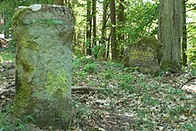
|
| 4th | Donkey bow | Waldw. | ⊙ North of the Bobenthal – St. Germanshof. Slide, where donkeysdraggedthe wood into theWieslautertal. Misspelling on the stone. |
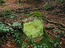
|
| 5 | Donkey grinding house | Waldw. | ⊙ With the help of donkeys,Triftholz wasdragged downhill to the Wieslauter. Refuge at the top of the Eselsschleif. |
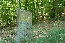
|
| 6th | Hill 1704 | Hist. | ⊙ . On the Pitzberg, hill from the War of the Spanish Succession (1701–1714). |

|
| 7th | Wegscheid | Orient. | ⊙ On the way fromSchweigento theGuttenberg ruins. Meeting point of five paths from the direction of Schweigen,Weiler, Langental, St. Germanshof and the Guttenberg ruins. |

|
| 8th | Mundathütte | Siedl. | ⊙ . North of the upper Kirchberg in theMundat Forest. Former part of the forest that was donated to the Weißenburg monastery by theMerovingian kingDagobert. Confirmation byPippin. |

|
| 9 | Glückauf L. v. G. 1838 | Ind. | ⊙ At the mouth of the formerSt.-Anna-Stollenore minenearNothweiler, which was operated byLudwig von Gienanth. |

|
| 10 | Glückauf L. v. G. 1838 | Ind. | ⊙ Stone close to the lower entrance of the mine. |

|
| 11 | R. Buchbacherhof | Siedl. | ⊙ . In the Buchbach Valley, south of the Zimmerhörnel, in the Mundat Forest. Remains of the courtyard, which was demolished in 1846. |
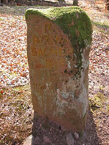
|
| 12 | Hill 1704 | Hist. | ⊙ The arrow points in the direction of the former ski jump on the western slope of the Querenberg, a hill from the War of the Spanish Succession (1701-1714) |

|
| 13 | Deer potion | Orient. | ⊙ . 150 m south of the Derstenhäuschen, large sandstone slab with a recess in which rainwater collects. |

|
| 14th | Three beeches | Orient. | ⊙ . In the saddle betweenSchloßbergand Querenberg, on the border with the Mundat Forest. Site of three mighty beeches. |
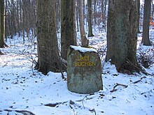
|
| 15th | R. Castle hut | Siedl. | ⊙ . 150 m north of the Guttenberg ruins, in the saddle between Kanzelberg and Schlossberg, on the border with the Mundat Forest, location of a former refuge, near the castle fountain. |

|
| 16 | Coronation Bush | Pers. | ⊙ . South-east of theStäffelsberg towernearDörrenbach. Joy rallies took place here on the occasion of the coronation ofNapoleon IIas King of Rome, son ofNapoleon I. |

|
| 17th | Biberkopf found in 1902 | Cattle | ⊙ . 800 m north of the confluence of thePortzbach valleyon the road to Bobenthal. A suspected beaver head was found in a crevice during road construction. |

|
| 18th | Chicken Rock | Orient. | ⊙ . On the western slope of theHohe Derst, probably a mating ground forcapercaillie |

|
| 19th | Palatinate Unger | Cattle | ⊙ . Next to a refuge on the road fromReisdorfto the Portzbachtal, resting place for the pigs during the forest pasture. Reluctance is an old word for rest. |

|
| 20th | table | Orient. | ⊙ . Table rocks on the ridge of the Hohen Derst |

|
| 21st | Three oaks | Orient. | ⊙ . North-east of the Hohe Derst, betweenFarrenbergand Schulzenberg. Site of three old oak trees thatwere shot to piecesduringWorld War II. Today there are three young oaks. |

|
| 22nd | Glückauf L. v. G. 1835 | Ind. | ⊙ . In the garden wall of the forester's house Erzgrube. Entrance to the tunnel thatLudwig von Gienanth had opened in1835. |

|
| 23 | At the picture | Orient. | ⊙ . In the curve of the road from Drei Eichen to Hohen Derst: the former location of a wayside shrine |
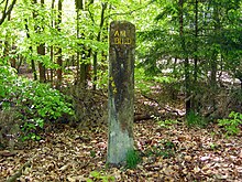
|
| 24 | At the picture | Orient. | ⊙ . In the saddle between theStäffelsbergand the Kohlbrunnberg, reference stone to the wayside shrine a few steps to the west. |
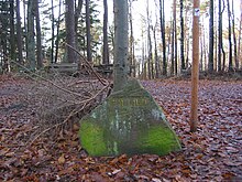
|
| 25th | Image 1756 | Orient. | ⊙ . The old wayside shrine column points to number 24. |

|
| 26th | At the picture oak | Orient. | ⊙ . On the road fromBirkenhördtto Lindelbrunn. Old wayside shrine. |

|
| 27 | signal | Orient. | ⊙ . On the Hohen Derst, at the end of the driveway, the location of an optical telegraph in theNapoleonic era. |
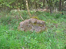
|
| 28 | Former Iron ore mines | Ind. | ⊙ . On the forest path opposite the road fromBöllenborntoBad Bergzabern. At the valley entrance to the Eißerstal. |

|
| 29 | Former Lead ore pit | Ind. | ⊙ . In the Portzbachtal at the southern end of the Seehofweiher. Location of a former lead ore mine. |

|
| 30th | Former Iron ore mines | Ind. | ⊙ . At the eastern tip of the Petronell near Bad Bergzabern. |

|
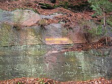
| 31 | New country hole | Orient. | ⊙ . In the rock face at the apex of the road from Birkenhördt toLauterschwan. Landlöchel is a popular expression for a road break. |
|
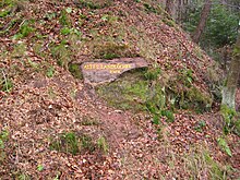
| 32 | Old country hole | Orient. | ⊙ . In the rock face at the apex of the road from Birkenhördt toVorderweidenthal, otherwise like 31. |
|
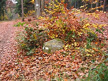
| 33 | Oberrot | Waldw. | ⊙ . On the way between the Querenberg and the Spitzenberg. The name comes from clearing. |
|
| 34 | Silzer linden tree | Orient. | ⊙ Name of the linden tree (popular expression). On the Höhenweg in the Abtswald betweenSilzand Birkenhördt. Location of an old linden tree. |

|
| 35 | At the holder picture | Orient. | ⊙ . On the forest path between Spitzenberg andAbtskopf. Location of a wayside shrine on an elder tree. |

|
| 36 | Monastery fountain | Orient. | ⊙ . In a side valley of the road fromSalzwoogtoLangmühle. The area with the spring belonged tothe Hornbach monastery. |

|
| 37 | R. Kaleseyerhof 1855 | Siedl. | ⊙ . Former Forest farm in a side valley of theStüdenbachtalnearEppenbrunn. Farm named after the owner, which was closed in 1867. |

|
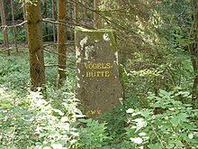
| 38 | Bird hut | Siedl. | ⊙ . Former Forest farm on the forest road in the Zieglertal nearHinterweidenthal. Farm named after the owner, Vogel, which was closed in 1855. |
|
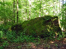
| 39 | Kunzelmannsgut | Siedl. | ⊙ . Former manorial estate on Waldstrasse in the Zieglertal near Hinterweidenthal, first mentioned in 1613. |
|
| 40 | Granitzenhütte | Siedl. | ⊙ . In theHorbach valleybetween Großer Boll and Großer Horberg. Sparse remains of a homestead, founded by Peter Granitz, laid down in 1845. |

|
| 41 | Prinzenweg | Pers. | ⊙ . On the road fromEschbachtoMadenburg. The road waslaid outin 1889 in honor ofPrince Regent Luitpold. |

|
| 42 | Cramer path | Pers. | ⊙ . On the path from Trifels to Madenburg. BuiltbyHeinrich Cramer,a skilled forester. The path was named in his honor. |

|
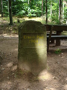
| 43 | Cramer path | Pers. | ⊙ On the hiking trail from the Madenburg to Trifels. BuiltbyHeinrich Cramer,a skilled forester. The path was named in his honor. |
|
| 44 | At the table - old Geraide court | Waldw., Forest / hunting | ⊙ . In the saddle betweenWetterbergandSchletterberg. Place of jurisdiction over matters of the so-called "Geraidewald". The decisions of the court were mandatory without appeal. There were a total of 19 Geraiden, pieces of land that belonged to several communities. |

|
| 45 | R. Neu-Falkenburg | Siedl. | ⊙ Below theFalkenburgruinsinWilgartswiesen. Below the castle, which was destroyed in 1689, the rule of Leiningen had a new castle, Neu-Falkenburg, built, which was also destroyed in 1793. The original stone was not far from where it is today. Until 2016/2017, the current stone was on the opposite side of Tiergartenstrasse. The old previous stone (see picture under "Lost Knight Stones") was removed and placed with a new inscription828 Rathausplatz 2003on the green area in the center of the village. |

|
| 46 | Zoo | Orient. | ⊙ . To the northwest of Wilgartswiesen in the valley between the Falkenburg ruins and the Großer Breitenberg. Count Hanns Heinrich von Leiningen had a zoo laid out here in 1553. |

|
| 47 | Grim Iron Trail | Pers. | ⊙ . North of Annweiler at the foot of theGroßer Adelsberg, at the path entrance behind the youth hostel of thePalatinate Turnerbund (PTB). In honor of Albert Grimmeisen, co-founder of the Palatinate Forest Association, who had a fatal accident with his friend Heinrich Holder on a climbing tour on the Wetterhorn in 1908. See also Ritterstein No. 228. |

|
| 48 | Wolfsgrub 105 Schr. | Cattle | ⊙ North of Wilgartswiesen, in the saddle between the Großer Breitenberg andGöckelberg. The inscription on a rock indicates the still recognizable wolf pit located on the path above the rock, in which the wolves were previously caught. |

|
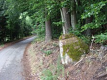
| 49 | R. Wiligartaburg | Orient. | ⊙ . 49 At the edge of the forest north of the road fromRinnthalto Wilgartswiesen; Pointing stone to the castle ruin, theWilgartaburgnearWilgartswiesen,located on a rock massif above |
|
| 50 | Wildsauhütte | Siedl. | ⊙ . On the hiking trail from Hinterweidenthal toHermersbergerhof, in the saddle between the Große Boll and the Haseneck. Location of a former log cabin for foresters and forest workers. |

|
| 51 | At the Zwiesel | Orient. | ⊙ Confluence of theKaltenbachandWellbach rivers. Today the town of Annweiler's valuable wood storage area. |

|
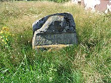
| 52 | Eussertal monastery property | Siedl. | ⊙ In the hamlet of Hermersbergerhof, which was owned bythe Eusserthal monasteryfrom 1165 to 1467. |
|
| 53 | Protected | Orient. | ⊙ The juniper trees no longer exist. Stone on private property! |

|
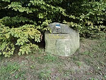
| 54 | Sheep farm | Cattle | ⊙ . East of Merzalben, in the saddle between theruins of Gräfensteinand theVorderen Winschertkopf. The shepherd's farm of Gräfenstein Castle and the shepherd's hut stood here. |
|
| 55 | gap | Orient. | ⊙ . In the saddle between theWartenbergandSchmalem Hals. The saddle between the two mountains forms a narrow gorge, which was popularly called "gap". |

|
| 56 | Königswoog | Waldw. | ⊙ . In theWartenbachtal, below the Graefenstein ruins. Old woog for the wood drift. |

|
| 57 | Dreiherrenstein | Orient. | ⊙ . On the old elevated road from Hermersbergerhof to Weißenberg. The grown rock served as a boundary stone. The boundary signs are carved on the rock, MB =Margraviate Baden, PZ =Pfalz-Zweibrücken, PZFW = ZweibrückischeFrankenweide, KW = royal forest wascarvedin 1816 by theBavarians. |

|
| 58 | Zimmer-Platz during the construction of Scharfeneck Castle, later the castle garden | Orient. | ⊙ At theWegspinneZimmerplatzsoutheast of theNeuscharfeneck Castlenear thePalatinate Forest Association-HütteLandauer hut. In the saddle between theNeuscharfeneck ruinsand theOrensberg. The place was the place of execution for the timber during the construction of Neuscharfeneck Castle. |

|
| 59 | R. Wüstmühle | Siedl., Ind. | ⊙ . North of the Hermersbergerhof in theKaltenbachtal. In a wall in the fenced-in area of a pumping station, not accessible. A saw and grinder once stood here. |

|
| 60 | R. Jagdhäuschen 20 Schr. | Siedl., Forest / hunting | ⊙ . On the northwestslope oftheWeißenberg, west of the Holländerklotz. Here was a little house for the hunters. |

|
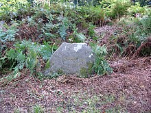
| 61 | Schanze 1794 100 Schr. | Hist. | ⊙ . On the road betweenJohanniskreuzandLeimen, shortly before the junction of the Waldstraße to the Hermersbergerhof. Reference to a Prussian redoubt from the time of theRevolutionary Wars (1793–1797). |
|
| 62 | Main hill I | Hist. | ⊙ . On the northwestslope of theSteigerkopfon the way from theforester's house Heldensteinto theSchänzelturm, a crescent-shaped Prussian ski jump from the time of the Revolutionary Wars (1793–1797). |

|
| 63 | Hill II | Hist. | ⊙ . On the southwest slope of the Steigerkopf between Forsthaus Heldenstein andBenderplatz, Prussian hill from the time of the Revolutionary Wars (1793–1797). |

|
| 64 | Hill III | Hist. | ⊙ . On the southeast slope of the Steigerkopf between Schänzelturm and Benderplatz, Prussian hill from the time of the Revolutionary Wars (1793–1797). |

|
| 64a | Hill III | Hist. | ⊙ Reference to Schanze III with arrow. |

|
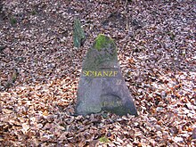
| 65 | Hill IV | Hist. | ⊙ . On the northwestslope of theSteigerkopf, on the road from the forester's lodge Heldenstein into theEdenkobener Valley, Prussian ski jump from the time of the Revolutionary Wars (1793–1797). |
|
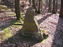
| 66 | Caught in front of Schanze I. | Hist. | ⊙ . On the western slope of the Steigerkopf, below the main hill I. Fortification with a small parapet in front of two trenches from the time of the Revolutionary Wars (1793–1797) |
|
| 67 | Caught under hill IV | Hist. | ⊙ . On the northwest slope of Steigerkopf, below Schanze IV. Fortification with a parapet in front of 2 trenches from the time of the Revolutionary Wars (1793–1797). |

|
| 68 | Place where General von Pfau fell on July 13, 1794 | Hist. | ⊙ Also called "peacock". About 100 m west of the Schänzelturm. The peacock stone marks the place whereGeneral von Pfaufell and is probably also buried. |

|
| 69 | Kohlplatz - battle of retreat of the Batl. von Schladen under Major von Borck on July 13, 1794 | Hist. | ⊙ . In the saddleKohlplatzbetweenKesselbergand Querenberg. Reference to thebattalion battalion of Schladenretreatafter the fighting for the Schänzel. |

|
| 70 | Prince Regent Luitpold March 12, 1911 90 years old | Pers. | ⊙ . On the road from Johanniskreuz to Hermersbergerhof, south of theLuitpold toweron the Weißenberg. Erected for the 90th birthday of Prince Regent Luitpold of Bavaria. |

|
| 71 | On the Dutch block | Waldw. | ⊙ . North-east of Weißenberg on the road from Johanniskreuz to Hermersbergerhof. In the 17th century there were tall fir trees that were bought by the Dutch for shipbuilding. |

|
| 72 | Schwörstein | Orient., Forest / hunting | ⊙ . To the northwest of the Eusserthal specialist clinic in the saddle betweenHarzofenberg, Kneipenkopf andHermeskopf. Boundary and bearing stone. Foresters were hired here. |

|
| 73 | On the vinegar | Cattle | ⊙ . At the confluence of the Hochstrasse from Heldenstein toTaubensuhl. Probably an old pasture. Etzen is an old word for grazing and grazing. |

|
| 74 | Feeding grounds | Orient., Cattle. | ⊙ . On the elevated road from Heldenstein to Taubensuhl. Resting place for carters who let their animals drink and graze here. |

|
| 75 | Death Man | Hist. | ⊙ . Next to the elevated road from Heldenstein to Taubensuhl. A deadherb collectorwas once found here. |

|
| 76 | Fire place | Orient. | ⊙ . On the elevated road from Heldenstein to Taubensuhl. Between cherry tree and pebble corner picture. Reference to a fire place for forest workers in earlier times. |

|
| 77 | Cherry tree | Orient., Waldw., Viehw. | ⊙ . On the elevated road from Heldenstein to Taubensuhl. There used to be a forest garden with a cherry tree here. |

|
| 78 | Mosisbruch | Siedl. | ⊙ . South of the Eschkopf, betweenMosisbergand Saukopf; Location of a forest farm on the edge of a swampy raised bog |

|
| 79 | Captain's hut | Hist. | ⊙ . On the road fromJohanniskreuztoLeimenwest of the Mosisberg, on the western slope of the Langerkopf; Location of the hut of a Prussian captain from the time of the Revolutionary Wars (1793–1797) |

|
| 80 | Preussenstein | Hist. | ⊙ . On the road from Johanniskreuz to Leimen, west of the Mosisberg, on the western slope of the Langerkopf; Location of aPrussianguard who carved the word "PREUSEN" into a rock slab with awkward letters |

|
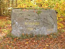
| 81 | Hill 1794 | Hist. | ⊙ . East of thefederal highway 48from Johanniskreuz into the Wellbachtal. About 500 m before the junction of the road to Leimen (L 496). Reference to a hill from the time of the Revolutionary Wars (1793–1797). |
|
| 82 | Soup bowl | Orient. | ⊙ . North of the elevated road from Heldenstein to Taubensuhl, northwest of Kieseleck. Mighty, earth-connected rock slab with a bowl-shaped hollow in which rainwater collects. Old boundary signs are chiseled in. |

|
| 83 | Boll | Orient. | ⊙ . North of the elevated road from Heldenstein to Taubensuhl, on the southern slope of the Kurzes Eck mountain. Boundary stone, earth-bound rock slab with a bowl-shaped hollow in which rainwater collects. Boll is the name of a large ladle. |

|
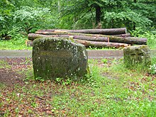
| 84 | Weisserstein | Orient. | ⊙ . South of the road from Johanniskreuz to Schmalenberg. Wrongly written, actually Weiserstein, Dreimark: Lauberwald, Hornbacher Klosterwald and Meiserwald. |
|
| 85 | On the three stones | Orient. | ⊙ . North of the road from Johanniskreuz through the Wellbachtal toRinnthal, near the confluence of the road fromIggelbach. The three boundary stones are located near the Birkeneck. |

|
| 86 | Shoemaker's boots | Orient., Hist. | ⊙ . On the forest road in the saddle between the Kühlkopf, Bösenberg and Flachkopf. Large slab of rock in which a boot is carved. The meaning of the boot is controversial. Next to the boot are the letters LD. A Leiner Daniel was a shoemaker and moved fromHornbachto nearbyEdenkobenin 1763or the sign of the Bundschuh the symbol of the rebellious peasants in 1525 or a sign of the French revolutionary troops in 1794. |

|
| 87 | Venninger Tower | Orient., Cattle. | ⊙ . At theLambrechtNaturfreundehaus at the end of theKohlbach valley. Room for carpenters, in this area the wood for the construction of theVenningenchurch tower was felled. |

|
| 88 | By the wind holes | Orient. | ⊙ . In the upperHelmbach valleyon the forest path on the northwest slope between the Geißkopf and the Hofberg. Lower exit of a cliff from which the heavier cold air flows out in summer, at the upper exit of the cliff the warmer air of the cliff emerges as fog in the daylight in winter. |

|
| 89 | Immensack | Orient. | ⊙ . On a lower foothill of the Miedersberg, above the youth campground on the Geiswiese. The foothills of the Miedersberg has the shape of a sack that was used to catch a swarm of forest bees that was attached to the tree (bee = Imme). |

|
| 90 | To the pulpit rock with the inscriptions of the division of the Haingeraide 108 Schr. | Orient., Waldw., Forest / Hunting | ⊙ . In the middle of the eastern mountain slope fromKanzelkopf, west ofTotenkopfstrasse. Reference to the pulpit rock 108 steps away with the inscriptions of the division of a community forest in 1823 between the villages ofMaikammer,St. Martin,DiedesfeldandKirrweiler. |

|
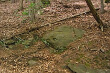
| 91 | To the pulpit rock 120 Schr. | Orient. | ⊙ . On the north-west slope of the pulpit head reference to the pulpit rock 120 paces away, otherwise like no.90. |
|
| 92 | To the Röhringsbrunnen 70 steps right | Orient. | ⊙ . On the middle northwest slope of the pulpit head. Reference to the tubular fountain 70 steps away. |

|
| 93 | Hexlerhütte | Siedl. | ⊙ . In the rearErlenbachtalat the Erlenbach farm nearSpeyerbrunn. In the wall on the road. Former homestead from which the small town ofErlenbachdeveloped. The name probably goes back to a Jakob Hexemer. He probably lives in the Hexlerhütte, on the Hexlerwoog near the Hexlereck. |

|
| 94 | Ore mines | Ind. | ⊙ . On the road in the Erlenbachtal, on the southeast slope of the Speyerbrunner Eck. There were two former iron ore mines in the vicinity; mining ceased at the end of the 18th century. |

|
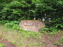
| 95 | Old enamel | Ind. | ⊙ . North of the road from Elmstein to Speyerbrunn, at the confluence of theLegelbachtal. An iron smelterstood here under ElectorKarl Theodor in1780. Operations ceased in 1829 and the buildings demolished in 1855. |

|
| 96 | In the Legeltal | Orient. | ⊙ . Inscription on the same stone as Ritterstein No. 95. Signpost to the beautiful Legelbach valley. |
|
| 97 | R. Hunting Lodge | Siedl., Hist., Forest / Hunting | ⊙ . On the hiking trail on the northwestslopeofBrogberg, southeast of the road fromIggelbachtoEschkopf. Location of ahunting lodge builtby Count PalatineJohann Casimir. Larger remains of the foundation have been preserved. |

|
| 98 | Bacon rich | Orient. | ⊙ . On the road from Iggelbach to Eschkopf. Name of a forest department. The name either goes back to a well-nourished forester Heinrich or because pines with fat, resinous wood used to grow there. |

|
| 99 | Cabbage fountain | Orient. | ⊙ . Next to the road at the entrance to the Kohlbachtal, southeast of theforester's house Helmbach. Source at a small forest pond. The name points to the former charcoal burning company there. |

|
| 100 | Cramer | Orient., Pers. | ⊙ . A few meters behind the forester's house Helmbach on a rock. In honor of the government director and head of the Chamber of Forests,Heinrich Cramer. |

|
| 101 | Burgalbsprung | Orient. | ⊙ . Southwest ofJohanniskreuz, in the upperSchwarzbachtal. Place where the Burgalb rises in a small forest pond, it flows into theSchwarzbachjust below. |

|
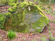
| 102 | Moosalbsprung 40 Schr. | Orient. | ⊙ . Southwest of Johanniskreuz, in the upper end of the Mooster Halde. TheMoosalbrises hereand flowsinto the SchwarzbachatWaldfischbach. |
|
| 103 | To the large pulpit rock 330 Schr. | Orient. | ⊙ . On the Mantelweg, named after a forester named Mantel, southwest of the. In 1912 the Palatinate Forest Association laid out a path that leads up to the pulpit rock. There is a half-cave there, ten meters long and four meters deep, once a protection for the population in times of war. |

|
| 104 | Treffnix | Orient., Forest / hunting | ⊙ . North-east of Iggelbach, between Kurzem Eck, Mönchberg and Grünberg. Location of a former shooting range for foresters and hunters, popularly called "Treffnix" for a joke. |

|
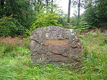
| 105 | Burr sole | Orient. | ⊙ . 200 meters north of Johanniskreuz, on the road from Johanniskreuz toHochspeyer. There used to be a hollow on the mountain ridge here. |
|
| 106 | Supreme Court 1767 | Orient. | ⊙ . On the road fromTrippstadttoKaiserslauternat the confluence of the road to HofLangensohl. The high court of theWilenstein lordship wasat this point, and thegallows stood nearby. |

|
| 107 | Wolf pit | Cattle | ⊙ . North-east of Elmstein, on the road between the villages ofHarzofenandSchwabenbach. There was a former wolf pit here, which can still be seen. |

|
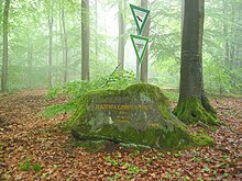
| 108 | Haidhaldbrunnen 220 Schr. | Orient. | ⊙ . East of theStüterhof, betweenLeiterbergand Hohlog. Reference to the well located 220 steps below, which used to be a cattle trough. |
|
| 109 | World Heritage Valley | Orient. | ⊙ . To the east of the village ofMückenwiese, on the road from Elmstein to Speyerbrunn, at the entrance to theWelterstal. Inscription on the rock to the west of the valley entrance. |

|
| 110 | World Heritage Valley | Orient. | ⊙ . Like Knight's Stone No. 109. Inscription on the rock to the east of the valley entrance. |
|
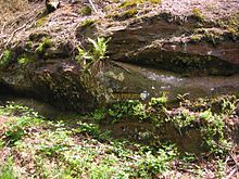
| 111 | St. John's Cross | Orient., Hist., Forest / Hunting | ⊙ . About 100 m north of the restaurant, directly on theB 48. Today there are three crosses below the knight's stone. The ancient cross was replaced in 1769 by a new one that later fell from its base. The third was added in 1863, this time made of cast iron. Probably a border cross. The coats of arms of theHoheneckerand Wilensteiner can be seenon the stone. |

|
| 112 | R. Mückenwies Forestry House | Siedl. | ⊙ . On the road fromElmsteinto Speyerbrunn, at the confluence of theEnkenbachtalin theElmsteiner Tal. This is where the Mückenwies forester's house stood, closed in 1883. No more leftovers. |

|
| 113 | R. Breitenstein 500 Schr. | Orient. | ⊙ . On the road from Elmstein to Erfenstein. Reference toBreitenstein CastlenearHelmbach. |

|
| 114 | RF Amsohl | Siedl., Forest / hunting | ⊙ This is where the ruins of the Amsohl forester's house, abandoned in 1874, are located directly on federal highway 48. |

|
| 115 | Glassworks 1767 | Siedl., Ind. | ⊙ . South ofMölschbachin the Eulental. Reference to the location of a former glassworks. Erected around 1600, abandoned in 1767. |

|
| 116 | RF Wittgenberg | Siedl., Forest / hunting | ⊙ . 2 km north of Trippstadt, between the Quellbachhübel and the Wittgenberg. The forester's house built in 1832 was abandoned in 1873. |

|
| 117 | Damsel | Orient. | ⊙ . North-west of the old elevated road, below the large road spider in the saddle between the Leiterberg and the Hohen Oselkopf. Presumably the old elevated road was also a Roman road. The earthfill gave reason to believe that it was a dam. |

|
| 118 | Thick oak 600 bar. | Orient. | ⊙ . North-east on the forest path from Schwarzsohl toSchwabenbach. Reference to a centuries-old oak. Approximately 5 m trunk circumference, natural monument. |

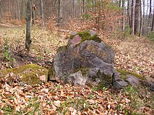
|
| 119 | Oak | Orient. | ⊙ . About 300 m northeast of Ritterstein No. 118 on the forest path that leads around the Bremeneck. From here a beaten path leads to the thick oak. |
|
| 120 | R. Breitscheid hunting lodge | Siedl., Forest / hunting | ⊙ . About 2 km southwest ofSchwarzsohl, at the height between Legelberg and Heidelbeereneck. Built by Count Palatine Johann Casimir (1543 - 1592), later a forester's house until 1831. Today the Nibelungenhaus stands there, built in 1929 by a group of wandering birds. |

|
| 121 | Early Haacke Holsriese | Waldw. | ⊙ . Next to the eastern end of the wall at the church of Speyerbrunn. Here was a wooden giant from the time of the Holztrift, created by BaronLudwig Anton von Hacke. The wood was brought to the raftable Speyerbach via the wooden giant. |
 . .
|
| 122 | Road built early Hoe 1737 | Waldw. | ⊙ . On the southwest slope of the southern foothills of theRiesenberg. The inscription is on the so-called Pestfelsen on the forest road from the Stüterhof to Speyerbrunn. The path was built by Ludwig Anton von Hacke in 1737. |

|
| 123 | Augustus head | Orient., Pers. | ⊙ . South of Mölschbach in the Eulental. The forest, which is still recognizable today, was built by Baron Karl Theodor von Hacke. He named her after his sister Auguste Elisabetha. |

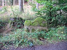
|
| 124 | R. Amoenenhof | Siedl. | ⊙ . In the upper Moosalbtal, east of theGutenbrunnerhof. The small courtyard was built by Baron Karl Theodor von Hacke, who named it after his mother Amöna Maria Karolina. The location information in the sources does not exactly match. |
|
| 125 | Molten iron | Ind. | ⊙ . In the lower Karlstal, on the corner wall at the confluence of the road from Stelzenberg intoKarlstal. Former iron smelter west ofTrippstadterUnterhammer. |

|
| 126 | Old forester's house 15 Schr. | Siedl. | ⊙ . On the road from Hochspeyer to Johanniskreuz, between Schwanenberg, Großem Scheidtaler Eck and Schweidwald. Baron von Hacke's forester's house, demolished in 1852. |

|
| 127 | Erlenbrunnen 140 Schr. | Orient. | ⊙ . On the forest path from the Stüterhof to Schwarzsohl, between Hohem Oselkopf, Krottenbuckel and Erlenbrunneck. Reference to the spring below, which served as a cattle trough. |

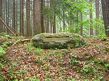
|
| 128 | Claw hump | Orient. | ⊙ . On the forest path from the Stüterhof to Schwarzsohl, about 250 m north of the Erlenbrunnen, between Erlenbrunneck and Krottenbuckel. At the foot of the mountain there should have been small wallows, so-called Krottenpfühle. |
|
| 129 | At the gentleman's table | Orient. | ⊙ . West ofNeidenfels, between Kleines Pflasterberg and Zigeunerkopf. Foresters and hunters are said to have rested at a stone table here, which is why forest workers called it a gentleman's table. |

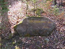
|
| 130 | In the Legeltal | Orient. | ⊙ . Southwest of the Schwarzsohl between the Heidelbeereneck and the Rumpelseck. Signpost to the Legelbach valley at the upper entrance to the valley. |
|
| 131 | Schoenlaub-Linden | Orient. | ⊙ . Southwest of the Schwarzsohl between the Heidelbeereneck and the Rumpelseck. Forester Schönlaub from the nearby forester's house Schwarzsohl is said to have planted seven linden trees there. |
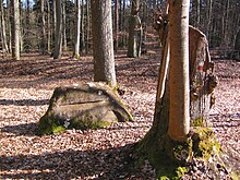
|
| 132 | Stone cross 1910 | Orient. | ⊙ . On the old elevated road southwest of Schwarzsohl. No special meaning. Established in its current form in 1910 by the Palatinate Forest Association. |

|
| 133 | Mooswieserhof 1767 | Siedl. | ⊙ . South of the road fromAschbacherhoftoMölschbachnear a hiking hut. Founded in 1767, at times used as a forester's house, it was demolished in 1833. |

|
| 134 | Beam fountain 160 Schr. | Orient. | ⊙ . In a rock slab a few meters north of the confluence of the road from Mölschbach into the B 48. Near the fountain, vintners from the Upper Palatinate are said to have prepared wood to make vineyard beams. |

|
| 135 | Glue base | Orient. | ⊙ . On the Hochstraße from Stüterhof to Schwarzsohl, between Legeleck and Wolfeneck. Probably an old clay pit in which water later collected. |

|
| 136 | Prince Regent Luitpold Linde March 12, 1911 | Pers. | ⊙ . On the road from Weidenthal to Schwarzsohl, between Meisenrain and Salzlecker Berg. The knight's stone was erected to celebrate the 90th birthday of Prince Regent Luitpold of Bavaria. |

|
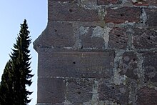
| 137 | Kath. Then Luth. Church 12-18 Century | Siedl., Hist. | ⊙ . At the entrance to the old Aschbacherhof, the inscription is on the south side of the church tower ruins. Church of St. Blasiusfirst mentioned in 1215, was a church for the villages of Trippstadt,Stelzenberg,Mölschbachand the Stüterhof. During the Reformation it was the first Lutheran church in the Palatinate. |
|
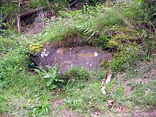
| 138 | Sea wave | Orient. | ⊙ . On the road from Waldleiningen to Johanniskreuz, at the foot of the northern slope of the Schlossberg. Reference to the beautiful Seewoog at the Leinbachquelle. Woogwest ofWaldleiningen. |
|
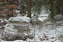
| 139 | Otterbergersohl | Orient. | ⊙ . On the forest path from Mölschbach to the B 48, between Brotpfadkopf and Hellerwald. Former cattle trough, the surrounding forest belonged tothe Otterberg monastery. |
|
| 140 | barn | Orient., Siedl., Waldw. | ⊙ . At the intersection of the streets Kaiserslautern - Waldleiningen and Hochspeyer - Johanniskreuz. There was a house with a stable up here. The wood was brought from the Kaiserslauter forest over the pass into theLeinbachtalto the Trift. In order to protect the animals, the horses were changed here. The stable was built for the harness horses. |
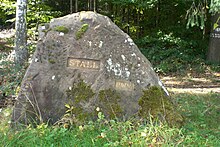
|
| 141 | Black stick | Orient. | ⊙ . About 500 m north of the road from Waldleiningen to Schwarzsohl, on a forest path on the northeast slope of Wolfeneck. The name is difficult to interpret, perhaps there was a hollow tree stump here that was once burned out. |

|
| 142 | Heidenbrunnen 100 Schr. | Orient. | ⊙ . Below the forest path from Schwarzsohl to Esthal, between Erdbeerenkopf andHeidenkopf. Reference to the Heidenbrunnen, which rises further down, while still in the old stone trough of the former cattle trough. |

|
| 143 | Donkey sole | Orient. | ⊙ . On the ridge of the Eselsohler mountain, northwest of the high road from Weidenthal to Schwarzsohl. Recalling the while lyingwallowin which wealthier wallowed serving as pack animals donkey. |
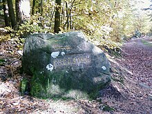
|
| 144 | Schanze 1793/94 360 Schr. | Hist. | ⊙ . North of the intersection at the stable, on the western slope of theHarten Kopfon the forest path to thedam well. Reference to a Prussianredoubtfrom the time of the Revolutionary Wars (1793–1797). |

|
| 145 | Horterkopf Schanze 1793–94 | Hist. | ⊙ . Northwest of the road from Hochspeyer to Johanniskreuz auf dem Harten Kopf, Prussian hill from the time of the Revolutionary Wars (1793–1797), partly still recognizable. Schanze from theFirst Coalition Waron theHorterkopf. |
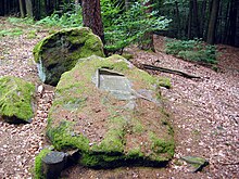
|
| 146 | Dam well | Orient. | ⊙ . North-west of the Horterkopf, on the plateau of the Dammberg. There used to be a cattle trough with an artificially created wallow and shelter here. |

|
| 147 | Wolf chew | Cattle | ⊙ . In the saddle between the medium and large cancer. Location of a formerwolf pit. See also Rittersteine 48 and 107. |
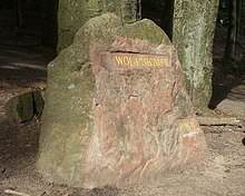
|
| 148 | Protztalbrunnen | Orient. | ⊙ . In a southern sidevalley oftheLeinbach valleybetween Schüsseleck and Protztaleck. Inscription in the rock wall above the spring. |

|
| 149 | Bad luck | Siedl. | ⊙ . In the Ungertal, a southern side valley of the Leinbachtal, between Schüsseleck, Wassersteinberg andGroßem Berg. Apitch hutwith a resin furnaceonce stood here. The resin from the pine trees was turned into pitch on the spot. |

|
| 150 | Hohlog | Orient. | ⊙ . At the Hohe Loog, south of the Leinbachtal, at the Wassersteinberg. Loog used to describe a limit. Pointing stone to a border there over the height. |

|
| 151 | Water stone | Orient. | ⊙ . On the forest path from Schwarzsohl into the Leinbachtal, betweenEselsohler Berg,Hohe Loogand Wassersteinberg. Mighty rock slab that is still in contact with the earth with bowl-shaped depressions in which the rainwater collects. |

|
| 152 | Virgin stone | Orient. | ⊙ . In a triangle of paths on the border of the Kaiserslautern city forest, betweenKleines Humbergand Kleiner Krebser. During the walk around the forest, which takes place every 10 years, the girls are squatted here, that is, they are gently pushed over their extended backs with a carnival cot. With the boys at the other boundary stones, the blows are a little harder. |

|
| 153 | Famine well | Orient. | ⊙ . In the Hungerbrunnental on the road from Kaiserslautern to Waldleiningen. Reference to the only periodically pouring source of theLauter. |

|
| 154 | Griesenfels | Orient. | ⊙ . In the Leinbachtal, north of the road from Waldleiningen to Weidenthal, between Schloßberg, Eisenkeil, Hoher Loog and Hohem Kopf. Overhanging rock. The origin of the name is unknown. |

|
| 155 | Water stone | Orient. | ⊙ . On the Hochstrasse on the Schlossberg, southwest of Frankenstein. Earth-connected horizontal plate with a bowl-shaped recess. See also knight stones nos. 13, 82, 83 and 151. |

|
| 156 | Biedenbacherwoog | Waldw. | ⊙ . In the Leinbach valley between Schloßberg and Eisenkeil. One of the trift clauses for timber rafting in the Leinbachtal. The inscription is at theWoogweir in the course of theLeinbach, southwest ofFrankenstein. |

|
| 157 | Axershäuschen 1824–1951 | Siedl. | ⊙ . On the hiking trail in the Hungerbrunnental opposite the large gate of the fencing of the water protection area, between Spitzrain and Großem Steinberg. Former location of a house that Christian Axer built in 1811 and expanded in 1824, demolished in 1951. |

|
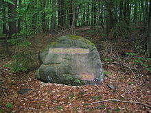
| 158 | Tit head sole | Orient. | ⊙ . North of the old high road in the Frankenstein Forest, between Sindelsberg, Franzosenkopf and Langem Eck. Former wallow. |
|
| 159 | Three linden trees | Orient. | ⊙ . On the old high road in the Frankenstein Forest, in the saddle betweenHohem KopfandSchlossberg. Site of three linden trees. |

|
| 160 | Elevated road | Orient. | ⊙ . Back to back with the knight's stone No. 159.Old traffic routeon which the indigenous people, later the Celts, Romans and Teutons, moved. |

|
| 161 | RF Stiftswald | Orient., Settl., Forest / hunting | ⊙ . To the west of the road in the Hungerbrunnental, southeast ofKaiserslautern. The forester's house, built in 1813 and demolished in 1848, is the birthplace of Reg. Dir. Karl Albrecht von Ritter, the namesake of the knight stones and chief chairman of the Palatinate Forest Association. |

|
| 162 | Beilstein 300 Schr. | Orient. | ⊙ . At the Wegspider between Rummelberg and Totenköpfchen, 200 m south of the road from Hochspeyer to Kaiserslautern. Reference to the castle ruins ofBurg Beilstein, located to the west on the Beilsteiner Kopf,east ofKaiserslautern. |

|
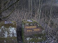
| 163 | Franzosenwoog | Orient., Cattle. | ⊙ . South of the road and railway line from Frankenstein to Hochspeyer, at the level crossing in front of thetunnel. FormerTriftklausefor timber rafting on the Hochspeyerbach. Inscription on the weir. |
|
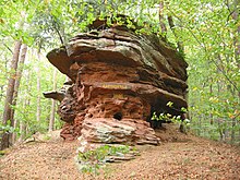
| 164 | Rat Rock | Orient. | ⊙ . On the southeastern foothills of theSchlossbergnearDiemerstein, betweenGlastaland Diemersteiner Tal. Rocks with weathering that look like rat caves. |
|
| 165 | Famine well | Orient. | ⊙ . In the Diemerstein valley, between Schlossberg and the front Langenberg. Source that pours only after heavy rains. |

|
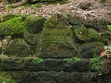
| 166 | Hundsbrunnen | Orient. | ⊙ . Northwest of Hochspeyer in the Hundsbrunner Tal, between Mitteleck, Hundsbrunnerkopf and Mehlweiler Kopf. Probably named after a Hundo, as they called a Hundred Leader in Merovingian-Carolingian times. |
|
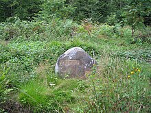
| 167 | Weidsohl | Orient., Cattle. | ⊙ . North of the road from Hochspeyer to Kaiserslautern, on the plateau in the saddle betweenQueitersbergand Mitteleck. The wallow was a meeting place for the shepherds from the area and also served as a cattle trough. |
|
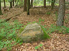
| 168 | On the thick oak | Orient., Hist. | ⊙ . Northwest of Hochspeyer on the old elevated road on the northwest slope of the Harzkopf. A mighty, ancient oak stood here, thrown by the storm in 1921, and a new oak was planted in 1925. |
|
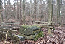
| 169 | Miller's table | Orient., Hist. | ⊙ . On the Höhenweg from Kleine Kieneck over the Großer Hetzelkopf to theSteinkopf. Seating group with benches and stone table top on the so-called bread path fromEnkenbachto Diemerstein. |
|
| 170 | Schanze 1 1793/94 | Hist. | ⊙ . West of the way in Langenthal, between theGroßer Kieneckand theKrummen Eck. Prussianredoubtfrom the time of the Revolutionary Wars (1793–1797)First coalition war. East ofFischbach. |

|
| 171 | Schanze 2 1793/94 | Hist. | ⊙ . On the southern summit of the Großer Kieneck. Prussian hill from the time of the Revolutionary Wars (1793–1797). |

|
| 172 | Schanze 3 1793/94 | Hist. | ⊙ . On the western mountain slope from the Großer Kieneck to the Buchelköpf. Prussian hill from the time of the Revolutionary Wars (1793–1797). |

|
| 173 | Schanze 4 1793/94 | Hist. | ⊙ . On the Kleiner Kieneck. Prussian hill from the time of the Revolutionary Wars (1793–1797). |

|
| 174 | Schanze 5 1793/94 | Hist. | ⊙ . On the Großer Hetzelkopf, west of the Höhenweg from Kleine Kieneck over the Großer Hetzelkopf to the Steinkopf. Prussianhillfrom the time of the Revolutionary Wars (1793–1797), also called Blücherschanze. |

|
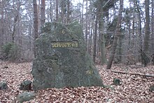
| 175 | Schanze 6 1793/94 | Hist. | ⊙ . On the southwestern promontory of the Kleiner Hetzelkopf, above the Altenhof. Prussian hill from the time of the Revolutionary Wars (1793–1797). |
|
| 176 | Schorlenberger sole | Orient. | ⊙ . About 1 km southwest of the forester's house Schorlenberg, on the plateau between Nußknick and Kleinem Kieneck, SuhleSuhleon the plateau of the Schorlenberg. |

|
| 177 | Smugglers' Dell | Orient. | ⊙ . On the middle eastern slope of the Großer Kieneck, on the way from Langenthal toSchorlenberg. Designation of the smuggling area near the turnpike, Ritterstein 180. |

|
| 178 | Buchel fountain | Orient. | ⊙ . About 400 m east of the forester's house Schorlenberg, on the southern slope of the Schlagbaumkopf, in a valley basin that leads to Langenthal. Reference to a rock spring. |

|
| 179 | F. Schorlenberg | Siedl., Forest / hunting | ⊙ . On the old elevated road on the Schorlenberg, between Nußknick and Schlagbaumkopf. Inscription in the lintel of the Schorlenberg forester's house on theA6 motorway. |

|
| 180 | Turnpike | Orient. | ⊙ . On the old elevated road on the Schorlenberg, between Salzleckerberg and Schlagbaumkopf. Former customs office on the Hochstraße fromWormstoKaiserslautern. |

|
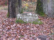
| 181 | Rhine-Moselle watershed | Orient. | ⊙ . North of the road from Fischbach to Eppenbrunn, between Eselskopf, Christkind-Felsen and Hollergrube. Reference to a point on thewatershedthat runs from north to south through the Palatinate Forest. |
|
| 182 | St. Pirmansborn | Orient., Hist. | ⊙ . About 50 m west of the road from Spirkelbach to Lug, between Höllenberg and Auf der Kipp. St. Pirminius is said to have baptized 3,000 pagans here. |

|
| 183 | Dagobert hedge | Orient., Hist., Waldw., Forest / Hunting | ⊙ . East of the road from Frankweiler to Siebeldingen on a side path. Location of an unusually large hawthorn bush. Destroyed by a thunderstorm in 1823. Under him, theMerovingian king Dagobertis said tohave hidden from his enemies. The loyal farmers helped him. Out of gratitude he gave them the scree forests. |

|
| 184 | Grim Iron Trail | Pers. | ⊙ . On the southwest slope of the Kehrenkopf, on the hiking trail from Annweiler to Taubensuhl. See Knight Stone No. 47. |

|
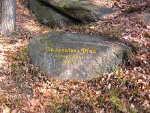
| 185 | Dr.-Sprater-Path built in 1953 | Pers. | ⊙ . At the beginning of the road leads over the southwest slope of the Kesselberg to the summit. Memory of the historianFriedrich Sprater, below the summit of theKesselberg. |
|
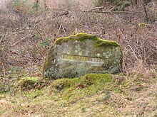
| 186 | R. Geiskopferhof | Siedl. | ⊙ . On the Geißkopf between Erdbirnkopf and Hofberg. Hardly visible ruins of five houses. Forest farming settlement south ofIggelbach,which was lost in 1852 |
|
| 187 | R. Geiswieserhof | Siedl. | ⊙ . Northwest at the foot of the Geiskopf. Reference to the former location of the Geiswieserhof. |

|
| 188 | Siebenbrunnen | Orient. | ⊙ . In the Vallunga south-east of the forester's house Schorlenberg. Strong pouring spring from seven tubes. 1927 revised,natural monument. |

|
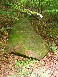
| 189 | Emil Ohler Path | Pers. | ⊙ . Path on the southwest slope of the Platte, between Sternberg and Platte. Founding member of the PWV, which has made a particular contribution to the construction of the Hellerplatzhaus and the path. |
|
| 190 | Karl Wertz New Year 1960/1961 | Pers. | ⊙ . Behind the Hellerplatzhaus. In memory of the volunteer helper, hut warden Karl Wertz, who was shot by Lutz Cetto, a member of theKimmel gang, onNew Year's Eve 1960/61. |

|
| 191 | Former Silver mine | Ind. | ⊙ . North of Bobenthal, on the way from Mattental to Wieslauter. Entrance to the tunnel of a silver mine. |

|
| 192 | Roesselsbrunner Hof ruins | Siedl. | ⊙ . Southwest of Ludwigswinkel, between Guckenbühl and Rösselsberg. Reference to the former Rösselsbrunnerhof. |

|
| 193 | Three men way | Orient. | ⊙ . Southwest of the Niederschlettenbach, between the Great Humberg and Teilberg. Built away by three unemployed people. |
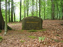
|
| 194 | At the old picture | Orient. | ⊙ . South of Dörrenbach, between Springenberg andStäffelsberg. A wayside shrine used to stand here. |

|
| 195 | Formerly Erlenkopfer-Hof | Siedl. | ⊙ . South of Eppenbrunn on the northwest slope of the Erlenkopf. Lost settlement on theErlenkopfsouth ofEppenbrunn. |

|
| 196 | Former Iron ore mine | Ind. | ⊙ . 100 m north behind the forester's house Erzgrube. Reference to the former iron ore mine. |
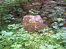
|
| 197 | Here was the Reissler forester's house | Siedl., Forest / hunting | ⊙ . North of Ludwigswinkel, at the parking lot at theSchöntalweiher. Destroyed in World War II and later demolished. |
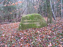
|
| 198 | Saarbach origin | Orient. | ⊙ . West of the road to Eppenbrunn, betweenGroßem Biesenbergand Hesselspfuhl. Source of theSaarbacheast ofEppenbrunn. |
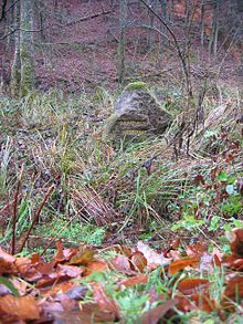
|
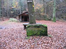
| 199 | Birkenhördter linden tree | Orient. | ⊙ . Southwest ofBirkenhördt, betweenHohem Kopfand Hoher Tanne. Location of an old linden tree. |
|
| 200 | Gruenbacher-Hof ruins | Siedl. | ⊙ . In the Saarbachtal, on the forest path, between Welschkornberg and Brechkaut, originally a Pottasch hut, later an estate, demolished in 1854. |

|
| 201 | Faunerhof ruins | Siedl. | ⊙ . North-east of Ludwigswinkel, between Fauner-Hang andGroßebet. Former outer courtyard ofthe Stürzelbronn Monasteryfrom the 12th century, demolished in 1869. |

|
| 202 | The Wolfsaegerhof stood here | Siedl. | ⊙ . To the northwest ofFischbach near Dahn, between Lemberger Kessel andMückenberg. The farm on the site of today's campground near Fischbach from the second half of the 18th century existed into the 20th century. |

|
| 203 | At the mosquito place | Orient. | ⊙ . South-west of Dahn, betweenKaletschkopf, Kleines Mückenkopf and Ederberg. Orientation point for hikers. |

|
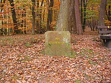
| 204 | At the Seicheneck | Orient. | ⊙ . West ofGleishorbach. Orientation point for hikers. The name means "wet corner". |
|
| 205 | Moosbach source | Orient. | ⊙ . Southwest Dahn, between Kaletschkopf andGroßes Mückenkopf. Orientation point for hikers, source of theMoosbach |

|
| 206 | Cat oak | Orient. | ⊙ . North-west of Blankenborn, between Abtskopf and Katzeneck. The name of the oak nearBlankenbornindicateswild cats. |

|
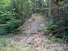
| 207 | Langental neck | Orient. | ⊙ . Southwest of Dahn, between Kaletschkopf and Kleines Mückenkopf. Orientation point for hikers. |
|
| 208 | Suhl island | Orient. | ⊙ . Southwest Dahn, between Kaletschkopf and Insel. Recalling the localwallow. |

|
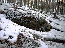
| 209 | Rodalb origin | Orient. | ⊙ . Source of theRodalbnearErlenbrunn(Pirmasens). Southwest of theRodalberhof, on the slope in the back of the valley. |
|
| 210 | Storrwoogerhof ruins - forester's house | Siedl., Waldw., Forest / Hunting | ⊙ . Southwest ofSalzwoog, in the middleStorrbachtal, between Aspen-Dell and Storreck. Former location of Pottaschhütten (18th century), later a forest farm, until 1892 forester's house, then demolished. |

|
| 211 | Wolfsdeller neck | Orient. | ⊙ . North-west ofDahn, betweenLehmbergand Mehrsberg. Orientation point for hikers on a seven-way spider. |

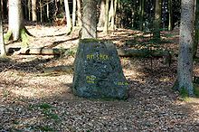
|
| 212 | On the sack | Orient. | ⊙ . West of Dahn, betweenBichtenbergnear Dahn and Geißkopf. Orientation point for hikers. Sack means: sack-like valley basin. |
|
| 213 | Three beeches | Orient. | ⊙ . North-west of Dahn, between Bichtenberg and Lehmberg. Orientation point for hikers on a six-way spider. |

|
| 214 | Queich origin | Orient. | ⊙ . South of Hauenstein, between Hohem Kopf and Mittel-Schachen. Source of theQueichsouth ofHauenstein. |

|
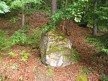
| 215 | Große Hasselskehl - Three beeches | Orient. | ⊙ . North-west of Dahn, between Eselsbühl, Lehmberg and Großem Hellenberg. Orientation point for hikers. |
|
| 216 | Darkthroat | Orient. | ⊙ . North-west of Dahn, between Eselsbühl, Lehmberg and Großem Hellenberg. Orientation point for hikers. |

|
| 217 | Here was the Schwanhof | Siedl., Forest / hunting | ⊙ . Between Hauenstein and Lug, at the parking lot opposite the sports field. Former courtyard ofthe Klingenmünster monastery, demolished in 1908. |

|
| 218 | Ruins of the Carolingian homestead, 750–850, now in the pond | Siedl. | ⊙ . In the Stephanstal on the western embankment of the paddle pond. Remains of a Carolingian settlement that sank in the pond. |

|
| 219 | Burghalder rock | Orient., Siedl., Hist. | ⊙ . On a rocky reef south of Hauenstein on the northern foothills of the Benz mountain. Former section fortifications on theBurghalder FelsnearHauenstein. |

|
| 220 | Brickstone - early medieval wooden castle | Orient., Siedl., Hist. | ⊙ . South of Hauenstein, on a rocky reef on the western slope of theWeimersberg. Small remains of anearly medieval wooden castle. |

|
| 221 | At the Windhof | Orient. | ⊙ . At the car park on Trifelsstrasse, between theScharfenberg ruinsand Wetterberg. Desolation of a courtyard. |

|
| 222 | Ahlmühle | Orient. | ⊙ . Between the ruins of Scharfenberg andFöhrlenbergat a parking lot on Trifelsstrasse. Orientation point for hikers. |

|
| 223 | Strong well | Orient. | ⊙ . North ofPirmasens-Ruhbankbetween Grosses Arius andSengelsberg. Spring set with red sandstones with heavy pouring. |

|
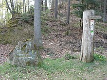
| 224 | Old street - Falkenburger Steige | Orient. | ⊙ . West of Wilgartswiesen on the edge of the forest between the Falkenburg ruins and Am Esel. Beginning of the ascent of an old road over the Hermersbergerhof to the old high road to Johanniskreuz. |
|
| 225 | Ruts - dam | Orient. | ⊙ . Northwest of Wilgartswiesen between Kleines Breitenberg and Großem Distel. Ruts of an old road in the rock. |

|
| 226 | Old Road - Celtic Age - Middle Ages - Ruts - Dam | Orient. | ⊙ . Northwest of Wilgartswiesen between Kleines Breitenberg and Großem Distel. Note on an old road with ruts and an embankment. |

|
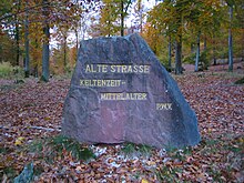
| 227 | Old Street - Celtic Age - Middle Ages | Orient. | ⊙ . Northwest of Wilgartswiesen betweenStaufelkopf, Am Steinweg and Steckeneck. Note on the old road Hauenstein - Johanniskreuz. |
|
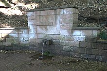
| 228 | Holder source | Orient., Pers. | ⊙ . North of Annweiler betweenKehrenkopfand Great Adelberg. Named in honor of Heinrich Holder, who crashed with Grimmeisen on the Wetterhorn. See also Ritterstein No. 47. |
|
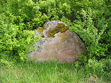
| 229 | Stahlbuehl - Former Speyergau-Thingstaette | Orient. | ⊙ . On the south side of the road from Frankweiler toNussdorf. Meeting place and court of law of the Speyergau. |
|
| 230 | Wieslauter origin | Orient. | ⊙ . North of Hinterweidenthal, in the rear Zieglertal, behind theWieslauterhof. Source of the Wieslauter nearHinterweidenthal. |

|
| 231 | At the Karlsmühle | Ind. | ⊙ . On the road from Leimen to Merzalben. Location of the former Karlsmühle. Demolished in 1869. |

|
| 232 | Gambsklause | Waldw., Pers. | ⊙ . Southeast of glues, alternatively Gambswoog called formerhermitagetoHolztriftnear the source of theraft of Bachorwait Bach(tributary of Wieslauter), named after the forest advice Gambs. |

|
| 233 | Fritz Claus way | Pers. | ⊙ . South of Leimen, in the upper Schamborner Valley. In memory of the writerFritz Claus(bourgeoisJohann Martin Jäger), south ofLeimen. |

|
| 234 | Three beeches | Orient. | ⊙ . Orientation point for hikers, reference to the Waldhaus of the Palatinate Forest Association. |

|
| 235 | Huettenbrunnen | Orient. | ⊙ . In theEdenkoben valley, on Schänzelstrasse. Source, as a reference to the house of the Palatinate Forest Association. |

|
| 236 | Haingeraide - Loogfelsen | Orient. | ⊙ . West of Edenkoben on the road toKropsburg. Border stone, also called Loogfelsen, with well-preserved border signs. |

|
| 237 | Guild stone | Orient. | ⊙ . In the Edenkoben valley, on Schänzelstraße, on the northern slope of the Querenberg. Quite large stone with initials and signs of the guild masters and officials from Edenkoben from 1770–1773. |

|
| 238 | Lolosrest - Five stones | Orient. | ⊙ . On Schänzelstraße, in the saddle betweenMorschenbergand Steigerkopf. Slab of rock surrounded by five stones set into the slab. In the middle there is a stone with border marks. Lolo's bench was a few yards north. |

|
| 239 | Huettenhohl - ruin of the old hut | Orient. | ⊙ . Northwest of St. Martin onTotenkopfstrasse, between Kalmit and Totenkopf. Old road junction, location of a shelter for carters. Stein at the top of theHüttenhohlpass. |

|
| 240 | Cave - mayor's stone - late Middle Ages - house brands | Orient. | ⊙ . On the southeast slope of thedwarf mountain, below the path to theHohe-Loog-Haus ofthe Palatinate Forest Association, the name of a small cave nearHambach, in whichhouse brands werecarvedin the 17th century. |

|
| 241 | Bender Square - Friedrich Bender | Pers. | ⊙ . West of Edenkoben, between Steigerkopf and Kesselberg. Gravestone of Friedrich Bender, co-founder of the Palatinate Forest Association. |

|
| 242 | Badisch hunting lodge ruins | Forest / hunting | ⊙ . Below the road from Johanniskreuz to Leimen, between Ramscheleck andHeltersberg. Reference to a former hunting lodge of theMargraves of Baden. |

|
| 243 | Wetzbrunnen | Orient. | ⊙ . West of St. Martin, on the south side of the road to theskull. Well with grooves at the top of the well trough, sickles, axes and scythes are said to have been sharpened here. |

|
| 244 | Hunds-Strasse - grave mound field | Orient. | ⊙ . On the south side from Johanniskreuz toHeltersberg, between Hornbacher Eck and Steinhübel. At the pass of an old road that goes back to Celtic times. |

|
| 245 | Schwarzbach origin | Orient. |
⊙ Source of theSchwarzbachsouth ofJohanniskreuz.The location information in the sources does not exactly match. |

|
| 246 | Road embankment - Roman times - Middle Ages - Speyer – Metz route | Orient. | ⊙ . At the car park across fromthe Pfälzerwald-Verein'sTotenkopfhaus. The stone stands in front of the well-preserved embankment of a Roman road. |

|
| 247 | Hellerplatz | Orient. | ⊙ . Southwest of Neustadt in front of theHellerhütte ofthe Palatinate Forest Association. Orientation point for hikers. |

|
| 248 | Speyerheld | Orient. | ⊙ . To the west of Neustadt-Hambach, on the hiking trail from Nollensattel to the Hohe Loog hut of the Palatinate Forest Association. Reference to theSpeierheld, a forestlanethrough which the border of theSpeyerer Haagwald runssteeply to the Triftbrunnen. |

|
| 249 | Dr. Karl Bäßler way | Pers. | ⊙ . West of Neustadt, behind the Königsmühle, on the way to theKaltenbrunner Valley. Named in honor of Dr. Karl Bäßler, long-time chairman ofPollichia. |

|
| 250 | Dr. Karl Bäßler way | Pers. | ⊙ . West of Neustadt, in the Kaltenbrunner Valley near the Kaltenbrunner Hut. Like Knight Stone No. 249. |

|
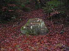
| 251 | Hecker Bridge | Orient., Pers. | ⊙ . South-east of Elmstein-Appenthal, between Ehscheid and Mönchberg, beyond the Speyerbach and therailway line. Friedrich Heckerwas afree army leader in Baden in 1848. This was about building a bridge over the Speyerbach. For this there was a “demo” led by a valley resident who was called “Hecker”. |
|
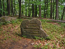
| 252 | Ringwall - mountain fortress - Hallstatt period - Middle Ages - burial grounds | Orient., Hist. | ⊙ . West Neustadt, on the ridge of the Königsberg. Ring wall from the 9th and 8th centuries BC on theKönigsbergwest ofNeustadt an der Weinstrasse |
|
| 253 | Elector's Chair | Orient. | ⊙ . Northwest of Iggelbach, between Klaffeneck,Bloskülband Möllberg. There is a stone with a crown and an arrow on the forest path. Earth-bonded, arched rock with depressions like a chair or a throne. |

|
| 254 | Speyerbach origin - Floßwoog with lock | Orient., Cattle. | ⊙ . InSpeyerbrunnat the confluence of theErlenbach valley. Source of theSpeyerbach |

|
| 255 | Width loog | Orient. | ⊙ . West of Neustadt, betweenKaisergartenand Überzwerchberg. Historical border point fromFranconian times |

|
| 256 | Kaisergarten | Orient., Pers. | ⊙ . West of Neustadt, between Schauerberg and Überzwerchberg. Here the Lambrecht people celebrated a feast to celebrate the birth of the son of Napoleon I, King of Rome. |

|
| 257 | Heidenburg 9-10 century | Orient., Hist. | ⊙ Heidenburg ring wallwest ofGimmeldingen. |

|
| 258 | Alte Straße - customs station and ski jump 1794 | Orient., Hist. | ⊙ . South of the Forsthaus Silbertal, in the saddle between the Vorderes Stoppelkopf andHinterem Langenberg. Old road junction. There was a customspostbetween theDiocese of Speyerand theElectoral Palatinateand a Prussian redoubt from the time of the Revolutionary Wars (1793-1997). |

|
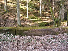
| 259 | Ungertal | Orient. | ⊙ . To the northeast of Waldleiningen, between Mitteleck and Schlüsseleck, on the bridge wall over the Leinbach. In the valley there was a pasture at the time of forest pasture; “Unger” is an old word for “willow”. |
|
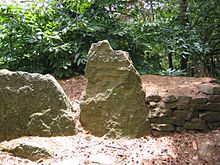
| 260 | Heidenlöcher - Fliehburg 9. – 10. Century | Orient., Hist. | ⊙ FliehburgHeidenlöchernorthwest ofDeidesheim. |
|
| 261 | At the Pottasch hut | Ind. | ⊙ . South-west of Bad Dürkheim, betweenDrachenfels, Hohekopf and Steinkopf. Location of a former Pottasch hut. Potash is needed to make glass. |

|
| 262 | Wilhelm Merkel Hut | Pers. | ⊙ Memorial to a former chairman ofPWV Kaiserslauternon the Kleiner Humberg, burned down years ago. |
 
|
| 263 | Forester Emil Haupt | Pers. | ⊙ Memorial to a former forester and chief executive of thePWVin theLeinbachtal, between Sonneneck and Langeneck. |

|
| 264 | Scheidhütte - Niliusburg | Orient., Cattle. | ⊙ . Southeast of Kaiserslautern, east ofHungerbrunnental, between Kleines Specht and Großem Steinberg. Location of a former wolf hunter's hut, built in 1739 by Cornelius (Nilius) Brügel. Peter Scheid lived there from 1761, and the hut was destroyed in 1793. |

|
| 265 | Ruins of old glassworks and forester's house old glassworks | Orient., Settl., Forest / Hunting, Ind. | ⊙ . To the north ofWeidenthal, between Schafunter and Großem Pfaffenkopf in the Glastal. Location of a former glassworks built in 1708, destroyed in 1731, later a forester's house was built on the rubble, which was demolished in 1875. Since 1951 there has been a refuge and a hunting lodge. |

|
| 266 | Oak wreath | Orient., Cattle. | ⊙ . Southeast of Kaiserslautern on the Spitzrain. Actually, a crane sign because there were mighty old oaks in the wreath. |

|
| 267 | Entersweiler mill | Orient., Cattle. | ⊙ . South-east ofKaiserslautern, north of the railway underpass into Hungerbrunnen Valley. From 12-13. and later in the 18th century the location of a mill. Parts of it, used as an excursion restaurant, stood until 1954. It is remarkable that there are beautiful winter linden trees. |

|
| 268 | Witch stone | Orient. | ⊙ . Between Auf dem Röthel and Wachenheim. The original grave crown stone was converted into a witch stone. |

|
| 269 | Level Kehrdichannasst - Altstrasse - Hunting Frontier - Former Jagdschlößchen - now forester's house | Orient., Forest / hunting | ⊙ . Southwest Bad Dürkheim, between Dreispitz and Steinkopf. Reference to the nearby formerKehrdichannasst castle. |

|
| 270 | Ruin of the Schaudichnichtum hunting lodge | Orient., Forest / hunting | ⊙ . SouthwestBad Dürkheim, betweenBecherskopfand Steinkopf. The formerSchaudichnichtum Palacestood here. |

|
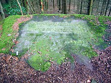
| 271 | Ruin watchtower Murrmirnichtviel | Orient., Forest / hunting | ⊙ . SouthwestBad Dürkheim, on the southwest ridge of the Dreispitz. Ruin of the former watchtower in the hunting area of theCounts of Leiningen |
|
| 272 | Hochspeyerbach origin in the bathroom | Orient. | ⊙ . Southwest ofHochspeyer, in the swimming pool by the fence. TheHochspeyerbachrises in a pond that has been converted into a swimming pool. |

|
| 273 | Wine press | Orient. | ⊙ . To the west ofWachenheim, on theSchwabenbach, betweenEbersbergandRindskehler Kopf. A rectangular treading basin is carved into the surface of the earth-bound boulder, which is to be regarded as one of the oldest wine presses in the Palatinate. The recessed area on the top was used for pressing (squeezing / stamping out) grapes. |

|
| 274 | Stüterhof Leiningisches Gestüt farm ruins 15. – 18. Century | Siedl., Viehw. | ⊙ . West of Bad Dürkheim, between Stüterberg and Stüterkopf. Reference to a former small village that emerged from a Liningian stud. Later there was also a hunting lodge for the Counts of Leiningen. |

|
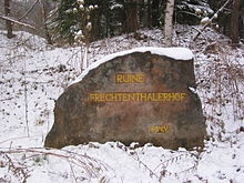
| 275 | Frechtenthalerhof ruins | Siedl. | ⊙ . East of Hochspeyer on the north side of theB 37in theHochspeyerbachtal. Remnants are still there. Frecht describes a tax that the farm stock had to pay. The farm existed until the middle of the 20th century. |
|
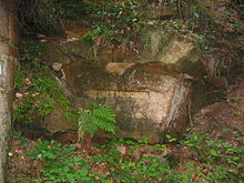
| 276 | Heene's monopoly | Orient., Pers. | ⊙ . North-east ofFrankenstein, on the forest path from the climb to the gallows. In honor of the forest warden Karl Theodor Heene, from 1838 forester in the Isenach forester's house, who carried out a cut through the ridge to facilitate the removal of wood. |
|
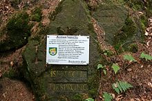
| 277 | Isenach origin | Orient. | ⊙ . Source of theIsenachnortheast of Frankenstein. In a small side valley of the rear Isenach valley, west of the rock heads. The Isenach rises in a small hollow in the forest. |
|
| 278 | Obere Isenach - Wolfenhütte ruins | Siedl. | ⊙ . West of theIsenachweiher, between Schützenfelderberg and Schnapphahnberg. Wood makers and charcoal burners lived here, named after a wood maker Franz Wolf. |

|
| 279 | Here stood forester's house Mittlere Isenach - Matternshuette | Siedl. | ⊙ . In the middle Isenach valley behind the Isenachweiher, between Klausenberg and Schnapphahnberg. A forester's house had stood here since 1822 and was demolished in 1871. Before that there was only a hut that was inhabited by a Heinz Mattern. |

|
| 280 | Heathen Wall - Hallstatt / Latène Period | Orient., Hist. | ⊙ . West ofBad Dürkheim, on the southern foothills of theTeufelsstein. Location of aring wallof which there are still a number of remains. |

|
| 281 | Leiningische Hofruin | Siedl. | ⊙ . Northwest Bad DürkheimBad Dürkheim, westForsthaus Weilach. Court of the Counts of Leiningen, first mentioned in 1381. Set on fire by robbers in 1790, in ruins since then. |

|
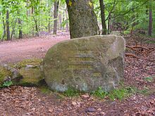
| 282 | Rote Hohl - Altstrasse - Kreuzsteig | Orient. | ⊙ . North-west of Bad Dürkheim, on the road fromLeistadttoHöningen. Intersection of two old streets. |
|
| 283 | Ruins of the Langenthaler Hof | Siedl. | ⊙ . South-east ofAlsenborn, in the valley between Salzleckerberg, Heidenberg andSteinkopf. The farm belonged to the municipality ofWattenheim, demolished in 1853. Remnants of the wall still exist. |

|
| 284 | Dedicated to Julius Schmitt, the author of the Wonnegau | Pers. | ⊙ . Southeast of Höningen, on the path to theRahnfels. Memorial to a former chairman of thePWV Frankenthal, who published a book onLeiningerland(“Der Wonnegau der Pfalz”). |

|
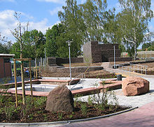
| 285 | Alsenz origin | Orient. | ⊙ . Source of theAlsenzdirectly at the swimming pool in Alsenborn. |
|
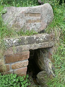
| 286 | Eckbach origin | Orient. | ⊙ . West ofHertlingshausen. Source of theEckbach. |
|
| 287 | Ice origin | Orient. | ⊙ . Southwest of Ramsen, south of the Eiswoog. Source of theEisbachnearRamsen. |

|
| 288 | Here stood the village of Zwingweiler - Zwingerstein - Forest Court | Siedl. | ⊙ . Northeast of Höningen. Location of the lost village of Zwingweiler near the formerHöningen monastery. |

|
| 289 | The district court on the Stampe was located here - the court of the Counts of Leiningen - later the complaint court nine chairs | Orient. | ⊙ . To the southeast of Neuhemsbach, between Schelmenkopf and Steinkopf. Former court in thestump forestnearNeuhemsbach, but in theEnkenbach-Alsenborn district. |

|
| 290 | Pfrimm origin 1927 | Orient. | ⊙ . In the valley south of thePfrimmerhof. Source of thePfrimmnearSippersfeld. |

|
| 291 | Former Grafenthaler Hof | Siedl. | ⊙ . North-west of Otterberg, in Grafenthal between Knieberg, Andreasberg and Bruchberg. Built in 1712, later demolished in 1977, today a park and barbecue area. |

|
| 292 | Castle and village of Rothenberg 11. – 14. Century | Siedl. | ⊙ . South of the settlement Auf der Füllenweide . The castle and / or village of Rotenberg / Rothenburg are said to have stood here. |

|
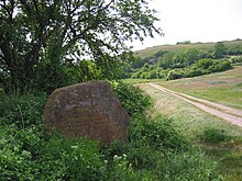
| 293 | Hohfels Prehistoric residential cave 300 m | Siedl. | ⊙ . 1 km west ofAsselheim, between Hochberg, Langental and Höllenberg. Reference to the nearby cave. |
|
| 294 | Lauterspring reason | Orient. | ⊙ . South-east of Kaiserslautern in the Hungerbrunnental on the road from Kaiserslautern to Waldleiningen. Reference to theLauter rivernear Kaiserslautern. |

|
| 295 | Hasenbuehl - Battle of the Two Kings - on July 2nd, 1298 | Hist. | ⊙ . In the Gutenbergstrasse inGöllheim, in front of theVerbandsgemeindewerke. Reference to the battle of KingAdolf von Nassauagainst the anti-king Albrecht of Austria. |

|
| 296 | Atlas rocks - Loog rocks - Middle Ages - 200 m | Orient. | ⊙ . South of theLeinbachtalon the ridge path of the Hohe Loog mountain. Seven meters high rock,natural monument, served as a boundary stone (cultural monument). |

|
| 297 | Loogfels - Waechterstein with hand painting 12th century 300 m | Orient. | ⊙ . On the forest slope north of the Cramer path fromTrifelstoMadenburg, at the end of the borderaisleleading upwards on a rock slab. Reference to the incised drawing that served as a border marker. Reference to the guardian stone, with misleading directions. |

|
| 298 | At the old Glastalerhof | Siedl. | ⊙ . East of Pirmasens, in the Glastal, between Glasberg and Little Arius. Reference to the former farm nearPirmasens, which existed from 1765 to 1877. |

|
| 299 | Rödelstein path inherited from Palatinate. Forest Association 1927 | Orient. | ⊙ . North of the Vorderweidenthal on the path up to therock. Orientation point in theclimbing area on RödelsteinnearVorderweidenthal. |

|
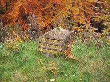
| 300 | Karlsplatz - Gleiszellen-Gleishorbach 10 years PWV 1992 | Orient. | ⊙ . To the west of thetrack cells, between Abtskopf, Hoher Tanne, Röhlberg and Spitzenberg. Landmark. |
|
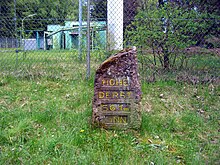
| 301 | High Derst 561 M above sea level | Orient., Forest / hunting | ⊙ . On the summit of the Hohe Derst at the end of the driveway. Highest elevation in the southeastern Palatinate Forest,fought over in1945 duringWorld War II. |
|
| 302 | Anno 1793 Battle of the Mäuerle | Hist. | ⊙ . North of Nothweiler, betweenBeißenbergandMäuerle, on thefarm roadfromBundenthalto Nothweiler. Theater of war from the time of the Revolutionary Wars (1793–1797). |

|
| 303 | Soup bowl | Orient. | ⊙ . South ofTotenkopfstrasse, in the saddle betweenRothsohlbergand Schafkopf. Sandstone slab with a recess in which rainwater collects. |

|
| 304 | Dedicated to the forest and hiking enthusiast Mr. Josef Fichtner Forest Master in Elmstein 1936–1956 | Pers. | ⊙ . North-west of Elmstein on the Wegspinne between Hohem Oselkopf and Niederer Oselkopf. Memorial to a former chairman of thePWV Elmstein. |

|
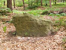
| 305 | Lellebebbel-Pädel | Pers. | ⊙ . South of Lambertskreuz, between Flurberg, Steinberg andHinterem Stoppelkopf. Orientation point on the path of the same name to theLambert Cross. |
|
| 306 | Langkehler sawmill ruins 1769–1894 | Waldw., Ind. | ⊙ . East ofLangmühle, at the entrance to Langkehl, on the forest path toSalzwoog. Reference to a former mill. |

|
Lost knight stones
| Surname | meaning | Location, description | Probable reason for the disappearance | photo |
|---|---|---|---|---|
| Flößholzhof | Waldw., Ind. | In Bobenthal where wood was collected on the Wieslauter to drift | - | |
| Milking place | Cattle | In the Storrbachtal | Westwall construction | - |
| Eichertshals | Orient. | East of the forester's house Hohe List | Westwall construction | - |
| Devil table | Orient. | At Kaltenbach | - | |
| Upper hammer | Ind. | At Trippstadt | Road construction | - |
| Hunting lodge ruin | Orient. | Waldleiningen | - | |
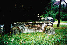
| Neu-Falkenburg ruins | Orient. | Wilgartswiesen , to the west at the confluence K56 / Tiergartenstraße; new Ritterstein (45) west of the confluence | Design of Rathausplatz in 2003 |
|
| Nut kink | Orient. | West of the forester's house Schorlenberg | Road construction | - |
| Customs lanes | Hist. | Connection from St. Germanshof to Schweigen | - |
Forgotten knight stones
| Surname | meaning | Location, description | photo |
|---|---|---|---|
| Gerbersdell | - | Valley of the Glasbach in the Diemerstein forest |

|
literature
- Karl Becker : Knight stones in the Palatinate Forest . In: Die Rheinpfalz (Ed.): Pälzer Feierowend . Our little house postil for contemplative and cheerful hours. No. 45–51, year 7. Ludwigshafen 1955.
- Erhard Rohe: The knight stones in the Palatinate Forest . In: Palatinate Forest Association (Ed.): 100 Years of the Palatinate Forest Association e. V . Neustadt an der Weinstrasse 2002, ISBN 3-00-010517-4 , p. 168-173 .
- Walter Eitelmann , Ernst Kimmel: Knight stones in the Palatinate Forest - with 59 hiking suggestions . Ed .: Palatinate Forest Association. 5th edition. Neustadt an der Weinstrasse 2005, ISBN 3-00-003544-3 .
- State Office for Surveying and Basic Geographic Information Rhineland-Palatinate (Ed.): Palatinate Forest Nature Park . Topographic map 1: 25,000. ISBN 978-3-89637-399-1 .
Web links
- Rittersteine , private website with incomplete data including map, accessed on April 28, 2016 (305 objects)
- Geoportal of the state of Rhineland-Palatinate
Individual evidence
- ↑ Knight Stones. Pfälzerwald-Verein Otterberg, accessed on December 27, 2014 .