Heidenlöcher (Palatinate)
| Heidenlöcher | ||
|---|---|---|
|
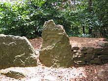
Main gate in the south of the Fliehburg |
||
| Creation time : | 9th, possibly 10th century | |
| Castle type : | Hilltop castle | |
| Conservation status: | Ruin , remains of the wall | |
| Construction: | Hewn stones, quarry stones, partly also boulders | |
| Place: | Deidesheim | |
| Geographical location | 49 ° 24 '55.7 " N , 8 ° 9' 57.6" E | |
| Height: | 344 m above sea level NHN | |
|
|
||
The Heidenlöcher are the ruins of a hilltop castle on the forest delimitation of the small Palatinate town of Deidesheim in Rhineland-Palatinate . The remains indicate a fortress from the late Carolingian , possibly also from the Ottonian period.
The Heidenlöcher are a cultural monument under the Monument Protection Act of the State of Rhineland-Palatinate . Investigations and targeted collection of finds are subject to approval, and accidental finds are reported to the monument authorities.
geography
location
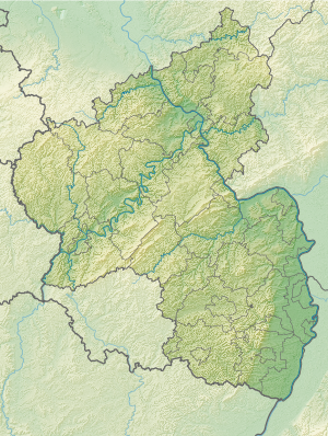
The Heidenlöcher are about 2.5 km northwest of Deidesheim at 344 m on the top of the Kirchberg , which belongs to the Haardt , the eastern ridge of the Palatinate Forest . The remains of the Fliehburg are surrounded by characteristic Haardtwald , which consists of pure pine forest with typical accompanying flora of heather and blueberries and which was used in various ways by the winemakers of Haardtrandes.
Surroundings
On the Kirchberg , 350 m closer to Deidesheim in an east-south-east direction, there is the late Gothic Michael’s Chapel from 1470. It was in ruins since it was destroyed in 1794 during the French coalition wars and was only rebuilt in 1952.
history
Emergence
Presumably, the Fliehburg was built in the 9th, maybe only in the 10th century, as a labor force to offer the residents of the surrounding area protection from the Normans who were then moving about. The original name of the plant was lost. The current name was not formed until the 18th century when the complex was assigned to the pagans . A violent destruction cannot be proven, the current ruinous condition can be traced back to the decay of the ground monuments discovered in the early 19th century. Similar facilities are the Heidenschuh , the Heidenburg , the Waldschlössel or Burg Schlosseck .
Excavations
In the 1820s, the so-called Heimatfreunde first brought the Fliehburg to the attention of a wider public. The excavation was carried out in 1907/08 under the direction of Friedrich Sprater from the Historisches Museum der Pfalz ( Speyer ). Sprater still assumed that it was a settlement from Celtic times, which is also indicated by the first part of the name, which classifies the Celts as pagans . The complex was marked by the knight stone 260 at the beginning of the 20th century .
Recent research has shown that the facility is more than a thousand years younger than previously thought. The second part of the name comes from the depressions that the collapsed buildings had left in the forest floor. According to current knowledge, it is not certain whether the facility was ever used for its intended purpose; at least it is assumed that the Heidenlöcher were never permanently inhabited. Although the building remains indicate a pronounced interior development, there are no regular fireplaces or garbage pits.
investment
The Fliehburg was surrounded by a ring-shaped outer wall with a length of 450 m, which enclosed an oval area of about 1.3 hectares; this corresponds to two soccer fields. The system extends in a west-east direction over about 150 and in north-south direction over 100 m.
The circular wall about 2.5 m high on the outside was made up of two parallel components with a total thickness of 3 m and consisted of hewn natural stones. It had a lower walkway inside and was crowned by a wooden picket fence , so that an absolute height of at least 3.5 m was reached. In the north and in the south the wall was broken through by two gates, the northern one was constructed as a kennel between two walls . A pre-fortification consisted of a 5 m wide trench , which was reinforced by a palisade wall.
Inside there were around 80 to 85 single-storey buildings, mostly pit houses, which then had no basement and, apart from one, only consisted of one room each measuring 10 to 20 m². Only an 80 m² building falls outside this scope; it was supposed to be used for congregation purposes. All houses have a sloping wall layout and rectangular or almost square floor plans. The walls were built as dry stone walls , which consisted of rubble stones and some large boulders . They are likely to have once supported structures made of half-timbered or wooden beams as a structure for a roof.
In addition to a network of alleys, the complex reveals a main path along the inside of the wall, especially on the south front.
literature
- Michael Geiger: Heidenlöcher . In: Adolf Hanle (Ed.): Meyers Naturführer, Pfälzerwald and Weinstrasse . Bibliographisches Institut, Mannheim 1990, ISBN 3-411-07131-1 , p. 51-53 .
- Jürgen Keddigkeit : Heidenlöcher . In: Jürgen Keddigkeit, Alexander Thon, Rolf Übel (eds.): Palatinate Castle Lexicon (= contributions to Palatinate history ). tape 12 .2, F − H. Institute for Palatinate History and Folklore, 2002, ISBN 3-927754-48-X , ISSN 0936-7640 , p. 318-323 .
Web links
Individual evidence
- ↑ a b General Directorate for Cultural Heritage Rhineland-Palatinate (ed.): Informational directory of cultural monuments - Bad Dürkheim district. Mainz 2020, p. 25 (PDF; 5.1 MB).
- ↑ Castle 48: Heidenlöcher. Hiking portal Pfalz, accessed on June 13, 2011 .
- ↑ Hiking destination Michaelskapelle. (No longer available online.) Tourist Service Deidesheim, archived from the original ; Retrieved June 13, 2011 .


