Haagwald (Hambach)
The former Haagwald on the forest area of Hambach an der Weinstrasse was in church property from the Middle Ages until the time of the French Revolution . Then around 1822 it became part of the Hambach community forest . As part of the administrative reform of Rhineland-Palatinate in 1969, this was incorporated into the urban forest of Neustadt an der Weinstrasse .
geography
Geographical location
The city forest of Neustadt an der Weinstrasse is part of the Haardt , which forms the eastern edge of the Palatinate Forest towards the Rhine plain .
Waters
From the former Haagwald three brooks flow eastwards through the Neustadt districts of Diedesfeld and Hambach. From south to north these are:
- Hartgraben (source at 266 m , length 14.2 km)
- Hambach (source at 249 m , length 3.1 km)
- Kanzgraben (source at 230 m , length 7.8 km)
history
According to an old document, the place Hambach was mentioned as a settlement as early as 865; the name is derived from the Franconian name Haganbach . This points to a stream that came out of a sparse forest, a hag . The Hambach , which rises at the north foot of the 379.2 m high Schlossberg - where light chestnut forests have dominated since Roman times - and flows through Mittelhambach to the east, comes into question because of its name . He used to drive the Gutting mill east of Hambach; Its water finally pours from the right into the Speyerbach via Kanzgraben, Hartgraben and Kropsbach .
The Kästenburg on the Schlossberg, which is now called Hambach Castle , was built around the year 1000 under the Salian family . During this time, about 200 hectares were cut out of the Hambach Forest, which were called the Kästenburger Burgfrieden , Herrschaftlicher Haag or Haagwald .
Around the year 1100 Johannes I , Bishop of Speyer, bequeathed the Kästenburg with the lordly Hague to the bishopric of his diocese from his personal property. Thus, Burg and Haagwald passed into the possession of the diocese. The borders of the Hague Forest were increasingly disregarded by subjects from Hambach; Assaults such as wood theft and forest crime were the order of the day. For this reason, the episcopal vicariate general decreed in June 1752 that the area should be marked with boundary stones in order to clearly show border violations. A total of 76 stones were to be set, some of the existing Loog rocks were also used to chisel in the boundary signs.
The borders of the Haagwald stretched from the Käsgasse over the Sommerberg to the Hohe-Loog-Ebene , to the Speierheld , to the Triftbrunnen, along the Haagwiesengraben to the Freiheitstrasse, up to the Forstacker, down into the Weihertal, then further around the Schlossberg and back to the Käsgasse.
The entire area of the Haagwald was divided into nine forest sections: beech pond (34 hectares), mountain rocks (24 hectares), Rittersberg A (30 hectares), Rittersberg B (40 hectares), winter side (30 hectares), Pfaffenplatte (15 hectares), soup bowl (5 hectares), Schlossberg (20 hectares), Kästenburg (2 hectares).
The rights of the Diocese of Speyer am Haagwald ended when, in the Peace of Lunéville in 1801, the German territories on the left bank of the Rhine were ceded to France and the properties of the church were subsequently expropriated . After the Palatinate became Bavarian in 1816 , the Haagwald was sold by the government in 1822/23. With the exception of the approximately 15-hectare narrow castle district, the Hague Forest has been converted into small-scale private property - right up to the present day.
The boundary stones
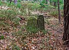
The stones from No. 1 to 43 are all still available on site, except for No. 4. Stone no. 51 was found during the construction of a rain retention basin at the corner of Freiheitstrasse and Bergstrasse and was re-erected on the former northeast corner of the Haagwald. At the foot of the Schlossberg, only stones No. 65, 66 and 67 as well as No. 74 and 75 are left. Furthermore, the upper part of a stone is fitted into a garden wall, which stands on private property in Andergasse, whereby only the year and the coat of arms can be seen.
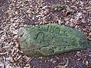
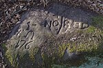
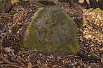
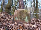
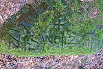
The stones bear the sculpted coat of arms of the bishopric of Speyer on the front, along with the year 1752 and consecutive numbers. The border of the Haagwald, which goes up from stone No. 1 to 29, coincides with the former border of the V. Haingeraide , today Diedesfelder Wald. On various landmarks and Loogfelsen also the symbol of V. Haingeraide (a three-wing character in the Y-shaped), for Diedesfeld the letters -DF- and a horseshoe with a small punch and numbering are engraved. From stone no. 29, the Hambach Forest begins on the west side, and the Hambach coat of arms, a horseshoe, can be seen on the stones.
The remaining witnesses of the former Haagwald can be seen clearly in the course of the border described. Only a few Loogfelsen are poorly visible due to the accumulation of leaves and soil.
List of the still existing landmarks
| Stone no. | location | description | Front image | Picture back |
|---|---|---|---|---|
| 1 | Landmark No. 1 | on the old Haagweg |

|

|
| 2 | Landmark No. 2 | on the summer mountain |

|

|
| 3 | Landmark No. 3 | on the summer mountain |

|
|
| 5 | Landmark No. 5 | on the summer mountain |

|

|
| 6th | Landmark No. 6 | on the summer mountain |

|

|
| 7th | Landmark No. 7 | on the summer mountain |

|

|
| 8th | Landmark number 8 | on the summer mountain |
|
|
| 9 | Landmark No. 9 | 20 m below Sommerbergweg |

|
|
| 10 | Landmark No. 10 | 15 m above the Sommerbergweg |

|
|
| 11 | Boundary stone no.11 | on the summer mountain |

|
|
| 12 | Landmark No. 12 | on the summer mountain |
|
|
| 13 | Landmark number 13 | on the summer mountain |

|
|
| 14th | Landmark No. 14 | on the summer mountain |

|

|
| 15th | Landmark No. 15 | on the summer mountain |

|

|
| 16 | Landmark number 16 | on the summer mountain |

|

|
| 17th | Landmark No. 17 | on the summer mountain |

|

|
| 18th | Landmark number 18 | Summer side |

|

|
| 19th | Landmark number 19 | Summer side |

|

|
| 20th | Landmark No. 20 | Summer side |

|

|
| 21st | Landmark No. 21 | Summer side |

|
 | |
|
| 22nd | Landmark number 22 | Summer side |

|

|
| 23 | Landmark number 23 | Rittersberg |

|

|
| 24 | Landmark No. 24 | Rittersberg |

|

|
| 25th | Landmark No. 25 | Rittersberg |

|

|
| 26th | Landmark no.26 | Rittersberg |

|

|
| 27 | Boundary stone no.27 | Rittersberg |

|

|
| 28 | Landmark No. 28 | Hohe Loog level |

|

|
| 29 | Landmark No. 29 | Hohe Loog level |

|
|
| 30th | Landmark No. 30 | Hohe Loog level |

|

|
| 31 | Landmark No. 31 | Hohe Loog level |

|

|
| 32 | Landmark No. 32 | Hohe Loog level |

|

|
| 33 | Landmark No. 33 | Hohe Loog level |

|

|
| 34 | Boundary stone no.34 | Hohe Loog level |

|

|
| 35 | Landmark No. 35 | on the Speyerheld – Hohe Loog hiking trail |

|

|
| 36 | Landmark No. 36 | on the Speyerheld – Hohe Loog hiking trail |

|

|
| 37 | Landmark no.37 | on the Speyerheld – Hohe Loog hiking trail |

|

|
| 38 | Landmark No. 38 | on the Speyerheld – Hohe Loog hiking trail |

|
|
| 39 | Landmark No. 39 | on the Speyerheld – Hohe Loog hiking trail |

|
|
| 40 | Landmark number 40 | on the Speyerheld – Hohe Loog hiking trail |

|
|
| 41 | Landmark number 41 | on the Speyerheld – Hohe Loog hiking trail |

|
|
| 42 | Landmark No. 42 | on the Speyerheld – Hohe Loog hiking trail |

|

|
| 43 | Landmark No. 43 | at Speyerheld |

|
|
| 51 | Landmark No. 51 | at the retention basin at the corner of Freiheitstrasse / Bergsteinstrasse |

|
|
| 65 | Landmark No. 65 | on the Schlossberg north-east slope |

|
|
| 66 | Landmark No. 66 | on the Schlossberg-Osthang |

|

|
| 67 | Landmark No. 67 | on the Schlossberg-Osthang, on the K 9 |

|
|
| 74 | Landmark No. 74 | on the southern slope of the Schlossberg |

|
|
| 75 | Landmark No. 75 | on the Schlossberg-Südhang, on Käsgasse |

|
|
| 90 | Landmark No. 90 | in Andergasse - private property |

|
literature
- Philipp Otto Abel: His forests . In: Hambach an der Weinstrasse. A walk through its local history . Book printing company Dr. A. Kraemer, Landau / Pfalz 1956.
- Karl Ost: community forest . In: Paul Habermehl: Hambach. Local history guide . Ceremony for the inauguration of the parish center St. Jacobus. Pilger printing house, Speyer 1977.
- Walter Eitelmann: Knight Stones in the Palatinate Forest. A stone history . 4th edition, self-published by the Palatinate Forest Association, Neustadt an der Weinstrasse 1998, ISBN 3-00-003544-3 .
Individual evidence
- ↑ a b Data source: www.lvermgeo.rlp.de, data processed with permission.
- ↑ a b GeoExplorer of the Rhineland-Palatinate Water Management Authority ( information )
- ↑ Hambach. City of Neustadt an der Weinstrasse, accessed on March 3, 2016 .
- ↑ Map service of the landscape information system of the Rhineland-Palatinate nature conservation administration (LANIS map) ( notes )


