Hunger well (Kaiserslautern)
| Famine well | |||
|---|---|---|---|
 Hunger Well (2017) |
|||
| location | |||
| Country or region | District of Kaiserslautern ( Rhineland-Palatinate ) | ||
| Coordinates | 49 ° 24 ′ 46 " N , 7 ° 49 ′ 50" E | ||
| height | 268 m above sea level NHN | ||
|
|||
| geology | |||
| Mountains | middle Palatinate Forest | ||
| Source type | Layer source | ||
| Exit type | unmounted source | ||
| Hydrology | |||
| River system | Rhine | ||
| Receiving waters | Lauter → Glan → Nahe → Rhine → North Sea | ||
Coordinates: 49 ° 24 ′ 46 ″ N , 7 ° 49 ′ 50 ″ E
The natural monument Hungerbrunnen is a spring in the Stiftswald Kaiserslautern in Rhineland-Palatinate .
location
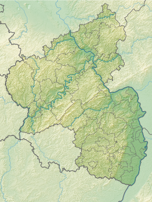
The source is located five kilometers southeast of Kaiserslautern in the valley between the Dammberg , Bärenkopf and Mittlerer Specht mountains . It marks the beginning of the Hungerbrunnen valley that ends at Lauterspring and is located directly on the eastern edge of the L 504 (Kaiserslautern-Waldleinigen) at 268 m above sea level. NHN . The source is unmounted.
Natural allocation
The Hungerbrunnen belongs to the Palatinate Forest natural area , which is classified as a 3rd order Greater Region in the systematics of the handbook of the natural spatial structure of Germany published by Emil Meynen and Josef Schmithüsen and its subsequent publications . If you consider the internal structure of the natural area , the Hungerwell belongs to the Middle Palatinate Forest.
In summary, the natural spatial allocation of the hunger well follows the following system:
- Greater region 1st order: Layer level land on both sides of the Upper Rhine Rift
- Greater region 2nd order: Palatinate-Saarland layer level land
- Greater region 3rd order: Palatinate Forest
- 4th order region (main unit): Middle Palatinate Forest
- 5th order region: unknown
Traffic and walking
The L 504 runs from northwest to southeast through the Hungerbrunnental. At the fountain, the hiking trail of the Palatinate Forest Association “white-red” crosses the country road at a hiking car park with rescue point 6412-404. A few meters from the fountain there is a boulder with inscriptions . The best way to get to the fountain is via Landstrasse 504.
Others
The spring only carries water in particularly rainy years (as of 2017). In contrast to the definition of a hunger well as a karst spring, this spring, like some others in the Palatinate, is only a periodically pouring layer spring .
Web links
Individual evidence
- ^ LANIS: Hunger wells on a topographical map from the map service of the landscape information system of the Rhineland-Palatinate nature conservation administration. Retrieved July 8, 2017 .
- ↑ Adalbert Pemöller: Geographical land survey: The natural spatial units on sheet 160 Landau i. d. Palatinate. Federal Institute for Regional Studies, Bad Godesberg 1969. → Online map (PDF; 4.2 MB)
- ↑ Helmut Beeger u. a .: The landscapes of Rheinhessen-Pfalz - naming and spatial delimitation. In: Reports on German regional studies , Volume 63, Issue 2, Trier, 1989, pp. 327–359
- ↑ State Office for Surveying and Geographic Base Information Rhineland-Palatinate: Topographical Map 1: 25,000 .-- Palatinate Forest Nature Park. In: Kaiserslautern and the surrounding area , sheet 3


