Gelterswoog
| Gelterswoog | ||
|---|---|---|

|
||
| Gelterswoog | ||
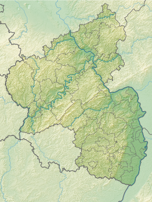
| Geographical location | West Palatinate ( Rhineland-Palatinate ) | |
| Tributaries | collected streams | |
| Drain | right tributary of the Aschbach | |
| Location close to the shore | Kaiserslautern | |
| Data | ||
| Coordinates | 49 ° 23 '41 " N , 7 ° 41' 37" E | |
|
|
||
| surface | 7-13 ha | |
| length | up to 1 km | |
| width | up to 500 m | |
| Maximum depth | 3.5 m | |
The Gelterswoog is a reservoir on the district of the West Palatinate city of Kaiserslautern ( Rhineland-Palatinate ). Three valley cuts in its tributaries, including the Walkmühl- and Kolbental with the Kolbenwoog and Kolbenmoor, as well as the siltation zones on the lakeshore have been classified as a nature reserve valleys and siltation zone on the Gelterswoog since 1997 .
geography
location
The Gelterswoog is about 11 km southwest of the center of the city and about 2 km south of the Hohenecken district . The lake can be reached over a large area via the Autobahn 6 ( Mannheim - Saarbrücken ), exit 15 Kaiserslautern-West , and the federal road 270 , which leads from Kaiserslautern to Pirmasens .
Surroundings
On the northern part of the reservoir there is an outdoor pool with a 300-meter-long sandy beach , where rowing boats can also be rented. A campsite is adjacent to the east . In the southern area - directly on the B 270 - there is a hotel with a lake terrace.
The Biebermühlbahn , which once had a stop here , also runs past the Gelterswoog .
Parameters
The Gelterswoog was created as a woog for breeding fish in a floodplain by damming several small streams in the Middle Ages . It gets its water from the western tributaries of the Aschbach , into which its overflow flows after a kilometer as a right tributary.
In the broadest sense, the lake forms a triangle that extends from west to east and then south, where it ends at an approximately 60 m long dam wall . When completely filled, it is almost 1 km long, up to 500 m wide and up to 3.5 m deep; its maximum area is more than 13 hectares. With an average filling, about 7 hectares of lake area are assumed.
Nature and sights
The Gelterswoog has the status of a natural monument . The nature reserve with other small lakes and moors, among which the Kolbenwoog and the Kolbenmoor are of particular importance, is home to numerous protected animal and plant species . In particular, several dragonfly species that are endangered in Germany , such as the spear damsel , the banded dragonfly and the blue-winged dragonfly , the little blue arrow , the green mosaic damsel and the two-striped damsel , occur here in larger numbers.
The largely natural Karlstal valley , which is almost reminiscent of a primeval forest, begins 2 km south of the Moosalb . The northern route of the historic Palatinate Way of St. James once led through the Karlstal, past the Gelterswoog and through the Walkmühltal towards the Sickingen town of Landstuhl .
The ruins of Hohenecken Castle rise 2 km north of the reservoir .
See also
Web links
Individual evidence
- ↑ Gelterswoog Kaiserslautern. (No longer available online.) Strandbad Gelterswoog, archived from the original ; accessed on April 11, 2020 .
- ↑ Am Gelterswoog campsite. camping.info, accessed January 5, 2012 .
- ↑ Spend the night. Seehotel Gelterswoog, accessed on January 5, 2012 .
- ↑ a b c Information boards at the Gelterswoog . City of Kaiserslautern.
- ↑ Gelterswoog. seen.de, accessed on March 2, 2011 .
- ↑ The dragonfly fauna of the piston woog. Specialist seminars on biology and chemistry of the state study seminar for teaching at grammar schools, Kaiserslautern, June 2002, accessed on April 29, 2010 .
- ↑ Nature walk 1: Gelterswoog nature reserve. Wanderportal Pfalz, accessed on April 29, 2010 .


