
Nothweiler
| coat of arms | Germany map | |
|---|---|---|

|
Coordinates: 49 ° 4 ' N , 7 ° 48' E |
|
| Basic data | ||
| State : | Rhineland-Palatinate | |
| County : | Southwest Palatinate | |
| Association municipality : | Dahn rock country | |
| Height : | 268 m above sea level NHN | |
| Area : | 3.67 km 2 | |
| Residents: | 130 (Dec. 31, 2019) | |
| Population density : | 35 inhabitants per km 2 | |
| Postal code : | 76891 | |
| Area code : | 06394 | |
| License plate : | PS , ZW | |
| Community key : | 07 3 40 034 | |
| Association administration address: | Schulstrasse 29 66994 Dahn |
|
| Website : | ||
| Mayoress : | Nicole Grüny | |
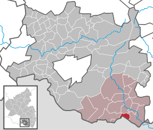
| Location of the local community Nothweiler in the district of Südwestpfalz | ||
  |
||


Nothweiler is a local community in the Rhineland-Palatinate district of Südwestpfalz , within which it is the second smallest local community in terms of population. It belongs to the community of Dahner Felsenland , which has its administrative seat in the city of Dahn . Nothweiler is a state-approved resort and border town to France .
geography
location
Nothweiler is in Wasgau , as the southern part of the Palatinate Forest and the adjoining northern part of the Vosges are also called, in the so-called Dahner Felsenland directly on the border with French Alsace . Neighboring communities are - clockwise - Bundenthal , Bobenthal , Wingen and Schönau .
Surveys
Immediately north of the settlement area, the Mäuerle stretches out , most of which is already within the boundaries of Bundenthal. The Kolbenberg rises in the east of the district . In the southwest of the district on the border with Schönau and France, the Schlossberg extends , further north, also on the border with Schönau, the 530-meter Kuhnenkopf . The 498 meter high Kappelstein is located exactly on the border with France .
geology
The rocks wulfenite , posnjakite and ranciéit occur locally .
history
Until the end of the 18th century, Nothweiler belonged to Pfalz-Zweibrücken . In 1793, the place was partially the scene of the battle in which the French 46e regiment d'infanterie was involved.
From 1798 to 1814, when the Palatinate was part of the French Republic (until 1804) and then part of the Napoleonic Empire , the place was incorporated into the canton of Pirmasens and was subordinate to the Mairie Schönau . In 1815 the place Austria was added. Just one year later, the place, like the entire Palatinate, changed to the Kingdom of Bavaria . In 1817 Nothweiler moved to the newly created canton of Dahn . From 1818 to 1862 the community belonged to the Landkommissariat Pirmasens ; from this the district office of Pirmasens emerged.
In 1939 it was incorporated into the Pirmasens district (from 1997 Südwestpfalz district ) . Since Nothweiler was in the Red Zone , the residents were temporarily evacuated at the beginning of the Second World War . After the war, the municipality within the French occupation zone became part of the then newly formed state of Rhineland-Palatinate. In the course of the first Rhineland-Palatinate administrative reform , Nothweiler was assigned to the newly created community of Dahner Felsenland in 1972 . In 1979 the community received bronze in the competition Our village should become more beautiful .
population
Population development
In 1815 Nothweiler had a total of 297 inhabitants. The number has halved over the past 200 years. In 1928 there were 209 residents, in 2018 there were only 136.
religion

In 1928 there were 183 Protestants and eleven Catholics in the village. The former belonged to the parish of Rumbach and the latter to that of Schönau.
In 2012, 62.2 percent of the population were Protestant and 24.3 percent Catholic. The rest belonged to another religion or were non-denominational. The Catholics belong to the Diocese of Speyer and are subordinate to the Deanery Pirmasens , the Evangelicals to the Protestant Church of the Palatinate . There is an evangelical church on site.
politics
Municipal council
The local council in Nothweiler consists of six council members, who were elected in the local elections on May 26, 2019 in a majority vote, and the honorary local mayor as chairman.
mayor
Nicole Grüny became the mayor of Nothweiler on June 24, 2019. Since there was no candidate for the direct election on May 26, 2019, the upcoming election of the mayor was carried out by the council in accordance with the municipal regulations. This unanimously decided in favor of Grüny, who was thus elected for five years. Her predecessors were Kurt Görtler (term 2009–2019) and Heinz Biehler (1979–2009).
coat of arms
|
|
Blazon : "In blue on a green Dreiberg, a three-towered silver castle, each topped by two crossed blue mallets."
It was approved by the Neustadt district government in 1977 . |
| Justification of the coat of arms: The mallets refer to the mining practice once practiced in the municipality |
Culture
Buildings

- Cultural monuments
There are a total of 18 objects on site that are listed , including Knight Stones 9 and 10 . The latter both bear the inscription Glückauf L. v. G. 1838 and refer to the mining operations once operated on site.
- Other structures
From 2001 to 2012 there was a museum on site with the instruments . The Graf Zeppelin fountain commemorates Ferdinand Graf von Zeppelin's visit to Nothweiler. Wegelnburg , which is already in the district of Schönau, is the highest castle in the Palatinate. On the other side of the border are Hohenburg , Löwenstein and Fleckenstein Castle .
nature
Nothweiler is located in the Palatinate Forest Nature Park , which in turn is part of the Palatinate Forest-Vosges du Nord biosphere reserve . The Zeppelinhalde nature reserve also extends to the west of the district .
Economy and Infrastructure
economy
To the east of the settlement area is the visitor mine of the old Sankt-Anna-Stollen Nothweiler mine ; in this iron ore with a high content of manganese was mined.
traffic

The district road 46 connects Nothweiler with Rumbach and Niederschlettenbach; there is also a road to Wingen. From 1924 to 1930 Nothweiler had a stop on the Wasgauwaldbahn , which was located far away from the community in the Rumbach district. The closest train station has since been Bundenthal-Rumbach on the Wieslauterbahn .
tourism
The Hornbach-Fleckenstein cycle path , which runs from Hornbach to Bundenthal, runs through Nothweiler .
In addition, the Staudernheim-Soultz-sous-Forêts long-distance hiking trail marked with a blue bar and a hiking trail marked with a green bar run through the municipality. The Donnersberg-Donon long-distance hiking trail marked with a red bar runs exactly along the boundary of Schönau .
literature
- Lothar Degen, Heinz Biehler: Chronicle 1304-2004, 700 years of Nothweiler . Ed .: Heimatverein Nothweiler. 2006.
Web links
- Internet presence of the community of Nothweiler
- Literature about Nothweiler in the Rhineland-Palatinate state bibliography
Individual evidence
- ↑ State Statistical Office of Rhineland-Palatinate - population status 2019, districts, communities, association communities ( help on this ).
- ↑ State Statistical Office of Rhineland-Palatinate. Regional data. Retrieved April 12, 2020 .
- ↑ a b daten.digitale-sammlungen.de: List of localities for the Free State of Bavaria . Retrieved April 12, 2020 .
- ↑ KommWis. Status: December 31, 2012. Accessed April 12, 2020 .
- ^ The Regional Returning Officer Rhineland-Palatinate: Local elections 2019, city and municipal council elections. Retrieved April 12, 2020 .
- ↑ Albert Nagel: The first woman at the top of the village. Die Rheinpfalz, June 26, 2019, accessed on April 8, 2020 .
- ^ Karl Heinz Debus: The great book of arms of the Palatinate. Neustadt an der Weinstrasse 1988, ISBN 3-9801574-2-3 .

Cities: Dahn | Hornbach | Rodalben
Municipalities: Althornbach | Battweiler | Bechhofen | Biedershausen | Bobenthal | Bottenbach | Bruchweiler-Bärenbach | Bundenthal | Busenberg | Clausen | Contwig | Darstein | Dellfeld | Dietrichingen | Dimbach | Donsieders | Eppenbrunn | Erfweiler | Erlenbach near Dahn | Fischbach near Dahn | Geiselberg | Großbundenbach | Grosssteinhausen | Hauenstein | Heltersberg | Hermersberg | Herschberg | Hettenhausen | Hilst | Hinterweidenthal | Hirschthal | Höheinöd | Höheischweiler | Cave frogs | Horbach | Käshofen | Kleinbundenbach | Kleinsteinhausen | Knopp-Labach | Crows Mountain | Kröppen | Gluing | Lviv | Ludwigswinkel | Lug | Maßweiler | Mauschbach | Merzalben | Münchweiler an der Rodalb | Niederschlettenbach | Nothweiler | Nünschweiler | Obernheim-Kirchenarnbach | Upper sime | Petersberg | Reifenberg | Riedelberg | Rieschweiler-Mühlbach | Rose head | Rumbach | Ruppertsweiler | Saalstadt | Schauerberg | Schindhard | Schmalenberg | Schmitshausen | Schönau | Schwanheim | Schweix | Spirkelbach | Stone albums | Thaleischweiler frogs | Trulben | Vinningen | Waldfischbach castle albums | Wallhalben | Walshausen | Weselberg | Wiesbach | Wilgartswiesen | Winterbach