
Altitude
| coat of arms | Germany map | |
|---|---|---|

|
Coordinates: 49 ° 17 ' N , 7 ° 37' E |
|
| Basic data | ||
| State : | Rhineland-Palatinate | |
| County : | Southwest Palatinate | |
| Association municipality : | Waldfischbach castle albums | |
| Height : | 400 m above sea level NHN | |
| Area : | 10.87 km 2 | |
| Residents: | 1190 (Dec. 31, 2019) | |
| Population density : | 109 inhabitants per km 2 | |
| Postal code : | 66989 | |
| Area code : | 06333 | |
| License plate : | PS , ZW | |
| Community key : | 07 3 40 022 | |
| Association administration address: | Friedhofstrasse 3 67714 Waldfischbach-Burgalben |
|
| Website : | ||
| Local Mayor : | Lothar Weber ( SPD ) | |
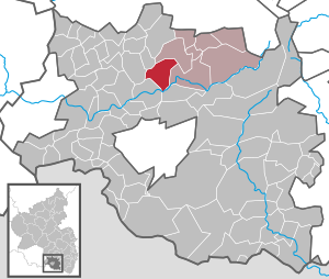
| Location of the local community Höheinöd in the district of Südwestpfalz | ||
  |
||


Höheinöd is a municipality in the Südwestpfalz district in Rhineland-Palatinate . It belongs to the Verbandsgemeinde Waldfischbach-Burgalben , within which it is the fourth largest local community in terms of both population and area.
geography
location
The place is on the Sickinger Höhe . To the north is Hermersberg , east Waldfischbach-Burgalben and south is Thaleischweiler-Fröschen . The Rieslochklamm is located in the south of the municipality . The Steinerbrücke residential area also belongs to Höheinöd.
Waters
In the south, the district extends to the Schwarzbach . The Schauerbach forms the north and east much of the district border Schauerberg and Herschberg. The Altenbach , which rises on the northern edge of the settlement and flows into the Schauerbach from the left, is also located along the entire length of the municipality .
history
middle Ages
The oldest surviving mention of Höheinöd dates from 1295. The village was a condominium shared between the counties of Zweibrücken-Bitsch and Leiningen-Dagsburg . In Zweibrücken-Bitsch it belonged to the Lemberg Office and there to the Frogs Office .
Early modern age
Count Jakob von Zweibrücken-Bitsch (1510–1570) died in 1570 as the last male member of his family. The Lemberg office was inherited by his daughter, Ludovica Margaretha von Zweibrücken-Bitsch , who was married to the (heir) Count Philipp (V) von Hanau-Lichtenberg . Her father-in-law, Count Philipp IV. Von Hanau-Lichtenberg , gave the strict Roman Catholic Duke Karl III by immediately introducing the Lutheran creed . of Lorraine, the opportunity to intervene militarily, as the latter had suzerainty over the Bitsch rule, which was also part of the inheritance . In July 1572 Lorraine troops occupied the county. Since Philip IV was unable to cope with the overwhelming power of Lorraine, he chose the legal route. In the subsequent process before the Reich Chamber of Commerce, Lorraine was able to prevail with regard to the Bitsch rule, while the Lemberg office - and thus also the Hanau-Lichtenberg part of Höheinöd - was awarded to the County of Hanau-Lichtenberg .
1736 died with Count Johann Reinhard III. the last male representative of the Hanau family. Due to the marriage of his only daughter, Charlotte (1700–1726), with the Hereditary Prince Ludwig (VIII.) (1691–1768) of Hesse-Darmstadt , the county of Hanau-Lichtenberg - and with it Hanau's share in Höheinöd - fell there. The Leining share up until 1791 then belonged to Sickingen's .
Development from 1800
In the course of the French Revolution , the left bank of the Rhine was occupied in the First Coalition War in 1794 . Höheinöd became French.
From 1798 to 1814, when the Palatinate was part of the French Republic (until 1804) and then part of the Napoleonic Empire , Hocheinöd - as it was called at the time - was incorporated into the canton of Waldfischbach in the Donnersberg department and had its own Mairie .
Due to the agreements made at the Congress of Vienna , the area first came to Austria in June 1815 and was ceded to the Kingdom of Bavaria in 1816 on the basis of a state treaty . It belonged to the Rhine district, the later Palatinate . Under the Bavarian administration, Heltersberg belonged from 1817 to the Pirmasens Land Commissioner in the Rhine District , which in 1862 became the Pirmasens District Office .
In 1939 Höheinöd was incorporated into the district of Pirmasens (from 1997 district of Südwestpfalz ) . After the Second World War , the municipality within the French occupation zone became part of the Palatinate administrative district in the then newly formed state of Rhineland-Palatinate . In the course of the first administrative reform in Rhineland-Palatinate , the community was assigned to the newly created community of Waldfischbach-Burgalben in 1972 .
population
Population development
The development of the population of Höheinöd, the values from 1871 to 1987 are based on censuses:
|
|
religion
In 2013, 61.1% of the population were Protestant and 24.4% Catholic. The rest belonged to another religion or were non-denominational. A Jewish cemetery has also existed within the local cemetery since 1905 .
politics
Municipal council
The local council in Höheinöd consists of 16 council members, who were elected in the local elections in 2019 in a majority election, and the honorary local mayor as chairman.
The distribution of seats in the municipal council:
| choice | SPD | CDU | FWG | WGR | total |
|---|---|---|---|---|---|
| 2019 | by majority vote | 16 seats | |||
| 2014 | 10 | - | 6th | - | 16 seats |
| 2009 | 9 | 2 | 3 | 2 | 16 seats |
| 2004 | 7th | 3 | 3 | 3 | 16 seats |
mayor
Lothar Weber (SPD) became mayor of Höheinöd in 2004. In the direct election on May 26, 2019, he was confirmed in his office for another five years with a share of 80.12% of the votes.
coat of arms
|
|
Blazon : "In a square shield on the top right in blue a red-armored silver eagle, in the top left in gold a blue-armored and tongued red lion, in the bottom right in gold three red rafters, in the bottom left in black five silver balls 2: 1: 2."
It was approved by the Mainz Interior Ministry in 1962 . |
Culture
Cultural monuments

There are a total of nine objects on site that are listed .
nature
The only natural monument on site is the summer linden avenue . The grass flower apple variety originally comes from the Höheinöd area , among others.
Economy and Infrastructure
economy
The Höheinöd wind farm has existed on the municipality mark since 2006 .
traffic
State road 474 , which connects to Pirmasens and Hermersberg , runs through the village . There is a connection to long-distance traffic via the nearby Sickingerhöhblick car park entrance on the A 62 . The Schwarzbachtal bridge passed by the latter is partly on the area around Höheinöd.
tourism
The Saar-Rhein-Main long-distance hiking trail marked with a yellow bar and one that is marked with a blue point and connects to Hauptstuhl and Leimen run through Höheinöd .
Personalities
Sons and daughters of the church
- Ludwig Mattil (1869–1946), politician
People who worked on site
- Ralf Appel (* 1971), chess player, won in 1997 and 1998 the Dr. Wagner memorial tournament
- Frank Giese , holder of the Federal Cross of Merit
literature
- Official directory and statistics of the royal Bavarian administrative district of the Palatinate . Speyer 1870.
- Friedrich Knöpp: Territorial holdings of the County of Hanau-Lichtenberg in Hesse-Darmstadt . [typewritten] Darmstadt 1962. [Available in the Hessisches Staatsarchiv Darmstadt , signature: N 282/6].
- Alfred Matt: Bailliages, prévôté et fiefs ayant fait partie de la Seigneurie de Lichtenberg, du Comté de Hanau-Lichtenberg, du Landgraviat de Hesse-Darmstadt . In: Société d'Histoire et d'Archaeologie de Saverne et Environs (Eds.): Cinquième centenaire de la création du Comté de Hanau-Lichtenberg 1480 - 1980 = Pays d'Alsace 111/112 (2, 3/1980), p 7-9.
Web links
Individual evidence
- ↑ a b State Statistical Office of Rhineland-Palatinate - population status 2019, districts, municipalities, association communities ( help on this ).
- ↑ State Statistical Office Rhineland-Palatinate (ed.): Official directory of the municipalities and parts of the municipality. Status: January 2018 [ Version 2020 is available. ] . S. 109 (PDF; 2.2 MB).
- ↑ Knöpp, p. 9; Matt, p. 9.
- ↑ Knöpp, p. 9.
- ↑ Directory of officials .
- ↑ State Statistical Office Rhineland-Palatinate - regional data
- ↑ KommWIS, as of December 31, 2013
- ^ The Regional Returning Officer Rhineland-Palatinate: Local elections 2019, city and municipal council elections
- ^ The Regional Returning Officer Rhineland-Palatinate: Municipal elections 2014, city and municipal council elections
- ↑ Andrea Daum: Fighting for the future of Höheinöd. Two questions - two answers: Lothar Weber. Die Rheinpfalz, June 26, 2015, accessed on March 31, 2020 .
- ^ The Regional Returning Officer Rhineland-Palatinate: direct elections 2019. see Waldfischbach-Burgalben, Verbandsgemeinde, fourth line of results. Accessed March 31, 2020 .
- ^ Karl Heinz Debus: The great book of arms of the Palatinate. Neustadt an der Weinstrasse 1988, ISBN 3-9801574-2-3 .

Cities: Dahn | Hornbach | Rodalben
Municipalities: Althornbach | Battweiler | Bechhofen | Biedershausen | Bobenthal | Bottenbach | Bruchweiler-Bärenbach | Bundenthal | Busenberg | Clausen | Contwig | Darstein | Dellfeld | Dietrichingen | Dimbach | Donsieders | Eppenbrunn | Erfweiler | Erlenbach near Dahn | Fischbach near Dahn | Geiselberg | Großbundenbach | Grosssteinhausen | Hauenstein | Heltersberg | Hermersberg | Herschberg | Hettenhausen | Hilst | Hinterweidenthal | Hirschthal | Höheinöd | Höheischweiler | Cave frogs | Horbach | Käshofen | Kleinbundenbach | Kleinsteinhausen | Knopp-Labach | Crows Mountain | Kröppen | Gluing | Lviv | Ludwigswinkel | Lug | Maßweiler | Mauschbach | Merzalben | Münchweiler an der Rodalb | Niederschlettenbach | Nothweiler | Nünschweiler | Obernheim-Kirchenarnbach | Upper sime | Petersberg | Reifenberg | Riedelberg | Rieschweiler-Mühlbach | Rose head | Rumbach | Ruppertsweiler | Saalstadt | Schauerberg | Schindhard | Schmalenberg | Schmitshausen | Schönau | Schwanheim | Schweix | Spirkelbach | Stone albums | Thaleischweiler frogs | Trulben | Vinningen | Waldfischbach castle albums | Wallhalben | Walshausen | Weselberg | Wiesbach | Wilgartswiesen | Winterbach