
Schoenau (Palatinate)
| coat of arms | Germany map | |
|---|---|---|

|
Coordinates: 49 ° 4 ' N , 7 ° 45' E |
|
| Basic data | ||
| State : | Rhineland-Palatinate | |
| County : | Southwest Palatinate | |
| Association municipality : | Dahn rock country | |
| Height : | 295 m above sea level NHN | |
| Area : | 16.34 km 2 | |
| Residents: | 408 (Dec. 31, 2019) | |
| Population density : | 25 inhabitants per km 2 | |
| Postal code : | 66996 | |
| Area code : | 06393 | |
| License plate : | PS , ZW | |
| Community key : | 07 3 40 045 | |
| Association administration address: | Schulstrasse 29 66994 Dahn |
|
| Website : | ||
| Local Mayor : | Rudolf van Venrooy | |
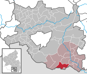
| Location of the local community Schönau (Pfalz) in the district of Südwestpfalz | ||
 _in_PS.svg) |
||

.jpg)
Schönau (Pfalz) is a municipality in the Südwestpfalz district in Rhineland-Palatinate . It belongs to the Verbandsgemeinde Dahner Felsenland , which has its administrative seat in the town of Dahn and within which it is the fifth largest in terms of area, but the sixth smallest in terms of population. Schönau is a state-recognized resort and border town to France .
geography
location
Schönau is located on the German-French border in Wasgau and belongs to the Dahn-Annweiler Felsenland subunit and, within it, to the Stürzelbronn-Schönauer Felsenland . The Gebüg district , the Heilsbach holiday colony and the Biehlerhof residential area belong to Schönau . Neighboring communities are - clockwise - Rumbach , Bundenthal , Nothweiler , Wingen , Lembach , Hirschthal , Lembach, Niedersteinbach and Fischbach bei Dahn .
Surveys
The 524 m high key rock rises in the northeastern municipal area directly on the border with Rumbach . Several kilometers to the east of the district on the border with Nothweiler and France is the 570.9 m high Schlossberg . In the southwest of the municipality, also on the border with France, there is the 515 m high Maimont , whose northeast flank with its 491 m high Herberg summit belongs to the municipality, and to the west on the border with France and Fischbach is the folding rule . The 540 m high Große Adelsberg also extends on the border with Rumbach . Is located on the border with Nothweiler of 530 m measured Kuhn head
Other surveys within the district are located in the northwest Nestelberg ( 441 m ), the roof mountain , the Zundelsberg and Hichtenberg the west, 495 m high Schwob mountain in the Northeast, the Sindelsberg in the southeast and 462 m measured Hichtenberg in the south.
Waters
The Sauer flows through the middle of the municipality in a north-south direction , and after passing Hirschthal, it flows through Alsace to the Rhine . In the north-west of the district there is the Königsbruchgraben, a right branch of it. The forest ditch and the Heilsbach flow into this from the right . Further downstream, the Sauer initially takes the Schwobbach from the left , which rises in the northeast of the district. In the center of the village it is dammed up to form the royal pond; In this area the Wengelsbach , which rises in France and which previously took up the creek from the ruins of Blumenstein , flows from the left . The Hichtenbach , which arises directly on the state border with France, crosses a short time later to the municipality mark of Hirschthal and thus beyond the area of Schönau. In the west, the Petersbächel also largely forms the border to Fischbach near Dahn; from the right it takes on the Wiesenbach .
history
Schönau was first mentioned in a document in 1129. Until the end of the 18th century, the place belonged to Pfalz-Zweibrücken .
From 1798 to 1814, when the Palatinate was part of the French Republic (until 1804) and then part of the Napoleonic Empire , Schönau was incorporated into the canton of Pirmasens and was the seat of a Mairie , which also included Hirschthal, Nothweiler and Rumbach. In 1815 the place Austria was added. Just one year later, Schönau moved to the Kingdom of Bavaria . In 1817 the community was reclassified to the canton of Dahn . From 1818 the place was part of the Landkommissariat Pirmasens , which was converted into a district office in 1862.
In 1939 Schönau was incorporated into the district of Pirmasens (from 1997 district of Südwestpfalz ) .
Since the place was in the Red Zone , the residents were temporarily evacuated with the beginning of World War II . During the western campaign , the area of the Maimont in particular was fought over, which was expressed in May 1940 in the form of the Battle of the Maimont . When the air raid on Zweibrücken on March 14, 1945 during the war, the community was part of the front line of the US Army .
After the war, the municipality within the French occupation zone became part of the then newly formed state of Rhineland-Palatinate. In the course of the first Rhineland-Palatinate administrative reform , the place became part of the newly created community of Dahner Felsenland .
Residents
Population development
The development of the population of Schönau (Palatinate), the values from 1871 to 1987 are based on censuses:
.svg)
|
|
religion
In 2012, 72.6 percent of the population were Catholic and 14.5 percent Protestant . The rest belonged to another religion or were non-denominational . The Catholics belong to the Diocese of Speyer , the Evangelicals to the Protestant Church of the Palatinate . In the north-west of the district there is also the Heilsbach educational and leisure center operated by the Speyer diocese, or alternatively known as the Heilsbach holiday colony .
politics
In Bundestag elections, Schönau belongs to the Pirmasens constituency . In state elections, the municipality was part of the Pirmasens-Land constituency from 1991 to 2016 . Due to the population decline in the region, it was dissolved, so that Rumbach will be part of the Pirmasens constituency from 2021 .
Municipal council
The municipal council in Schönau (Palatinate) consists of eight council members who were elected in a majority vote in the local elections on May 26, 2019 , and the honorary local mayor as chairman. In the 2009 election, the council members were elected in a personalized proportional representation.
The distribution of seats in the municipal council:
| choice | SPD | CDU | total |
|---|---|---|---|
| 2019 | Majority vote | 8 seats | |
| 2014 | Majority vote | 8 seats | |
| 2009 | 5 | 3 | 8 seats |
| 2004 | 3 | 5 | 8 seats |
Due to the population decline, the municipal council reduced in 2004 from 12 to 8 members.
mayor
Rudolf van Venrooy became mayor of Schönau in 2018. In the direct election on May 26, 2019, he was confirmed in office for a further five years with a share of 77.61% of the votes. His predecessor Sabrina Müller, who was elected in 2014, resigned from office for personal reasons with effect from the end of 2017. Her predecessor, in turn, was Michael Boeck, who, after 20 years as local mayor, no longer took office in 2014.
coat of arms
|
|
Blazon : "In a split shield on the right in red under a golden crown an upright silver ploughshare, on the left divided twice by silver and green, in the silver field crossed mining hammer and mallet in black, topped with a golden abbot."
It was approved by the Mainz Ministry of the Interior in 1956 and the front half is based on a court seal from 1730. |
Culture and sights
Buildings
- Cultural monuments

The Blumenstein Castle and the Wegelnburg are designated as monument zones.
In addition, there are a total of 12 individual objects that are under monument protection , including the two churches in the village. The Catholic Church of St. Michael , which was built by August von Voit between 1840 and 1842 as a five-axis hall building in the neo-Romanesque style, contains a pneumatic Späth organ from 1934 inside .
The Protestant Nikolauskirche is a baroque hall building from 1746, which was designed by the architect Philipp Heinrich Hellermann . Your most valuable piece of equipment is a Voit organ from Bauschlott from 1800. In 1971 the instrument was installed by Oberlinger Orgelbau in Schönau and expanded to II / 16 with a Rückpositiv.
- Other structures

The so-called Peace Cross is located on the Maimont
nature
The municipality is located in the Palatinate Forest Nature Park , which in turn belongs to the Palatinate Forest-Vosges du Nord biosphere reserve , which is protected by UNESCO . There are a total of six natural monuments in the district of Schönau . The Königsbruch nature reserve is also partly located in the municipality. In the west lies the Wiesen biotope in the Wengelsbach valley . The Kaiser-Wilhelm-Stein is also located in the southeast of the district, directly on the border with France .
Economy and Infrastructure
economy

The dukes of Pfalz-Zweibrücken set up an iron ore smelter in the village with the Schönau ironworks , making Schönau an early industrial community. In 1835 the large industrialist Ludwig von Gienanth bought the company. After the plant was closed in 1883, Schönau turned into a resort.
Due to the geographic conditions, the forest and timber industry dominated the area for centuries. The local forest areas are subordinate to the Wasgau Forestry Office , which is based in Dahn.
traffic
From 1924 to 1930, the community was connected to the rail network via the Schönau-Brettelhof stop of the Wasgauwaldbahn , which is on the other side of the district .
The state road 488 runs through Schönau, which joins the L 478 in the north between Fischbach and Rumbach and leads south to Hirschthal and France, where it becomes Département road 925 after crossing the state border . District road 43 branches off from the L 488 and leads over Gebüg and Petersbächel to Ludwigswinkel . There is also a road that leads into Wengelsbach , France , and that was the only way to get there until 1936. Passage there is now prohibited.
tourism

There are several weekend houses in the west of the district . The Hornbach-Fleckenstein-Radweg runs through the municipality from Bundenthal to Hornbach . Tours 15 and 16 of the Pfälzerwald Mountain Bike Park lead through the village, among other things.
Lead through Schönau and a hiking trail that is marked with a green bar that runs from Niederauerbach to the Bienwald . There is also one that is marked with a green-yellow bar and that leads from Kirchheimbolanden to Hirschthal. The so-called 7-Burgen-Wanderweg has its starting point in the municipality and leads past the Blumenstein Castle. In addition, the place is the northern end point of the Vosges pass Col de Hirchtenbach . In addition, the Felsenland Sagenweg leads through Schönau.
The Staudernheim-Soultz-sous-Forêts long-distance hiking trail marked with a blue bar and the Donnersberg-Donon long-distance hiking trail marked with a red bar lead through the southeast of the district .
Personalities
- Susanne Ganster (* 1976), politician (CDU), headed the local Heilsbach educational and leisure center from 2006 to 2011
Web links
- Official website of the community of Schönau (Pfalz)
- Literature about Schönau in the Rhineland-Palatinate state bibliography
Individual evidence
- ↑ State Statistical Office of Rhineland-Palatinate - population status 2019, districts, communities, association communities ( help on this ).
- ^ A b State Statistical Office Rhineland-Palatinate: My village, my city. Retrieved July 30, 2019 .
- ↑ State Statistical Office Rhineland-Palatinate (ed.): Official directory of the municipalities and parts of the municipality. Status: January 2019 [ Version 2020 is available. ] . S. 171 (PDF; 3 MB).
- ↑ KommWis, as of December 31, 2012
- ^ The Regional Returning Officer Rhineland-Palatinate: Local elections 2019, city and municipal council elections. Retrieved July 30, 2019 .
- ↑ Anna Warczok: Schönau: Rudolf van Venrooy is the new local mayor. Die Rheinpfalz, February 4, 2018, accessed on April 9, 2020 .
- ^ The Regional Returning Officer Rhineland-Palatinate: direct elections 2019. see Dahner Felsenland, Verbandsgemeinde, 14th line of results. Retrieved April 9, 2020 .
- ↑ Anna Warczok: the mayor is stopping . Die Rheinpfalz, September 20, 2017, accessed on April 9, 2020 .
- ^ Karl Heinz Debus: The great book of arms of the Palatinate. Neustadt an der Weinstrasse 1988, ISBN 3-9801574-2-3 .

Cities: Dahn | Hornbach | Rodalben
Municipalities: Althornbach | Battweiler | Bechhofen | Biedershausen | Bobenthal | Bottenbach | Bruchweiler-Bärenbach | Bundenthal | Busenberg | Clausen | Contwig | Darstein | Dellfeld | Dietrichingen | Dimbach | Donsieders | Eppenbrunn | Erfweiler | Erlenbach near Dahn | Fischbach near Dahn | Geiselberg | Großbundenbach | Grosssteinhausen | Hauenstein | Heltersberg | Hermersberg | Herschberg | Hettenhausen | Hilst | Hinterweidenthal | Hirschthal | Höheinöd | Höheischweiler | Cave frogs | Horbach | Käshofen | Kleinbundenbach | Kleinsteinhausen | Knopp-Labach | Crows Mountain | Kröppen | Gluing | Lviv | Ludwigswinkel | Lug | Maßweiler | Mauschbach | Merzalben | Münchweiler an der Rodalb | Niederschlettenbach | Nothweiler | Nünschweiler | Obernheim-Kirchenarnbach | Upper sime | Petersberg | Reifenberg | Riedelberg | Rieschweiler-Mühlbach | Rose head | Rumbach | Ruppertsweiler | Saalstadt | Schauerberg | Schindhard | Schmalenberg | Schmitshausen | Schönau | Schwanheim | Schweix | Spirkelbach | Stone albums | Thaleischweiler frogs | Trulben | Vinningen | Waldfischbach castle albums | Wallhalben | Walshausen | Weselberg | Wiesbach | Wilgartswiesen | Winterbach