
Border between Germany and France


Today's border between Germany and France is a 448 kilometer long state border in Central Europe, 182 kilometers of which is the Rhine (in the middle).
It separates the territory of the Federal Republic of Germany from that of the French Republic .
Borderline


North of the border is the west and east of the border is the south of Germany; to the west and south of the border are Lorraine and Alsace in the French region of Grand Est , which forms the north-east of France.
The border runs from
-
Border triangle Germany-France-Luxembourg ( ) - in the Moselle , west of Perl (Germany), northwest of Apach (France) and east of Schengen ( Luxembourg ) as well as south of a bridge over the Moselle and west of the northern area of an island in the Moselle - in the north to

- Germany-France-Switzerland triangle ( ) - in the Rhine , north of Basel ( Switzerland ), east of Hüningen (France) and west of Weil am Rhein (Germany) as well as south of the three-country bridge between France and Germany and north of a stele at the "Dreiländereck" named tip in the Rhine port of Basel - in the south.
On the French side of the border lie from north to south
- the departments
on the German side
- the countries
- Saarland (~ 157 km border with France),
- Rhineland-Palatinate (~ 108 km) and
- Baden-Wuerttemberg (~ 179 km).
The border runs from Perl to the southeast over the
- "Dreiländereck Saarland / Rhineland-Palatinate / France" near Hornbach ( ) and that
- "Dreiländereck Moselle / Bas-Rhin / Rhineland-Palatinate" at Ludwigswinkel ( ) to
- "Rhineland-Palatinate / Baden-Württemberg / France tri-border region" near Au am Rhein ( ).
From here the valley path of the Rhine forms the border over the
- "Bas-Rhin / Haut-Rhin / Baden-Württemberg triangle" near Sasbach am Kaiserstuhl ( ) south to Weil am Rhein .
history
The border follows the line agreed in the Second Peace of Paris in 1815, which was confirmed and slightly modified in 1825 by the Border Convention between Bavaria and France and in 1829 by the Border Convention between Prussia and France . In the meantime, in the Peace of Frankfurt in 1871, the border line was moved westwards in favor of the German Empire through the annexation of Alsace-Lorraine , and in 1920 in the Treaty of Versailles it was moved eastwards again in favor of France. From 1940 to 1944, with the occupation of France, the former Alsace-Lorraine was subordinated to a German civil administration as the CdZ area Lorraine and CdZ area Alsace .
Administrative units and localities at the state border
International transport
Border crossing and border traffic
Saarland
Streets and paths
- Bundesstraße 419 - Département-Straße 654 between Perl and the French Apach
- Landesstraße 173 - Département-Straße 855 between Hilringen and Waldwisse
- Waldwieser Straße - Département-Straße 64 between Biringen and Waldwisse
- Schwerdorfer Weg - Rue de la Frontière between Fürweiler and Schwerdorff
- Landesstraße 171 - Département-Straße 956 between Niedaltdorf and Neunkirchen-lès-Bouzonville
- Landesstraße 359 - Département-Straße 64 between Niedaltdorf and Guerstling
- Neutral street in Leidingen
- Bundesstraße 405 - Département-Straße 918 between Ittersdorf and Schreckling
- Bundesstraße 269 - Département-Straße 954 between Felsberg and Villing
- State road 169 - Département road 55 between Bisten and Merten
- Landesstraße 167 - Département-Straße 73 between Überherrn and Creutzwald
- Bundesstraße 269 - Route nationale 33 between Überherrn and Creutzwald
- Landesstraße 165 - Département-Straße 26A between Lauterbach and Carling
- Landesstraße 164 - Département-Straße 603 between Naßweiler and Rosbruck
- Landesstraße 274 - Département-Straße 32 between Saarbrücken and Schœneck
- Bundesstraße 41 - Département-Straße 603 between Saarbrücken and Stiring-Wendel , in the Goldene Bremm area
- Bundesautobahn 6 ( E 50 ) - Autoroute 320 between Saarbrücken and Stiring-Wendel
- Landesstraße 273 - Département-Straße 32C between Saarbrücken and Spicheren
- Bundesstraße 406 - Route nationale 61 between Güdingen and Grosbliederstroff
- Landesstraße 253 - Route nationale 61 / Département-Straße 31bis / Département-Straße 33 between Auersmacher and Grosbliederstroff
- Bundesstraße 51 - Département-Straße 82A between Rilchingen-Hanweiler and Sarreguemines
- Bundesstraße 423 - Département-Straße 974 between Habkirchen and Frauenberg
- Landesstraße 208 - Département-Straße 82 between Reinheim and Bliesbruck
- Obergailbacher Straße - Département-Straße 34A between Niedergailbach and Obergailbach
- Landesstraße 101 - Département-Straße 84 between Peppenkum and Guiderkirch
- Landesstraße 102 / Landesstraße 104 - Département-Straße 85C between Brenschelbach and Schweyen
Railway lines
- “ Thionville – Trier railway ” between Perl and Apach
- " Niedtalbahn " between Niedaltdorf and Guerstling
- “ Völklingen – Thionville railway ” between Überhern and Falck
- " Forbacher Bahn " (Saarbrücken - Metz ) between Saarbrücken and Stiring-Wendel
- “ Saarbrücken – Sarreguemines railway line ”, also known as the “ Upper Saar Valley Railway ”, between Rilchingen-Hanweiler and Sarreguemines
Rhineland-Palatinate
Streets and paths

- Bundesstraße 424 - Département-Straße 35a between Hornbach and Schweyen
- Kreisstraße 81 - Département-Straße 86c between Großsteinhausen and Opperding
- Landesstraße 483 - Département-Straße 86 between Kröppen and Walschbronn
- Kreisstraße 1 - Département-Straße 86b between Schweix and Lied Various
- Landesstraße 488 - Département-Straße 925 between Hirschthal and Lembach
- Landesstraße 478 - Département-Straße 334 between Bobenthal and Wissembourg
- Bundesstraße 38 - Département-Straße 264 between Schweigen-Rechtenbach and Wissembourg
- Landesstraße 546 - Département-Straße 534 between Schweighofen and Wissembourg
- Landesstraße 547 - Département-Straße 303 between Schweighofen and Altenstadt
- Landesstraße 545 - Département-Straße 403 between Scheibenhardt and Scheibenhard
- Bundesstrasse 9 - Route nationale 363
- State roads 545 and 554 - Département-Strasse 468 between Neulauterburg and Lauterbourg
Railway lines

- “ Neustadt – Wissembourg railway ” between Schweighofen and Wissembourg
- “ Railway line Wörth – Strasbourg ” between Berg (Pfalz) and Lauterbourg
Baden-Württemberg
Streets and paths
- Landesstraße 78b - Département-Straße 87 between Wintersdorf and Beinheim
- Bundesstraße 500 - Département-Straße 4 between Iffezheim and Roppenheim
- Landesstraße 87 - Département-Straße 2 between Rheinau and Gambsheim
- Bundesstraße 28 - Route nationale 4 between Kehl and Strasbourg
- Landesstraße 98 - Route nationale 353 between Goldscheuer and Illkirch-Graffenstaden
- Landesstraße 100 - Département-Straße 426 between Nonnenweier and Erstein
- Landesstraße 113 - Département-Straße 424 between municipalities at the Kaiserstuhl and Marckolsheim
- Bundesstraße 31 - Département-Straße 415 between Breisach am Rhein and Vogelgrun
- District road 4998 - Rue de l'Europe to Département-Straße 52 between Hartheim am Rhein and Fessenheim
- Bundesstraße 378 - Département-Straße 39 between Neuenburg am Rhein and Chalampé
- Federal motorway 5 ( Neuchâtel triangle ) - Autoroute 36
- Barrage de Kemps between Märkt and Rosenau
- Bundesstraße 532 - Département-Straße 105 between Weil am Rhein and Huningue
- Three-country bridge between Weil am Rhein and Huningue
Railway lines
- Steinbourg – Rastatt railway line , reopening is requested by the Pamina region
- “ Magistrale for Europe ” from Vienna to Paris , here on the Europabahn between Kehl and Strasbourg
- “ Müllheim – Mulhouse railway ” between Neuenburg am Rhein and Chalampé
Ferries
- " Rhine ferry Plittersdorf - Seltz " between Plittersdorf (Landesstraße 77) and Seltz (Département-Straße 28)
- " Rhine ferry Greffern - Drusenheim " between Greffern (Landesstraße 85) and Drusenheim (Département-Straße 429)
- " Rhine ferry Kappel - Rhinau " between Kappel-Grafenhausen (Landesstraße 103) and Rhinau (Département-Straße 5)
Significant buildings and sights
Buildings
Rhine bridges
- Rhine kilometer 335: " Rheinbrücke Wintersdorf " between the Rastatt district of Wintersdorf and the French Beinheim
- Rhine kilometer 293: “ Kehl Rhine Bridge ” between Kehl and Strasbourg
- Rhine kilometer 293: “ Tram bridge ” between Kehl and Strasbourg
- Rhine kilometer 293: “ Europe Bridge ” between Kehl and Strasbourg
- Rhine kilometer 292: “ Passerelle des Deux Rives ” between Kehl and Strasbourg
- Rhine kilometer 282: " Pierre-Pflimlin-Brücke " between Neuried and Eschau
- Rhine kilometer 240: “ Rheinbrücke Sasbach – Marckolsheim ” between Sasbach am Kaiserstuhl and Marckolsheim
- Rhine kilometer 225: “ Rhine bridge Breisach – Neuf-Brisach ” between Breisach and the French Neuf-Brisach
- Rhine kilometer 210: " Alain-Foechterle-Erich-Dilger-Brücke " between Hartheim am Rhein and Fessenheim
- Rhine kilometer 199: “ Rheinbrücke Neuenburg – Chalampé ” between Neuenburg am Rhein and Chalampé
- Rhine kilometer 194: “ Rheinbrücke Ottmarsheim ” between Neuenburg am Rhein and Ottmarsheim
- Rhine kilometer 171: “ Palmrain Bridge ” between Weil am Rhein and the French Huningue
- Rhine kilometer 170: “ Dreiländerbrücke ” between Weil am Rhein and Huningue; longest arched bridge for cyclists and pedestrians in the world


Rhine barrages and power plants
- Rhine kilometer 334: " Iffezheim barrage " between Iffezheim and Roppenheim
- Rhine kilometer 309: “ Rheinau-Gambsheim barrage ” between Rheinau and Gambsheim
- Rhine kilometer 235: " Marckolsheim power plant " between Wyhl am Kaiserstuhl and Sasbach am Kaiserstuhl and Marckolsheim
- Rhine kilometer 174: “ Märkt weir ” between Weil am Rhein and Village-Neuf
Attractions
- “ Gardens without borders ” / “ Jardins sans limites ”; historic restored gardens from different eras in the triangle of Saarland, Lorraine and Luxembourg
- "Straße der Menhirs" / " Rue des Menhirs " near Launstroff
- "Alter Grenzweg" / " Chemin de la Frontière ": a seven-kilometer hiking trail whose destination and starting point is the European monument in Berus ( )
- Bisttal with the nature reserve " Bistaue - state border "
- "Carrière Freyming viewing platform" near Freyming-Merlebach
- " Druidenpfad " near Rehlingen-Siersburg
- Saarbrücken main cemetery , opened in 1914 as a cemetery of honor and also as a civil cemetery in 1916
- Güdingen Racecourse
- " European Culture Park Bliesbruck-Reinheim " / "Parc Archéologique Européen de Bliesbruck-Reinheim" , an archeology park near Reinheim and Bliesbruck
- Bitsch military training area / Camp militaire de Bitche
- Schlossberg (570.9 m) in the Palatinate Forest near Schönau
- Nature reserve on the Rohrschollen Island
-
Isteiner thresholds , rapids near the southern Baden town of Istein ( ), at Rhine kilometer 177
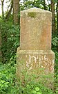
- Myriameter stones : historical milestones that are attached every ten thousand meters to the right and left of the Rhine
- "Germany-France-Switzerland triangle" ( ) at Rhine kilometer 170

Nature reserve on the Rohrschollen Island
Myriameter stone on the Rhine island between Grißheim and Chalampé

At the " border triangle Germany-France-Switzerland"
-01.jpg)

_10.jpg)


.jpg)
See also
literature
- Daniel-Erasmus Khan : The German state borders: legal historical foundations and open legal questions. Mohr Siebeck, 2004, ISBN 3-16-148403-7 , chap. X: The German-French border, pp. 512-580.
Web links
Individual evidence
- ^ Federal Statistical Office Germany: Common borders between Germany and the neighboring countries (status on December 31, 2000) ; accessed June 8, 2015.
- ↑ The unloved border on saar-nostalgie.de; Retrieved March 5, 2017.
- ↑ Dieter Gube: Rhineland-Palatinate - From the poor test tube baby to the self-confident Mittelland. Onpolitical-bildung-rlp.de; Retrieved March 5, 2017.
- ↑ Common border with three states and three German states on baden-wuerttemberg.de; Retrieved March 5, 2017.

with:
Belgium |
Denmark |
France |
Luxembourg |
Netherlands |
Austria |
Poland |
Switzerland |
Czech Republic![]()
![]()
![]()
![]()
![]()
![]()
![]()
![]()
![]()
Historically:
Inner German border

with:
Andorra |
Belgium |
Brazil |
Germany |
Italy |
Luxembourg |
Monaco |
Netherlands |
Switzerland |
Spain |
Suriname |
United Kingdom![]()
![]()
![]()
![]()
![]()
![]()
![]()
![]()
![]()
![]()
![]()
![]()