
Dalhounds
| Dalhounds | ||
|---|---|---|
.svg)
|
|
|
| region | Grand Est | |
| Department | Bas-Rhin | |
| Arrondissement | Haguenau-Wissembourg | |
| Canton | Bischwiller | |
| Community association | Pays Rhénan | |
| Coordinates | 48 ° 46 ′ N , 7 ° 59 ′ E | |
| height | 118-125 m | |
| surface | 7.45 km 2 | |
| Residents | 1,171 (January 1, 2017) | |
| Population density | 157 inhabitants / km 2 | |
| Post Code | 67770 | |
| INSEE code | 67082 | |
 Dalhounds |
||

The French commune of Dalhunden is located in the Bas-Rhin department in the Grand Est region (until 2015 Alsace ) and has 1171 inhabitants (as of January 1, 2017). There are agricultural zones, forests and small lakes around the village . The Rhine flanks the town in the south and east, where it forms the border with the Federal Republic of Germany .
coat of arms
Description of the coat of arms : In silver, a black horseshoe over a fallen red crescent .
Population development
| 1910 | 1962 | 1968 | 1975 | 1982 | 1990 | 1999 | 2007 | 2017 |
|---|---|---|---|---|---|---|---|---|
| 576 | 677 | 691 | 823 | 846 | 867 | 874 | 974 | 1171 |

St. Laurence
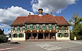
town hall

Protestant Church


See also
literature
- Le Patrimoine des Communes du Bas-Rhin . Flohic Editions, Volume 1, Charenton-le-Pont 1999, ISBN 2-84234-055-8 , pp. 140-141.
Web links
Commons : Dalhunden - Collection of images, videos and audio files
- Website of the municipality (French)