Gunstett
| Gunstett | ||
|---|---|---|

|
|
|
| region | Grand Est | |
| Department | Bas-Rhin | |
| Arrondissement | Haguenau-Wissembourg | |
| Canton | Reichshoffen | |
| Community association | Sauer-Pechelbronn | |
| Coordinates | 48 ° 55 ' N , 7 ° 46' E | |
| height | 152-222 m | |
| surface | 6.30 km 2 | |
| Residents | 655 (January 1, 2017) | |
| Population density | 104 inhabitants / km 2 | |
| Post Code | 67360 | |
| INSEE code | 67177 | |
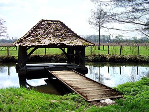
 Lavoir in Gunstett |
||
Gunstett is a French commune with 655 inhabitants (as of January 1, 2017) in the Bas-Rhin department in the Grand Est region (until 2015 Alsace ).
Neighboring communities are Oberdorf-Spachbach in the north, Biblisheim in the southeast, Durrenbach in the south and Morsbronn-les-Bains in the south-southwest.
history
Gunstett was an imperial village .
Population development
| year | 1962 | 1968 | 1975 | 1982 | 1990 | 1999 | 2007 | 2017 |
|---|---|---|---|---|---|---|---|---|
| Residents | 549 | 552 | 577 | 558 | 631 | 683 | 688 | 655 |
See also
literature
- Le Patrimoine des Communes du Bas-Rhin. Flohic Editions, Volume 2, Charenton-le-Pont 1999, ISBN 2-84234-055-8 , pp. 1636-1638.
Web links
Commons : Gunstett - collection of images, videos and audio files
