Buhl (Bas-Rhin)
| Buhl | ||
|---|---|---|

|
|
|
| region | Grand Est | |
| Department | Bas-Rhin | |
| Arrondissement | Haguenau-Wissembourg | |
| Canton | Wissembourg | |
| Community association | Plaine du Rhin | |
| Coordinates | 48 ° 55 ' N , 8 ° 0' E | |
| height | 125-178 m | |
| surface | 4.40 km 2 | |
| Residents | 524 (January 1, 2017) | |
| Population density | 119 inhabitants / km 2 | |
| Post Code | 67470 | |
| INSEE code | 67069 | |
 Mairie Buhl |
||
Buhl (German Bühl ) is a French commune with 524 inhabitants (as of January 1, 2017) in the Bas-Rhin department in the Grand Est region (until 2015 Alsace ).
Buhl is surrounded by the communities of Stundwiller , Trimbach , Crœttwiller , Niederrœdern and Hatten .
history
The name comes from "Bühel" - that means a hill , as foothills of the Vosges end next to the village . The spelling changed several times: The place 991 appears as “Bühelen”. Later it became "Bühel", "Bihel" and then "Biel". These spellings are listed on a board on the Kalvarienberg on the road that connects Buhl with Trimbach . The first known mention of the village comes from the year 991 - in connection with the construction of the Seltz monastery . According to a chronicler , Buhl was a village around a fortress on the Herrenreben Hill in the 14th century. However, he did not give any sources.
The village was settled by the Fleckenstein family , one of the most powerful families in Alsace . The last barons of Fleckenstein were Jacques and Christian Friedrich Wolfgang von Fleckenstein. Their grave slabs are in the Protestant church. The Fleckenstein family owned a castle in Buhl, which was destroyed during the Thirty Years War . After the war, a castle was built near Niederrœdern .
From 1720 Bühl belonged to the Amt of Hatten of the County of Hanau-Lichtenberg , which in turn belonged to the Landgraviate of Hesse-Darmstadt from 1736 . As a result of the French Revolution , the left bank of the Hanau-Lichtenberg county - and thus Bühl - fell to France. From 1871 until the end of the First World War , Bühl belonged to the German Empire as part of the realm of Alsace-Lorraine and was assigned to the Weißenburg district in the Lower Alsace district .
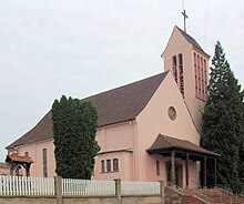
The local church was a simultaneous church between the Lutherans and the Roman Catholics until 1820 , when they moved into a new building. This historic church was destroyed in World War II and replaced by a new building.
Population development
| year | 1798 | 1910 | 1962 | 1968 | 1975 | 1982 | 1990 | 1999 | 2006 | 2017 |
|---|---|---|---|---|---|---|---|---|---|---|
| Residents | 400 | 503 | 386 | 388 | 394 | 391 | 435 | 508 | 514 | 524 |
literature
- Kathrin Ellwardt: Lutherans between France and the Reich: Church buildings in the Alsatian offices of the County of Hanau-Lichtenberg under Johann Reinhard III. and Louis IX. In: New Magazine for Hanau History 2016, pp. 18–59.
- Alfred Matt: Bailliages, prévôté et fiefs ayant fait partie de la Seigneurie de Lichtenberg, du Comté de Hanau-Lichtenberg, du Landgraviat de Hesse-Darmstadt . In: Société d'Histoire et d'Archaeologie de Saverne et Environs (Eds.): Cinquième centenaire de la création du Comté de Hanau-Lichtenberg 1480 - 1980 = Pays d'Alsace 111/112 (2, 3/1980), p 7-9.
- Le Patrimoine des Communes du Bas-Rhin. Flohic Editions, Volume 2, Charenton-le-Pont 1999, ISBN 2-84234-055-8 , pp. 1235-1236.


