
Hirschthal (Palatinate)
| coat of arms | Germany map | |
|---|---|---|

|
Coordinates: 49 ° 3 ' N , 7 ° 45' E |
|
| Basic data | ||
| State : | Rhineland-Palatinate | |
| County : | Southwest Palatinate | |
| Association municipality : | Dahn rock country | |
| Height : | 206 m above sea level NHN | |
| Area : | 1.59 km 2 | |
| Residents: | 93 (Dec. 31, 2019) | |
| Population density : | 58 inhabitants per km 2 | |
| Postal code : | 66996 | |
| Area code : | 06393 | |
| License plate : | PS , ZW | |
| Community key : | 07 3 40 021 | |
| Association administration address: | Schulstrasse 29 66994 Dahn |
|
| Website : | ||
| Mayoress : | Yvonne Darsch | |
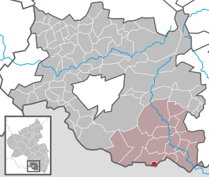
| Location of the local community Hirschthal in the district of Südwestpfalz | ||
  |
||


Hirschthal is a local community in the Rhineland-Palatinate district of Südwestpfalz , within which it is the smallest community in terms of population. It belongs to the community of Dahner Felsenland , which has its administrative seat in the city of Dahn . Hirschthal is a border town with France and is one of the smallest municipalities in Germany in terms of area .
geography
location
Hirschthal is located in the southern Palatinate Forest , the German part of the Wasgau, and belongs to the Stürzelbronn-Schönauer Felsenland subunit . The local church is located directly on the border with France . 56.1 percent of the district area is forested. Neighboring communities are Schönau in the north and Lembach in the south . The next major cities are the Alsatian Weißenburg in the east and Pirmasens in the northwest.
Elevations and waters
The southeast slope of the Hichtenberg is located in the district of Hirschthal.
The Sauer , which is still called Saarbach on the German side of the French border, flows through the local community from north to south . The Sauer is a left tributary of the Rhine and has a length of 85 kilometers. On site it takes the Hichtenbach from the right .
climate
The annual precipitation is 928 millimeters. The precipitation is high and lies in the upper quarter of the values recorded in Germany. Lower values are registered at 80 percent of the measuring stations of the German Weather Service . The driest month is April, with the most rainfall in December. In December there is 1.4 times more rainfall than in April. Precipitation hardly varies and is evenly distributed over the year. Lower seasonal fluctuations are registered at only eleven percent of the measuring stations .
history
The place was first mentioned in 1129 under the name "Hirzthal" when Gottfried von Fleckenstein gave the village together with Schönau to the St. Walburgis monastery in the Hagenauer Forest .
Until the end of the 18th century the place belonged to the Duchy of Pfalz-Zweibrücken . After taking the left bank of the Rhine by French Revolution troops in 1794, he was from 1798 to 1814 the Canton Pirmasens in the department of Donnersberg assigned. Due to the agreements of the Congress of Vienna , the area of the Palatinate came to Austria in June 1815 and on the basis of an exchange agreement in May 1816 to the Kingdom of Bavaria . Under the Bavarian administration, Hirschthal was transferred to the canton of Dahn in 1817, together with six other communities , which belonged to the Landkommissariat Pirmasens in the Rhine district, later Palatinate . In 1828 the village of Hirschthal had 80 Catholic and 201 Protestant residents. From 1862 the place was part of the district office of Pirmasens .
In 1939 Hirschthal was incorporated into the district of Pirmasens (from 1997 district of Südwestpfalz ) . Since the place was in the Red Zone , the residents were temporarily evacuated with the beginning of World War II . After the war, the municipality within the French occupation zone became part of the then newly formed state of Rhineland-Palatinate. In the course of the first Rhineland-Palatinate administrative reform , the place became part of the newly created community of Dahner Felsenland .
population
Population development
The development of the population of the municipality of Hirschthal was as follows, the values from 1871 to 1987 are based on censuses:
|
|
religion
In 2012, 43.2 percent of the population were Protestant and 39.8 percent Catholic. The rest belonged to another religion or were non-denominational. The Catholics belong to the Diocese of Speyer and are subordinate to the deanery of Pirmasens , the Evangelicals to the Protestant Church of the Palatinate .
politics
Municipal council
The council in Hirschthal consists of six council members, who in the local elections on May 26, 2019 in a majority vote were elected, and the volunteer local mayor as chairman.
mayor
Yvonne Darsch became the local mayor of Hirschthal on July 7, 2014. Since there was no candidate for the direct election on May 26, 2019, the upcoming election of the mayor was carried out by the council in accordance with the municipal regulations. This confirmed Darsch on September 5, 2019 for a further five years in her office. Her predecessor in office was Ingeborg Kessler; before that, Volker Koch held this office until 2008.
coat of arms
|
|
Blazon : "Divided and divided six times at the top by green and silver, covered with a sloping red crook , at the bottom in black gold deer antlers." |
| Foundation for the coat of arms: It was approved by the Neustadt district government in 1982 . |
Culture and sights
Cultural monuments

On the main street there are three very well restored half-timbered houses that are under monument protection .
nature
The community is located in the Palatinate Forest Nature Park , which in turn belongs to the Palatinate Forest-Vosges du Nord biosphere reserve .
Economy and Infrastructure
economy
Due to the geographic conditions, the forest and timber industry dominated the area for centuries.
traffic
The state road 488 runs through the village, which comes from Dahn as an extension of two further state roads - 478 and 489 - and continues in France as D 925. The federal highway 427 runs about seven kilometers to the northeast in an east-west direction and leads from Kandel via Bad Bergzabern and Dahn to Hinterweidenthal .
tourism
The Hornbach-Fleckenstein cycle path , which runs from Hornbach to Bundenthal, runs through Hirschthal . In addition, the community is the southern end point of a hiking trail that is marked with a green-yellow bar and that starts in Kirchheimbolanden in the north. Hirschthal is also located on the Staudernheim-Soultz-sous-Forêts long-distance hiking trail marked with a blue bar . A few hundred meters south-east of the community, across the French border, the ruins of Fleckenstein Castle stand at 370 m above sea level . It is the second most frequented castle in Alsace.
Web links
- Literature about Hirschthal in the Rhineland-Palatinate state bibliography
Individual evidence
- ↑ a b State Statistical Office of Rhineland-Palatinate - population status 2019, districts, municipalities, association communities ( help on this ).
- ↑ a b State Statistical Office Rhineland-Palatinate - regional data. Retrieved March 22, 2020 .
- ↑ a b Geographical-statistical handbook from Rheinbaiern . Zweibrücken 1828, p. 135 ( google.de ).
- ↑ Michael Frey : Attempt of a geographical-historical-statistical description of the royal. bayer. Rhine district , Volume 4 . Neidhard 1837, p. 228 ( google.de ).
- ↑ KommWis, as of December 31, 2012. Accessed March 22, 2020 .
- ^ The Regional Returning Officer Rhineland-Palatinate: Local elections 2019, city and municipal council elections.
- ^ The Regional Returning Officer Rhineland-Palatinate: Election of the honorary local and city mayors. Verbandsgemeinde Dahner Felsenland, Hirschthal, 2014. Accessed April 8, 2020 .
- ^ The State Returning Officer Rhineland-Palatinate: direct elections 2019. see Dahner Felsenland, Verbandsgemeinde, eighth line of results. Retrieved April 8, 2020 .
- ^ Wasgau-Anzeiger: From the last municipal council meeting. Weekly newspaper for the Dahner Felsenland community with the official announcements, issue 38/2019, p. 8. Geiger-Druck, accessed on April 8, 2020 .
- ^ The Regional Returning Officer Rhineland-Palatinate: Election of the honorary local and city mayors. Verbandsgemeinde Dahner Felsenland, Hirschthal, 2008. Accessed April 8, 2020 .
- ^ Karl Heinz Debus: The great book of arms of the Palatinate . Neustadt an der Weinstrasse 1988, ISBN 3-9801574-2-3 .

Cities: Dahn | Hornbach | Rodalben
Municipalities: Althornbach | Battweiler | Bechhofen | Biedershausen | Bobenthal | Bottenbach | Bruchweiler-Bärenbach | Bundenthal | Busenberg | Clausen | Contwig | Darstein | Dellfeld | Dietrichingen | Dimbach | Donsieders | Eppenbrunn | Erfweiler | Erlenbach near Dahn | Fischbach near Dahn | Geiselberg | Großbundenbach | Grosssteinhausen | Hauenstein | Heltersberg | Hermersberg | Herschberg | Hettenhausen | Hilst | Hinterweidenthal | Hirschthal | Höheinöd | Höheischweiler | Cave frogs | Horbach | Käshofen | Kleinbundenbach | Kleinsteinhausen | Knopp-Labach | Crows Mountain | Kröppen | Gluing | Lviv | Ludwigswinkel | Lug | Maßweiler | Mauschbach | Merzalben | Münchweiler an der Rodalb | Niederschlettenbach | Nothweiler | Nünschweiler | Obernheim-Kirchenarnbach | Upper sime | Petersberg | Reifenberg | Riedelberg | Rieschweiler-Mühlbach | Rose head | Rumbach | Ruppertsweiler | Saalstadt | Schauerberg | Schindhard | Schmalenberg | Schmitshausen | Schönau | Schwanheim | Schweix | Spirkelbach | Stone albums | Thaleischweiler frogs | Trulben | Vinningen | Waldfischbach castle albums | Wallhalben | Walshausen | Weselberg | Wiesbach | Wilgartswiesen | Winterbach