
Horbach (Palatinate)
| coat of arms | Germany map | |
|---|---|---|
.png)
|
Coordinates: 49 ° 20 ' N , 7 ° 39' E |
|
| Basic data | ||
| State : | Rhineland-Palatinate | |
| County : | Southwest Palatinate | |
| Association municipality : | Waldfischbach castle albums | |
| Height : | 278 m above sea level NHN | |
| Area : | 5.31 km 2 | |
| Residents: | 519 (Dec. 31, 2019) | |
| Population density : | 98 inhabitants per km 2 | |
| Postal code : | 66851 | |
| Area code : | 06333 | |
| License plate : | PS , ZW | |
| Community key : | 07 3 40 025 | |
| Association administration address: | Friedhofstrasse 3 67714 Waldfischbach-Burgalben |
|
| Website : | ||
| Local Mayor : | Walfried Schäfer ( CDU ) | |
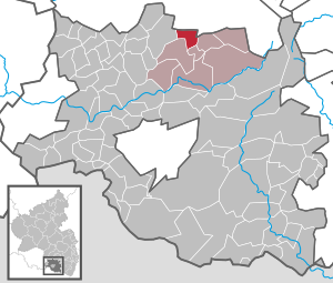
| Location of the local community Horbach in the district of Südwestpfalz | ||
  |
||


Horbach is a municipality in the Südwestpfalz district in Rhineland-Palatinate . It belongs to the Verbandsgemeinde Waldfischbach-Burgalben , within which it is the second smallest local community both in terms of area and in terms of population.
geography
location
The place is at the transition from the Palatinate Forest to the Sickinger Höhe . To the north is Linden , east Geiselsberg , south is Steinalben and west Hermersberg . Horbach also includes the Brachhof, Horbachermühle and Schwanenmühle residential areas . Neighboring communities are - clockwise - Linden , Schopp , Geiselberg, Steinalben, Hermersberg and Weselberg .
Waters
The Queidersbach flows through Horbach ; In the middle of the settlement area, the Horbach flows into it from the right . The moss ointment forms the eastern boundary of the district.
history
Until the end of the 18th century, the village of Horbach belonged to the so-called Grand Court of the Landstuhl Lordship , which was owned by the Barons von Sickingen of the line to Hohenburg. In 1794 the left bank of the Rhine was occupied in the First Coalition War.
From 1798 to 1814 Horrbach belonged - as it was spelled at the time - to the canton of Waldfischbach in the Donnersberg department and had its own Mairie . Due to the agreements made at the Congress of Vienna , the area first came to Austria in June 1815 and was ceded to the Kingdom of Bavaria in 1816 on the basis of a state treaty . Under the Bavarian administration, Horbach belonged to the Pirmasens Land Commissioner in the Rhine District from 1817, and to the Pirmasens District Office from 1862 .
In 1939, Horbach was incorporated into the district of Pirmasens (from 1997 district of Südwestpfalz ) . After the Second World War , the municipality of Heltersberg within the French occupation zone became part of the administrative district of Palatinate in the then newly formed state of Rhineland-Palatinate . In the course of the first administrative reform in Rhineland-Palatinate , the community was assigned to the newly created community of Waldfischbach-Burgalben in 1972 .
population
Population development
The development of the population of Horbach, the values from 1871 to 1987 are based on censuses:
|
|
religion
At the end of 2013, 67. percent of the population were Catholic and 19. percent Protestant. The rest belonged to another religion or were non-denominational. The Catholics belong to the Diocese of Speyer and are subordinate to the Deanery Pirmasens , the Evangelicals to the Protestant Church of the Palatinate .
politics
Municipal council
The municipal council in Horbach consists of twelve council members, who were elected in a personalized proportional representation in the local elections on May 26, 2019 , and the honorary local mayor as chairman.
The distribution of seats in the municipal council:
| choice | CDU | WVH | BGU | total |
|---|---|---|---|---|
| 2019 | 4th | 5 | 3 | 12 seats |
| 2014 | 4th | 5 | 3 | 12 seats |
| 2009 | 3 | 5 | 4th | 12 seats |
| 2004 | 3 | 6th | 3 | 12 seats |
- WVH = Voting Association Horbach e. V.
- BGU = Citizens for Society and Environment e. V.
mayor
Walfried Schäfer (CDU) became the local mayor of Horbach in 2009. In the direct election on May 26, 2019, he was confirmed in office for another five years with a share of the vote of 69.83%. His predecessor in office was Egon Meyer.
coat of arms
|
|
Blazon : "Split by silver and black, on the right a vertical downward-facing green oak branch with four leaves and three acorns, on the left five silver balls 2: 1: 2." |
| Justification of the coat of arms: It was approved by the Mainz Ministry of the Interior in 1957 and reminds with the five spheres of the former membership of the Lords of Sickingen . |
Culture
Cultural monuments

There are a total of six objects on site that are under monument protection , including the 14th century Catholic parish church of St. Peter. It is partly built with stones from Roman times.
nature
The part of the municipal park east of the Queidersbach is part of the Palatinate Forest Nature Park , which in turn belongs to the Palatinate Forest-Vosges du Nord Biosphere Reserve .
regional customs
In Horbach the fool's call Holau is cultivated during carnival , sometimes also in the form of the modification Horbach-Holau .
Economy and Infrastructure
economy
The Schwanenmühle Business Park is located south of the town center, close to the 270 federal highway on the other side of the municipality . Here some companies - some of which are among the global market leaders in their branch - produce products especially for electrical and energy technology. The Horbach wind farm has also existed in the north-west of the municipality since 2018 .
traffic
Horbach is located on Landesstraße 363, which runs from Landstuhl to Steinalben in a north-south direction . At the southern edge of the settlement, the district road 31 branches off from this , which runs via Heltersberg to Heltersberg. There is a connection to long-distance traffic via the nearby Weselberg driveway of the A 62 .
tourism
The Palatinate Forest Tour cycle path from Kaiserslautern to Hinterweidenthal leads through the middle of Horbach. In addition, the community is on the route of a hiking trail, which is marked with a green and yellow cross and which connects to Oberbexbach and Rheingönheim . There is also another one, which is marked with a green-yellow bar and which runs from Kirchheimbolanden to Hirschthal .
Personalities
Sons and daughters of the church
- Johann Jakob Hemmer (1733–1790), physicist, linguist and meteorologist
People who worked on site
- Johannes Kriebitzsch (1857–1938) painted the windows of the local St. Peter's Church.
Web links
- Horbach on the website of the Waldfischbach-Burgalben association
- Main street in Horbach called from the SWR Landesschau Rheinland-Pfalz on May 26, 2014.
- Website with pictures of Horbach (Pfalz)
Individual evidence
- ↑ State Statistical Office of Rhineland-Palatinate - population status 2019, districts, communities, association communities ( help on this ).
- ↑ State Statistical Office Rhineland-Palatinate (ed.): Official directory of the municipalities and parts of the municipality. Status: January 2018 [ Version 2020 is available. ] . S. 109 (PDF; 2.2 MB).
- ↑ State Statistical Office Rhineland-Palatinate - regional data
- ↑ KommWis, as of December 31, 2013
- ^ The Regional Returning Officer Rhineland-Palatinate: Local elections 2019 City and municipal council elections
- ↑ Andrea Daum: As a pensioner, more time for office. Die Rheinpfalz, March 15, 2019, accessed on March 31, 2020 .
- ^ The Regional Returning Officer Rhineland-Palatinate: direct elections 2019. see Waldfischbach-Burgalben, Verbandsgemeinde, fifth row of results. Accessed March 31, 2020 .
- ^ Karl Heinz Debus: The great book of arms of the Palatinate . Neustadt an der Weinstrasse 1988, ISBN 3-9801574-2-3 .

Cities: Dahn | Hornbach | Rodalben
Municipalities: Althornbach | Battweiler | Bechhofen | Biedershausen | Bobenthal | Bottenbach | Bruchweiler-Bärenbach | Bundenthal | Busenberg | Clausen | Contwig | Darstein | Dellfeld | Dietrichingen | Dimbach | Donsieders | Eppenbrunn | Erfweiler | Erlenbach near Dahn | Fischbach near Dahn | Geiselberg | Großbundenbach | Grosssteinhausen | Hauenstein | Heltersberg | Hermersberg | Herschberg | Hettenhausen | Hilst | Hinterweidenthal | Hirschthal | Höheinöd | Höheischweiler | Cave frogs | Horbach | Käshofen | Kleinbundenbach | Kleinsteinhausen | Knopp-Labach | Crows Mountain | Kröppen | Gluing | Lviv | Ludwigswinkel | Lug | Maßweiler | Mauschbach | Merzalben | Münchweiler an der Rodalb | Niederschlettenbach | Nothweiler | Nünschweiler | Obernheim-Kirchenarnbach | Upper sime | Petersberg | Reifenberg | Riedelberg | Rieschweiler-Mühlbach | Rose head | Rumbach | Ruppertsweiler | Saalstadt | Schauerberg | Schindhard | Schmalenberg | Schmitshausen | Schönau | Schwanheim | Schweix | Spirkelbach | Stone albums | Thaleischweiler frogs | Trulben | Vinningen | Waldfischbach castle albums | Wallhalben | Walshausen | Weselberg | Wiesbach | Wilgartswiesen | Winterbach