
Rumbach
| coat of arms | Germany map | |
|---|---|---|

|
Coordinates: 49 ° 6 ' N , 7 ° 47' E |
|
| Basic data | ||
| State : | Rhineland-Palatinate | |
| County : | Southwest Palatinate | |
| Association municipality : | Dahn rock country | |
| Height : | 233 m above sea level NHN | |
| Area : | 14.79 km 2 | |
| Residents: | 438 (Dec. 31, 2019) | |
| Population density : | 30 inhabitants per km 2 | |
| Postal code : | 76891 | |
| Area code : | 06394 | |
| License plate : | PS , ZW | |
| Community key : | 07 3 40 039 | |
| Association administration address: | Schulstrasse 29 66994 Dahn |
|
| Website : | ||
| Local Mayor : | Ralf Weber | |
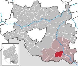
| Location of the local community Rumbach in the district of Südwestpfalz | ||
  |
||


Rumbach is a municipality in the district of Südwestpfalz in Rhineland-Palatinate . It belongs to the community of Dahner Felsenland , which has its administrative seat in the city of Dahn . The community has been a state-approved resort since 1984 .
geography
location
Rumbach im Wasgau , as the southern part of the Palatinate Forest and the adjoining northern part of the Vosges are also called within the Dahner Felsenland . The area, which has partly rugged mountain slopes, is criss-crossed by numerous valleys with grassland. Neighboring communities are - clockwise - Bruchweiler-Bärenbach , Bundenthal , Schönau and Fischbach bei Dahn .
Rumbach to additionally include the habitations factory Aubühl, Falkenberg, Falkenmühle and settlement Langenthal. The Falkenmühle is already at the entrance to Bundenthal .
Surveys
In the southeast of the district on the border to Bundenthal rise the 484.7 m above sea level. NN high Beißenberg and north of this the 309.3 m above sea level. NN high Great Heinzenkopf . Further to the west is the mountain An der Stirne , which is 400.6 m above sea level. NN measures. In the northwest on the boundary to Fischbach bei Dahn lies the. In the south on the border to Schönau the 524 m above sea level extend . NN high key rocks and the Great Adelsberg and north of the latter the Small Adelsberg and the Rumbergskopf . In the northwest on the border to Fischbach bei Dahn lies the Große Roßberg
Waters
The extensive parish of the local community extends east to the Wieslauter . The creek of the same name flows through the middle of the settlement area and the Dumbach forms the boundary to Bruchweiler-Bärenbach in the northeast; both are right tributaries of the Wieslauter. In the west, the district extends to the Sauer . From the left, a body of water that is also called Rumbach and the swamp hole ditch flow into it .
history
From the first half of the 15th to the end of the 18th century, Rumbach belonged to the Pfalz-Zweibrücker Amt Wegelnburg .
After the Left Bank of the Rhine was taken by French revolutionary troops in 1794 and the administration was reorganized based on the French model, the place belonged to the canton of Pirmasens in the Donnersberg department from 1798 to 1814 . In 1815 the place was added to Austria as part of the Congress of Vienna . Just one year later, Rumbach moved to the Kingdom of Bavaria due to an area swap . In 1817 the community was reclassified to the canton of Dahn . From 1818 the place was part of the Landkommissariat Pirmasens , which was converted into a district office in 1862. During this time, the community was assigned to the Schönau mayor's office .

In 1939 Rumbach was incorporated into the district of Pirmasens (from 1997 district of Südwestpfalz ) . During the Second World War , the place was in the area of the Red Zone . After the war, the municipality within the French occupation zone became part of the then newly formed state of Rhineland-Palatinate. In the course of the first Rhineland-Palatinate administrative reform , the place became part of the newly created community of Dahner Felsenland .
In 2009 Rumbach came third in the Capital of Fair Trade competition . A year later, the municipality was the national winner in the competition Our village has a future and received the silver medal and in 2019 the gold medal. In 2009 Rumbach was in the competition Our village has future district, regional and state winner in the special class. In May 2010, Rumbach was the winner of the state finals. In addition, the place was awarded the special prize for interior development . In 2000 and 2005, Rumbach was district winner and in 2000 and 2010 received the special award for exemplary ecological performance .
population
Population development
The development of the population of Rumbach, the values from 1871 to 1987 are based on censuses:
|
|
religion
In 2012, 53.0 percent of the population were Protestant and 28.7 percent Catholic. The rest belonged to another religion or were non-denominational. The Catholics belong to the Diocese of Speyer and are subordinate to the Deanery Pirmasens , the Evangelicals to the Protestant Church of the Palatinate .
politics
In federal elections, Rumbach belongs to the constituency of Pirmasens . In state elections, the municipality was part of the Pirmasens-Land constituency from 1991 to 2016 . Due to the population decline in the region, it was dissolved, so that Rumbach will be part of the Pirmasens constituency from 2021 .
Municipal council

The council in Rumbach consists of eight council members, who in the local elections on May 26, 2019 in a majority vote were elected, and the honorary mayor as chairman.
mayor
Ralf Weber (FWG) became the local mayor of Rumbach in 2014. In the direct election on May 26, 2019, he was confirmed in office for a further five years with a share of the vote of 86.29 percent. His predecessor was Heidelinde Koslowski (FWG).
coat of arms
|
|
Blazon : "Divided by a wavy line of blue and silver, above under a golden crown an erect silver ploughshare, below on a green ground with three green fir trees a red tree stump and a red fallen tree trunk."
It was approved by the Neustadt district government in 1980 . |
Culture and sights
Cultural monuments

The town center is designated as a monument zone .
There are also numerous individual objects that are under monument protection , including the 1000-year-old Christ Church located in the center of the village . The latter is a Romanesque fortified church that used to be called "St. Gangolf Church"; it is furnished with old frescoes , among other things . Below the church there are also some well-preserved half-timbered houses from the 19th century. Other listed objects are a fountain that was made by the Schönauer Hüttenwerk and a war memorial.
nature
The municipality is located in the Palatinate Forest Nature Park , which in turn belongs to the Palatinate Forest-Vosges du Nord biosphere reserve , which is protected by UNESCO . A total of four natural monuments exist in the municipality ; all of them are rocks. In the south there is also the nature reserve Brauntal and in the south-west, across boundaries, the nature reserve Königsbruch . In addition, the community is part of the climbing area Palatinate Forest .
Economy and Infrastructure
economy
Rumbach is a so-called forest farming village . Due to the geographic conditions, the forest and timber industry dominated the area for centuries. The local forest areas are subordinate to the Wasgau Forestry Office , which is based in Dahn.
traffic

The Wieslauterbahn has been running from Hinterweidenthal Ost to Bundenthal since 1911 . The terminus, which is located at the entrance to the neighboring municipality of Bundenthal, was named “ Bundenthal-Rumbach ” because it was also responsible for Rumbach. After passenger traffic was discontinued in 1966, it has been operating again since 1997 for excursion traffic. From this the leading right through the settlement area branched 1921-1930 Wasgauwaldbahn by Ludwig angle from which the heeresfeldbahn was built and offered on the 1924 passenger traffic.
State road 478 , which runs from the state border with Saarland near Hornbach to the German-French border near Sankt Germanshof , runs through the village . From this the county road 46 branches off south of the settlement area , which leads via Nothweiler to Niederschlettenbach .
The Bundenthal-Rumbach small airfield is partly located in the municipality .
tourism
.jpg)
With the biosphere tour, a cycle path leads through the local community; this is a circular route that begins and ends in Dahn. The Donnersberg-Donon long-distance hiking trail marked with a red bar , the southern route of the Pfälzer Jakobswege and the Felsenland Sagenweg run through the municipality, a so-called premium hiking trail. In addition, the community was a station on the West Palatinate hiking trail . Tour 14 of the Pfälzerwald mountain bike park runs a short distance over the Rumbach forest markings in the area of the Beißenberg and tour 15 through larger parts of the municipality.
Personalities
Honorary citizen
- Fritz Perret (1904–1996), former mayor
People who worked on site
- Heidelinde Koslowski, owner of the Freiherr-vom-Stein plaque since 2013 , mayor until 2014
Web links
- Local community Rumbach with host directory
- Literature about Rumbach in the Rhineland-Palatinate state bibliography
Individual evidence
- ↑ a b State Statistical Office of Rhineland-Palatinate - population status 2019, districts, municipalities, association communities ( help on this ).
- ↑ a b State Statistical Office Rhineland-Palatinate - regional data
- ↑ State Statistical Office Rhineland-Palatinate (ed.): Official directory of the municipalities and parts of the municipality. Status: January 2018 [ Version 2020 is available. ] . S. 108 (PDF; 2.2 MB).
- ↑ Complete collection of the ordinances and resolutions of the citizen government commissioner and the central administrations of the four new departments on the left bank of the Rhine , Volume 1, Issue 2, Wirth, 1798, pp. 62, 71 ( Google Books )
- ^ Advertisement of civil servants and employees in the state and communal services of the Royal Bavarian Rhine District , Kranzbühler, 1827, p. 66 ( Google Books )
- ↑ KommWis, as of December 31, 2012
- ^ The Regional Returning Officer Rhineland-Palatinate: Local elections 2019, city and municipal council elections
- ↑ Holger Keller: CDU consolidates position as the strongest force. Local elections in the community of Dahner Felsenland. Die Rheinpfalz, May 28, 2014, accessed on April 9, 2020 .
- ^ The State Returning Officer Rhineland-Palatinate: direct elections 2019. see Dahner Felsenland, Verbandsgemeinde, twelfth line of results. Retrieved April 9, 2020 .
- ^ Karl Heinz Debus: The great book of arms of the Palatinate. Neustadt an der Weinstrasse 1988, ISBN 3-9801574-2-3 .

Cities: Dahn | Hornbach | Rodalben
Municipalities: Althornbach | Battweiler | Bechhofen | Biedershausen | Bobenthal | Bottenbach | Bruchweiler-Bärenbach | Bundenthal | Busenberg | Clausen | Contwig | Darstein | Dellfeld | Dietrichingen | Dimbach | Donsieders | Eppenbrunn | Erfweiler | Erlenbach near Dahn | Fischbach near Dahn | Geiselberg | Großbundenbach | Grosssteinhausen | Hauenstein | Heltersberg | Hermersberg | Herschberg | Hettenhausen | Hilst | Hinterweidenthal | Hirschthal | Höheinöd | Höheischweiler | Cave frogs | Horbach | Käshofen | Kleinbundenbach | Kleinsteinhausen | Knopp-Labach | Crows Mountain | Kröppen | Gluing | Lviv | Ludwigswinkel | Lug | Maßweiler | Mauschbach | Merzalben | Münchweiler an der Rodalb | Niederschlettenbach | Nothweiler | Nünschweiler | Obernheim-Kirchenarnbach | Upper sime | Petersberg | Reifenberg | Riedelberg | Rieschweiler-Mühlbach | Rose head | Rumbach | Ruppertsweiler | Saalstadt | Schauerberg | Schindhard | Schmalenberg | Schmitshausen | Schönau | Schwanheim | Schweix | Spirkelbach | Stone albums | Thaleischweiler frogs | Trulben | Vinningen | Waldfischbach castle albums | Wallhalben | Walshausen | Weselberg | Wiesbach | Wilgartswiesen | Winterbach