
Spirkelbach
| coat of arms | Germany map | |
|---|---|---|

|
Coordinates: 49 ° 12 ' N , 7 ° 53' E |
|
| Basic data | ||
| State : | Rhineland-Palatinate | |
| County : | Southwest Palatinate | |
| Association municipality : | Hauenstein | |
| Height : | 230 m above sea level NHN | |
| Area : | 6.89 km 2 | |
| Residents: | 679 (Dec. 31, 2019) | |
| Population density : | 99 inhabitants per km 2 | |
| Postal code : | 76848 | |
| Area code : | 06392 | |
| License plate : | PS , ZW | |
| Community key : | 07 3 40 049 | |
| Association administration address: | Schulstrasse 4 76846 Hauenstein |
|
| Website : | ||
| Local Mayor : | Edgar Perret ( SPD ) | |
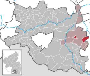
| Location of the local community Spirkelbach in the district of Südwestpfalz | ||
  |
||


Spirkelbach is a municipality in the district of Südwestpfalz in Rhineland-Palatinate . It belongs to the Verbandsgemeinde Hauenstein , within which it is the fourth largest local community in terms of population.
geography
location
Spirkelbach is located in the middle of Wasgau , as the southern part of the Palatinate Forest and the adjoining northern part of the Vosges are also called, between Hauenstein and Annweiler am Trifels in the Wasgau sub-area Dahner Felsenland . 76.5 percent of the district area is forested. Neighboring communities are - clockwise - Wilgartswiesen , Rinnthal , Wernersberg , Lug , Schwanheim and Hauenstein. The municipality also has a forest dexclave to the north-west, which is located within the southern Franconian pasture . In the north it borders on Wilgartswiesen and in the south on Hauenstein.
Surveys
The 455.2 m high Höllenberg in the south, the Rindsberg in the north on the boundary with Rinnthal and the Spirkelbacher Rauhberg in the west surround the place.
Waters
The eponymous Spirkelbach rises in the south of the district and then runs north through the settlement area. Beyond the boundary of the district it flows into the Queich from the right . In the west forms the Steinbach , which also flows in a south-north direction , which largely forms the boundary with Hauenstein and also flows into the Queich from the right.
geology
The so-called Trifels layers dominate on site .
history
The eponymous brook was first mentioned in a document as Spurchinebach 828. It flowed through uninhabited forest area that was donated to Hornbach Abbey . The place itself can be proven since 1303. By the end of the 18th century, the community formed a condominium , as it belonged jointly to Zweibrücken and the Leiningern .
From 1798 to 1814, when the Palatinate was part of the French Republic (until 1804) and then part of the Napoleonic Empire , Spirkelbach was incorporated into the canton of Annweiler and was subordinate to the Wilgartswiesen Mairie. In 1815 the place Austria was added. Just one year later, Spirkelbach moved to the Kingdom of Bavaria . From 1818 to 1862 the place was part of the Landkommissariat Bergzabern , which was then converted into a district office. On June 17, 1849, Spirkelbach was partially the scene of the battle near Rinnthal ; a Prussian battalion was sent to bypass the troopers across the community to Sarnstall .
In 1939 the place was incorporated into the Bergzabern district. After the Second World War , Spirkelbach became part of the then newly formed state of Rhineland-Palatinate within the French occupation zone . In the course of the first Rhineland-Palatinate administrative reform , the place moved in 1969 to the district of Pirmasens (from 1997 district of Südwestpfalz ) . Three years later it was incorporated into the newly created community of Hauenstein .
population
Population development
In 1815 Spirkelbach had a total of 273 inhabitants. In 1928 the community already had 465 residents who lived in 86 residential buildings. At the end of 2019, 679 people lived in the community.
religion
On the catholic side, the community belongs to the diocese of Speyer and there is subordinate to the deanery of Pirmasens , the evangelicals to the Protestant regional church of the Palatinate .
politics
Municipal council
The council in Spirkelbach consists of twelve council members, who in the local elections on May 26, 2019 in a majority vote were elected, and the honorary mayor as chairman.
mayor
Edgar Perret (SPD) became mayor of Spirkelbach in 2009. In the direct election on May 26, 2019, he was confirmed in office for a further five years with a share of 80.95% of the vote. Perret's predecessor, Gerhard Christmann (SPD), who died in 2017, held the office from 1999 to 2009.
coat of arms
|
|
Blazon : “In a square shield on the top right in blue a red-armored silver (white) eagle, in the top left in gold (yellow) a blue-armored and tongued red lion, in the bottom right in silver (white) a green juniper branch with four blue juniper berries, bottom left a silver (white) oblique left-hand shaft bar in green. " |
| Justification of the coat of arms: The coat of arms awarded by the Rhineland-Palatinate Ministry of the Interior on February 7, 1950 reminds of the medieval rule in the upper half of the shield with the Leininger eagle and the lion of the Counts of Zweibrücken , while the lower half of the coat of arms with Spirkel = bird cherry and buckthorn and brook the place name (" Redendes Wappen ") reproduces. |
Banner and flag
 |
|
 |
|
Culture
Cultural monuments

There are a total of eleven objects on site that are listed , including the war memorial.
nature
Spirkelbach is located in the Palatinate Forest Nature Park , which in turn is part of the Palatinate Forest-Vosges du Nord Biosphere Reserve . There are several red sandstone rocks on site that are part of the Palatinate Forest climbing area , for example the Wackelstein on the Rindsberg or the Rauhbergfelsen with the Otto Wendelturm , which is very well known among climbers. The latter is also designated as a natural monument .
Club life
There are several associations in the Rhineland-Palatinate community of Spirkelbach, including the choral society 1866 Spirkelbach and the fruit and horticultural association Spirkelbach . The local community also has a fishing club. A total of seven clubs are based in the place.
Economy and Infrastructure
economy
After the Second World War, Spirkelbach was also part of the Pirmasens Military Community, which has now been dissolved .
traffic

District roads 54 and 55 run through Spirkelbach . The former leads from Wilgartswiesen to Schwanheim , the latter branches off in the settlement area from this one, which leads to Wernersberg on the other side of the district, where it becomes district road 61 .
The place is connected to the local transport network via the bus line 525 of the transport association Rhein-Neckar , which leads to Bad Bergzabern and Annweiler am Trifels . The closest train station is Wilgartswiesen on the Landau – Rohrbach railway line .
tourism
The Pirminius cycle path , which runs from Hornbach to Wilgartswiesen , leads through the community , as well as a hiking path marked with a red dot and one marked with a blue cross .
Personalities
Sons and daughters of the church
- Adolf Rapp (* 1933), chemist, expert in wine analysis
People who worked on site
- Fritz Herrfurth (1899–1944), painter, sculptor and architect, designed the local war memorial
- Jean-Philippe Devise (* 1960), French writer, founded a local language school in 1996 where he teaches French
Web links
- spirkelbach.de
- Local community Spirkelbach on the website of the association community Hauenstein
- Literature about Spirkelbach in the Rhineland-Palatinate State Bibliography
Individual evidence
- ↑ State Statistical Office of Rhineland-Palatinate - population status 2019, districts, communities, association communities ( help on this ).
- ↑ daten.digitale-sammlungen.de: List of localities for the Free State of Bavaria . Retrieved July 25, 2018 .
- ^ The Regional Returning Officer Rhineland-Palatinate: Local elections 2019, city and municipal council elections
- ^ Judith Hörle: Spirkelbach: incumbent Edgar Perret is running again. Die Rheinpfalz, May 3, 2019, accessed on April 5, 2020 .
- ^ The Regional Returning Officer Rhineland-Palatinate: direct elections 2019. see Hauenstein, Verbandsgemeinde, seventh line of results Retrieved April 5, 2020 .
- ↑ Committed and competent. Gerhard Christmann. Die Rheinpfalz, April 21, 2017, accessed on April 5, 2020 .
- ↑ General Directorate for Cultural Heritage Rhineland-Palatinate (ed.): Informational directory of cultural monuments - District of Südwestpfalz. Mainz 2020, p. 46 f. (PDF; 8.7 MB).

Cities: Dahn | Hornbach | Rodalben
Municipalities: Althornbach | Battweiler | Bechhofen | Biedershausen | Bobenthal | Bottenbach | Bruchweiler-Bärenbach | Bundenthal | Busenberg | Clausen | Contwig | Darstein | Dellfeld | Dietrichingen | Dimbach | Donsieders | Eppenbrunn | Erfweiler | Erlenbach near Dahn | Fischbach near Dahn | Geiselberg | Großbundenbach | Grosssteinhausen | Hauenstein | Heltersberg | Hermersberg | Herschberg | Hettenhausen | Hilst | Hinterweidenthal | Hirschthal | Höheinöd | Höheischweiler | Cave frogs | Horbach | Käshofen | Kleinbundenbach | Kleinsteinhausen | Knopp-Labach | Crows Mountain | Kröppen | Gluing | Lviv | Ludwigswinkel | Lug | Maßweiler | Mauschbach | Merzalben | Münchweiler an der Rodalb | Niederschlettenbach | Nothweiler | Nünschweiler | Obernheim-Kirchenarnbach | Upper sime | Petersberg | Reifenberg | Riedelberg | Rieschweiler-Mühlbach | Rose head | Rumbach | Ruppertsweiler | Saalstadt | Schauerberg | Schindhard | Schmalenberg | Schmitshausen | Schönau | Schwanheim | Schweix | Spirkelbach | Stone albums | Thaleischweiler frogs | Trulben | Vinningen | Waldfischbach castle albums | Wallhalben | Walshausen | Weselberg | Wiesbach | Wilgartswiesen | Winterbach