
Donsieders
| coat of arms | Germany map | |
|---|---|---|

|
Coordinates: 49 ° 16 ' N , 7 ° 39' E |
|
| Basic data | ||
| State : | Rhineland-Palatinate | |
| County : | Southwest Palatinate | |
| Association municipality : | Rodalben | |
| Height : | 320 m above sea level NHN | |
| Area : | 9.03 km 2 | |
| Residents: | 917 (Dec. 31, 2019) | |
| Population density : | 102 inhabitants per km 2 | |
| Postal code : | 66978 | |
| Area code : | 06333 | |
| License plate : | PS , ZW | |
| Community key : | 07 3 40 007 | |
| Association administration address: | Am Rathaus 9 66976 Rodalben |
|
| Website : | ||
| Local Mayor : | Peter Spitzer ( SPD ) | |
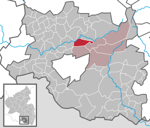
| Location of the local community Donsieders in the district of Südwestpfalz | ||
  |
||


Donsieders ( Dunsiters ) is a municipality in the district of Südwestpfalz in Rhineland-Palatinate . It belongs to the Verbandsgemeinde Rodalben , within which it is the second smallest in terms of population and the smallest in terms of area. Donsieders was first mentioned in a document in 1295.
geography
Geographical location
Donsieders lies on two parallel ridges of the Westrich plateau on the western border of the Palatinate Forest Nature Park and the Palatinate Forest-Vosges du Nord biosphere reserve at the transition to the Westrich landscape . The village developed on this ridge: on the south is the district called Eck , it is the core of the historic Donkey. The origins of the medieval hamlet as a scattered settlement lay here . The northern district, called Neuland , was built from the end of the 18th century, strengthened since the end of the Franco-Prussian War and the economic boom of the early days . For a long time, the two parts were connected by the main road. Since the 1980s, both parts have grown together structurally into a single unit due to the development of the Stockbrunnen valley, which had been separating for a long time . Donsieders also includes the hamlet of Biebermühle , which is located in the southwest of the district and historically the Diederberger Hof and a paper mill .
geology
In the area of Donsieders, the upper and middle red sandstone predominates, in addition, as an extension of the Westrich, there is occasional lower shell limestone . At the edges, in the northwest and west, where the plateau slopes down towards the Schwarzbachtal , is the middle red sandstone of the Karlstal layers . The plateaus are covered with slightly loamy sand to sandy loam ; the soils are poor in bases. The soil types are brown earth and tendrils as well as transitional gleye . In terms of landscape ecology , the Donsieders district consists of plateaus and slopes. The red sandstone appears more often at the foot of slopes, for example on the Saufelsen , the Nesselfelsen or the Hasterfelsen .
Elevations and waters
The highest point of the place is the Orleberg at 432 meters . In the west of the village arise the three springs that unite to the Bächleich Reezbach . It flows through the Rotzthal and flows into the Rodalb after a few kilometers . The Dietersbach rises in the northeast .
Vegetation and land use
The potential natural vegetation is pearl grass beech forest . 38.5% of the district area is forested, 49.2% is used for agriculture. The water area is 0.3%, the settlement and traffic area 12%. This means that in the last 25 years there has been a clear decline in the agriculturally used area (1980: 57.1%), settlement area and traffic area (1980: 8.2%) and forest (1980: 34.2%) increased.
Place and district names
Donsieders means elongated woodland that has been separated for the purpose of clearing . Donsieders was therefore a village that emerged in a cleared forest area. Field names indicate the forest areas surrounding the place: Kühnenwäldchen (pine groves), In den Erlen , An de Keschdebääm (sweet chestnuts) or Orleberg (Orle = Middle High German for maple). In the course of time there were also district designations that related to the use of the areas: Long gardens or light gardens (= hillside gardens) and pasture areas such as the Farrenwiese , which was probably used by the keeper of the community bull or a pasture area called Schofhenriche Trift of a resident named Heinrich Sheep. Livestock farming was common until the middle of the 20th century. Hemp and flax were grown in Donsieders and processed into natural fibers for ropes and spinnable fibers in the Reezbach , so the name Rotzthal shows . In the Leimenkaut , clay was extracted for building houses and barns. The construction method with solid sandstone extracted from local quarries only prevailed in the village in the 19th century.
Since 1594, field names such as vor borg or bey dem burg, so called for an area at the western end of the Orleberg, southwest of the present-day village near the Reezbach springs, have been handed down. The current field name is An der Burg . At the site of this high medieval castle - its name is not known - there is a large rectangular area. Remnants of masonry, upright rock slabs and traces that indicate a well shaft were found here.
Neighboring communities
To the north is Waldfischbach-Burgalben , east Clausen and south is Rodalben . The next larger city is Pirmasens , located to the southwest .
history
middle Ages
Local researchers assume that Donsieders was settled over the Schwarzbachtal from the Bliesgau and that following the Rodalb settled over the valley of the Reezbach on the ridges where the settlement was established in the 12th century.
The oldest surviving mention of Donsieders comes from a document about the division of the County of Zweibrücken from 1295, where the place is called Dunsutere . Then different spellings are used, for example Dunsithers (1315) Donsiters (1470) Dansieders (1522) Dhonseuters (1539) or Tuntzetters (1680). The current notation has been in use since 1837.
The early Donsieders was under the spell of the Burgalba monastery courtyard , which in turn belonged to the Wadgassen Abbey . At the end of the Middle Ages, the village belonged to the Lemberg office of the County of Zweibrücken-Bitsch and there to the Donsieders office of the same name .
Early modern age
Count Jakob von Zweibrücken-Bitsch (* 1510; † 1570) died in 1570 as the last male member of his family. The Lemberg office was inherited by his daughter, Ludovica Margaretha von Zweibrücken-Bitsch , who was married to the (heir) Count Philipp (V) von Hanau-Lichtenberg . Her father-in-law, Count Philipp IV. Von Hanau-Lichtenberg , gave the strict Roman Catholic Duke Karl III by immediately introducing the Lutheran creed . of Lorraine, the opportunity to intervene militarily, as the latter had suzerainty over the Bitsch rule, which was also part of the inheritance . In July 1572 Lorraine troops occupied the county. Since Philip IV was unable to cope with the overwhelming power of Lorraine, he chose the legal route. In the subsequent process before the Imperial Court of Justice, Lorraine was able to prevail with regard to the Bitsch rule, while the Lemberg office - and thus also Donsieders - was awarded to the County of Hanau-Lichtenberg .
The rebuilding on the remains of the old village after the destruction of the Thirty Years' War is historically guaranteed .
Due to France's reunification policy , in 1680 the parts of the County of Hanau-Lichtenberg in Alsace fell under French sovereignty . However, only three villages belonging to the Lemberg Office were included.
1736 died with Count Johann Reinhard III. the last male representative of the Hanau family. Due to the marriage of his only daughter, Charlotte (* 1700; † 1726), with the Hereditary Prince Ludwig (VIII.) (* 1691; † 1768) of Hesse-Darmstadt , the county of Hanau-Lichtenberg fell there. In the course of the French Revolution , the part of the County of Hanau-Lichtenberg on the left bank of the Rhine - and with it the office of Lemberg and Donsieders - fell to France in 1793.
From 1798 to 1814, when the Palatinate was part of the French Republic (until 1804) and then part of the Napoleonic Empire , the place was incorporated into the canton of Pirmasens and was subordinate to the Mairie Rodalben . After the end of Napoleonic rule, Münchweiler was initially added to Austria in 1815. A year later the place moved to the Bavarian Rhine district . From 1818 to 1862 he was a member of the Pirmasens Land Commissioner ; from this the district office of Pirmasens emerged.
Donsieders in the 20th century
At the turn of the 20th century, the village's infrastructure was gradually improved. As a first modern achievement, on December 20, 1898, the village set up its own post office - then called the Post Expedition; it lasted until the beginning of the 21st century.
Until the turn of the century, water was drawn from public and private wells. In 1899 the construction of a water pipeline began and was put into operation in 1902. In 1910, the annual flat rate for the minimum purchase of 25 cubic meters cost eight Reichsmarks; for each additional cubic meter ten pfennigs were charged in the winter half and twenty pfennigs in the summer half. From June 1933 it became mandatory to use public water pipes.
Weimar Republic
During the Weimar Republic, agriculture and the shoe industry were the dominant branches of the economy; The working population consisted mainly of farmers and shoe factory workers, the latter usually worked in the shoe factories in the surrounding villages and also had their own garden or a small farm. The majority of the shoe factory workers were unemployed for long periods of time in the 1920s.
Overall, the elections of the Weimar Republic show that the left-wing parties in the village of Donsieders could only win a small number of votes. The right-wing camp dominated, in this the bourgeois Catholic forces retained the majority throughout.
In the elections for the constituent German National Assembly on January 19, 1919 in Donsieders, Johann Sophian Richter from Landau, who was nominated by the Bavarian People's Party and the Center, was elected with 176 votes (out of 346 eligible voters) .; Richter was one of six Palatine MPs there.
The elections for the Reichstag in 1924 show a clear separation along the denominational dividing line that was sharply drawn in the village at the time between the Catholic and Protestant sections of the population:
| Reichstag elections on December 7, 1924 in Donsieders and the Palatinate | |||||||
| Political party | Bavarian People's Party | Christian National People's Party | DVP | KPD | SPD | center | Freedom movement |
| Share of votes in% Donsieders | 34.4 | 30.5 | 11.2 | 10.7 | 8.6 | 2.9 | 1.6 |
| Share of votes in% in the Palatinate | 15.6 | 23.6 | - (add) | 8.1 | 26.8 | 11.6 | 1.9 |
The parties of the Catholic voters in these elections in the Palatinate were the Bavarian People's Party and a newly founded Catholic Center Party . On the evangelical side, there was the Christian National People's Party . Thus a political-denominational dichotomy emerged for the village, which is also well documented in the rest of the Palatinate.
In the period that followed, the Protestant part of the Palatinate electorate moved from the national to the National Socialist camp, while the Catholic part remained relatively stable at the Bavarian People's Party or the center.
| Results of the Reichstag elections in 1932 and 1933 in Donsieders | |||||||
| Political party | Center / BVP | NSDAP | KPD | SPD | CSVP | Economic party | DVP |
| Election on November 6, 1932 | 45 | 36 | 13.7 | 2.7 | 1 | 0.7 | |
| Election on March 5, 1933 | 46.5 | 40.8 | 5.9 | 2.4 | 2.9 | not started | 0.9 |
National Socialism
At the beginning of the era of National Socialism, the village - like large parts of the rural Palatinate - was essentially politically divided along the denominational boundaries, into a predominantly Catholic, center-oriented part and a predominantly Protestant part, which opted for National Socialism. In 1939 Donsieders was incorporated into the district of Pirmasens (from 1997 district of Südwestpfalz ) .
Consequences of war
68 soldiers from Donsieders died in World War II . In 1944 two houses were partially destroyed by an air raid and one child was killed. In March 1945 a house on Gartenstrasse was set on fire by a phosphor bomb and destroyed. When the Americans marched in on March 21, 1945 at around 9 p.m., a local civilian and a Frenchman who worked as a prisoner of war for a farmer were shot.
The 504 slave laborers who died in the region and were buried in the cemetery specially laid out for them by the community of Donsieders were exhumed in July 1950 by order of the French military government. Most of them were buried in the field of honor for Soviet victims of National Socialism in the forest cemetery in Mainz-Mombach . 35 Polish nationals were reburied in the cemetery in Donsieders, their graves are still preserved today.
After the war, the community accepted 65 new citizens from the formerly German eastern areas . Some of them had lost their homeland through displacement , some had been deployed as soldiers in the Wehrmacht on the Western Front at the end of the war and then stayed in West Germany. To alleviate the housing shortage caused by the influx of new residents, three houses with twelve apartments were built between Triftstrasse and Burgalber Strasse from 1950 .
post war period
After the Second World War , the municipality within the French occupation zone became part of the then newly formed state of Rhineland-Palatinate.

Since the end of the war, the village has changed from an agricultural community to a predominant place of residence. At the beginning of the fifties of the 20th century, animal and small animal husbandry was still widespread, 142 of 290 households kept livestock, and many citizens ran agriculture as a sideline. There were 89 agricultural or forestry holdings, which farmed a total of 458 hectares with 241 workers . 31 of them cultivated an area at most about the size of two football fields. There were 52 horses, 483 cattle, 223 pigs, 138 sheep, 136 goats, 1,894 poultry in the village.
In the course of the first administrative reform in Rhineland-Palatinate , the municipality was assigned to the newly created Verbandsgemeinde Rodalben in 1972 .
In 2005 there were still nine farms cultivating 403 hectares. They kept 289 head of cattle.
Population development
There is documentary evidence of the great loss of population due to the Thirty Years' War . While 25 families lived in Donsieders in 1620, there were seven in 1661. In 1680 seven families were also counted. So from the second half to the end of the 17th century, supported by the settlement policy of the ruling Count Friedrich Casimir von Hanau, Neusiedler from Switzerland, Austria and France settled in the village.
The first data comparable to the modern census are available from 1769; they show a gradual increase in the population up to the end of the 18th century: in 1769 Donsieders including Biebermühle had 269 inhabitants; In 1787 there were 312. In 1800, when Donsieders belonged to the Département du Mont-Tonnerre , at that time administered by the First French Republic , 301 inhabitants were counted, of which 207 were Lutherans and 94 Catholics .
At the end of the 18th century emigration began, initially to the east. First, in 1785, the Beer family of five moved via Mährisch-Neustadt to Galicia , which at that time had been under Austrian rule for just 13 years. Recruited emigrants from the Palatinate were settled there. In 1809, Magdalena Schäfer, born in Donsieders, emigrated to New Russia with her husband Jakob Reinhard . The Reinhards were among the founders of the now defunct Russian-German Catholic village Sulz near Odessa in the Beresan region . In this region of the Russian Empire the Palatinate made up the largest group of German-speaking new settlers at that time, as evidenced by old place names such as Landau, Kandel, Neu Speyer or Worms. Since 1836 there has been regular relocation to the USA, and this continued until the 1920s. In total, over 40 families, couples, or individuals immigrated to the United States. Donsieders thus follows the main lines of the Palatinate migration history : The Palatinate was a classic immigration country in the late 17th century and became a country of emigration in the 19th century.
The last demographically remarkable immigration occurred between 1945 and 1950, when a total of 65 new citizens from the formerly German eastern areas settled in Donsieders. Most of their descendants still live in the village today.
At the end of 2013, 52.5 percent belonged to the Roman Catholic Church, 34.8 percent belonged to the Protestant Church, and 12.5 percent belonged to the category no or no public religious communities . There has been a significant aging of the population over the past 30 years. The proportion of people under 20 years of age fell from 31.4% (1975) to 19.1% (2006). At the same time, the proportion of 20 to 60 year olds rose from 48.9% (1975) to 55.1% (2006), that of the over 60 year olds from 19.6% (1975) to 25.8% (2006) .
| Population development in Donsieders | |||||||||||||||||
| year | 1769 | 1780 | 1787 | 1800 | 1815 | 1835 | 1871 | 1905 | 1939 | 1950 | 1970 | 1990 | 2000 | 2006 | 2015 | ||
| Residents | 269 | 274 | 312 | 301 | 887 | 586 | 522 | 633 | 916 | 982 | 1,191 | 1,069 | 1,034 | 1,025 | 977 | ||
politics
Municipal council
The local council in Donsieders consists of twelve council members, who were elected in a personalized proportional representation in the local elections on May 26, 2019 , and the honorary local mayor as chairman. Up to 2014 the council had 16 council members.
The distribution of seats in the municipal council:
| choice | SPD | WG Peifer | Flat share Kotz | total |
|---|---|---|---|---|
| 2019 | 7th | 4th | 1 | 12 seats |
| 2014 | 6th | 4th | 2 | 12 seats |
| 2009 | 4th | 9 | 3 | 16 seats |
| 2004 | 2 | 11 | 3 | 16 seats |
Local mayor
Peter Spitzer (SPD) became the local mayor of Donsieders in 2009. In the direct election on May 26, 2019, he was confirmed in office for a further five years with a share of the vote of 82.94%.
coat of arms
|
|
Blazon : "Split by gold and red, on the right a rooted golden beech, on the left three red rafters." |
| Justification of the coat of arms: The coat of arms approved in 1988 shows a golden beech tree with roots in the right field as a reference to the place name. The three red rafters in the left field indicate the historical affiliation to the County of Hanau-Lichtenberg . |
Partner municipality
The origins of the partnership between Donsieders and Brasles in the Aisne department go back to the time of the Second World War, when Robert Hervier, a prisoner of war from Brasles, worked for a peasant family in Donsieders. In the 1980s, Hervier's family first visited the German family where her father had worked in the 1940s; from this the partnership developed between the two communities, which was officially sealed on October 23, 1993 in Brasles.
Culture and sights
Cultural monuments

There are two cultural monuments in Donsieders: The Roman Catholic Church of the Sacred Heart of Jesus from 1934, built in Clauser Strasse according to plans by the Würzburg architect Albert Boßlet , a romanized quarry sandstone hall building that is typical for this phase of Boßlet's work. In the north of Donsieders, on the edge of the path to Maria Rosenberg Monastery, there is a cross that is characteristic of this region. The crucifix dates from around 1900.
The pilgrimage site of Maria Rosenberg is located 700 meters from the outskirts of the village, in the area of the municipality of Waldfischbach-Burgalben . The Maria Rosenberg cemetery served as a burial place for Donsieders for a long time.
societies
Music clubs
On July 2nd, 1883, the choral society Fröhlichkeit 1883 eV was founded in Donsieders . Today the association has four choirs:
- A male choir has existed since the beginning.
- In 1988 the choir sine nomine was founded, an ensemble that is primarily dedicated to classical and modern a cappella singing.
- In 1989 a women's choir was affiliated.
- In 1994 the young choir Young Voices was founded, originally open to gospel singing, its repertoire now covers the full musical spectrum, from oldies to hits, pop, traditional choral music to folklore.
Achim Baas has been the conductor of all choirs since 1983.
The Catholic church choir and the Evangelical trombone choir complete the musical offer in Donsieders.
Other clubs
The sports club 1950 eV was founded on August 20, 1950 under the name Sportverein Donsieders eV as a football club. The club colors are red and white. The football clothing consists of a white shirt, red trousers and red socks or a red shirt, red trousers and red socks. In October 1975, a women's gymnastics group was founded within the SV Donsieders. The club maintains a restaurant on the sports field.
A group of tractor friends came together in 2000 under the name Bulldog Friends. Among other things, she devoted herself to locating and restoring historical tractors. In 2010 the association Bulldogfreunde Donsieders eV , which emerged from this group, was entered in the register of associations.
The history of the fire brigade in Donsieders goes back to 1870. Written records exist for the first time from 1880. Today the Donsieders fire brigade is part of the voluntary fire brigade of the Rodalben community . There is also a local branch of the Palatinate Forest Association .
Economy and Infrastructure
economy
Donsieders is the headquarters of POLY-TOOLS bennewart GmbH . It produces blow molds and injection molding tools for detergent and cleaning agent manufacturers, blow molding companies and filling companies, among others. The company has eighty employees.
traffic
State road 498 runs through the village . The district road 27 connects the core town with the Biebermühle. There is a connection to long-distance traffic via the nearby Thaleischweiler-Fröschen driveway on the A 62 . Donsieders with the honeycomb number 731 is connected to the Rhein-Neckar transport association via a bus line .
The Pirmasens Nord train station is located in the immediate vicinity of the Biebermühle , although it is already on the district of Thaleischweiler-Fröschen , and it also bore its name until the 1930s. From there there is a connection to Pirmasens as well as the Landau – Rohrbach railway to Saarbrücken and Landau and the Biebermühlbahn to Kaiserslautern .
tourism
The refuge at Kaltenbrunnen is located in the south of the district . By Donsieders runs with the Kaiserslautern according to silence law Bach leading forest path Palatine a so-called trail predicate
literature
- Willi Alter: Palatinate Atlas . Volume 1 . Speyer 1963.
- Official directory and statistics of the royal Bavarian administrative district of the Palatinate . Speyer 1870 ( online [accessed January 6, 2019]).
- Friedrich Knöpp: Territorial holdings of the County of Hanau-Lichtenberg in Hesse-Darmstadt . Ed .: Hessisches Staatsarchiv Darmstadt . Darmstadt 1962 (signature: N 282/6).
- Alfred Matt: Bailliages, prévôté et fiefs ayant fait partie de la Seigneurie de Lichtenberg, du Comté de Hanau-Lichtenberg, du Landgraviat de Hesse-Darmstadt . In: Société d'Histoire et d'Archaeologie de Saverne et Environs (ed.): Cinquième centenaire de la création du Comté de Hanau-Lichtenberg 1480 - 1980 = Pays d'Alsace 111/112 (2, 3/1980) . 1980, p. 7-9 .
- Willi Schmitt: Donsieders in his story: Contributions to the history of Donsieders and the surrounding area . Ed .: Municipality of Donsieders. Donsieders 1995.
- Willi Schmitt: Historical development of the ways and streets in Donsieders . Ed .: Municipality of Donsieders. Donsieders 2009.
Web links
- Website of the community of Donsieders
- Website of the community of Donsieders via VG Rodalben
- Literature about Donsieders in the Rhineland-Palatinate state bibliography
Individual evidence
- ↑ State Statistical Office of Rhineland-Palatinate - population status 2019, districts, communities, association communities ( help on this ).
- ↑ Willi Schmitt p. 396, p. 400
- ↑ Knöpp, p. 9.
- ^ Alter, Map 3 Geological overview map of the Palatinate .
- ^ Alter, Map 5 Soil overview map of the Palatinate .
- ↑ Explanatory report on the landscape plan of the Verbandsgemeinde Rodalben p. 116
- ↑ Age, Map 5 The natural vegetation areas .
- ↑ Information from the Rhineland-Palatinate State Statistical Office ( Memento from September 4, 2012 in the web archive archive.today )
- ↑ Martin Dolch, Albrecht Greule : Historisches Siedlungsnamesbuch der Pfalz . Speyer 1991.
- ↑ Walter Gundacker: Field names in the district of Donsieders In: Willi Schmitt p. 413 ff.
- ↑ Jürgen Keddigkeit, Karl Scherer, Eckhard Braun, Alexander Thon, Rolf Übel : Palatinate Burgenlexikon Vol. 1 Kaiserslautern, Institute for Palatinate History and Folklore 1999 ISBN 3-927754-18-8
- ^ Berthold Wilhelm: First historical news about Burgalben and the Rodenberg p. 464 f. In: Schmitt: Donsieders .
- ↑ Knöpp, p. 8; Matt, p. 9.
- ↑ Willi Schmitt: Donsieders in his story p. 396.
- ↑ Directory of officials .
- ↑ Willi Schmitt p. 284.
- ↑ Willi Schmitt p. 366.
- ↑ Report by Mayor Bettinger from 1928 quoted from: Willi Schmitt p. 672
- ↑ Willi Schmitt p. 236 and Geiger, Preuss, Rothenberger: Pfälzische Landeskunde Volume 3, p. 323 Landau 1981 self-published
- ↑ Hedwig Brüchert: Forced Labor 1939-1945 - the “labor deployment” of civilian forced laborers in the regions of what is now the state of Rhineland-Palatinate On: Website of the University of Mainz on forced labor in Rhineland-Palatinate
- ↑ Willi Schmitt: Donsieders in his story p. 335 f.
- ↑ ( Page no longer available , search in web archives: information from the State Statistical Office of Rhineland-Palatinate )
- ↑ Willi Schmitt, p. 83 ff.
- ↑ Roland Parl: Emigration from the Palatinate from the 18th century to the middle of the 20th century In: Michael Geiger, Günter Preuß, Karl-Heinz Rothenberger (eds.): Palatinate regional studies, Vol. 3 Landau 1981
- ↑ Data from the municipal inventory statistics KommWis
- ↑ ( Page no longer available , search in web archives: information from the State Statistical Office of Rhineland-Palatinate )
- ^ The Regional Returning Officer Rhineland-Palatinate: Local elections 2019, city and municipal council elections.
- ↑ Personal details: Peter Spitzer. Die Rheinpfalz, May 3, 2017, accessed on April 3, 2020 .
- ^ The Regional Returning Officer Rhineland-Palatinate: direct elections 2019. Accessed on April 3, 2020 (see Rodalben, Verbandsgemeinde, second line of results).
- ↑ General Directorate for Cultural Heritage Rhineland-Palatinate (ed.): Informational directory of cultural monuments - District of Südwestpfalz. Mainz 2020, p. 13 (PDF; 8.7 MB).
- ↑ District court Zweibrücken VR 20376.
- ^ Website of the choral society Fröhlichkeit 1883 eV. Accessed on June 17, 2010.
- ↑ District court Zweibrücken VR 20508.
- ↑ ( Page no longer available , search in web archives: The women's gymnastics group of the SVD. ) Website of the SV Donsieders. Retrieved June 17, 2010.
- ↑ District court Zweibrücken VR 30181.
- ^ Website of the volunteer fire brigade of the Rodalben community
- ↑ Company data on the homepage of POLY-TOOLS bennewart GmbH

Cities: Dahn | Hornbach | Rodalben
Municipalities: Althornbach | Battweiler | Bechhofen | Biedershausen | Bobenthal | Bottenbach | Bruchweiler-Bärenbach | Bundenthal | Busenberg | Clausen | Contwig | Darstein | Dellfeld | Dietrichingen | Dimbach | Donsieders | Eppenbrunn | Erfweiler | Erlenbach near Dahn | Fischbach near Dahn | Geiselberg | Großbundenbach | Grosssteinhausen | Hauenstein | Heltersberg | Hermersberg | Herschberg | Hettenhausen | Hilst | Hinterweidenthal | Hirschthal | Höheinöd | Höheischweiler | Cave frogs | Horbach | Käshofen | Kleinbundenbach | Kleinsteinhausen | Knopp-Labach | Crows Mountain | Kröppen | Gluing | Lviv | Ludwigswinkel | Lug | Maßweiler | Mauschbach | Merzalben | Münchweiler an der Rodalb | Niederschlettenbach | Nothweiler | Nünschweiler | Obernheim-Kirchenarnbach | Upper sime | Petersberg | Reifenberg | Riedelberg | Rieschweiler-Mühlbach | Rose head | Rumbach | Ruppertsweiler | Saalstadt | Schauerberg | Schindhard | Schmalenberg | Schmitshausen | Schönau | Schwanheim | Schweix | Spirkelbach | Stone albums | Thaleischweiler frogs | Trulben | Vinningen | Waldfischbach castle albums | Wallhalben | Walshausen | Weselberg | Wiesbach | Wilgartswiesen | Winterbach