Niffer
| Niffer | ||
|---|---|---|

|
|
|
| region | Grand Est | |
| Department | Haut-Rhin | |
| Arrondissement | Mulhouse | |
| Canton | Rixheim | |
| Community association | Mulhouse Alsace agglomeration | |
| Coordinates | 47 ° 43 ' N , 7 ° 31' E | |
| height | 222–245 m | |
| surface | 8.72 km 2 | |
| Residents | 946 (January 1, 2017) | |
| Population density | 108 inhabitants / km 2 | |
| Post Code | 68680 | |
| INSEE code | 68238 | |
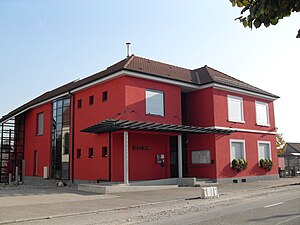
 Mairie Niffer |
||
Niffer is a French commune with 946 inhabitants (as of January 1, 2017) in the Haut-Rhin department in the Grand Est region (until 2015 Alsace ). It belongs to the canton of Rixheim .
geography
Niffer is located near the border triangle Germany, France and Switzerland in the southern Upper Rhine plain . The Rhine-Rhône Canal and the Rhine Side Canal run through the municipality . To the west of the Rhine-Rhône Canal, the community has a share in the Harthwald ( Forêt de la Hardt ). The Rhine forms the eastern border of the municipality.
The distance to Basel in the south is 23 kilometers, to Mulhouse in the west it is about 17 kilometers.
Neighboring communities of Niffer are Petit-Landau in the north, Bad Bellingen (Germany) in the east, Efringen-Kirchen (point of contact, Germany) in the south-east, Kembs in the south, Schlierbach (point of contact) and Dietwiller in the south-west and Habsheim in the west.
history
The area of Niffer was already settled in Roman times. The place was first mentioned in the 11th century under the name Nuffar (new ford). In 1418 the place came to the von Andlau family , who were masters of the place until the French Revolution . During the Thirty Years War , Niffer was destroyed and looted in 1633.
The development of the place was always shaped by the Rhine, which was tamed and made usable in the 19th and 20th centuries. The Rhine-Rhône Canal was built in 1834, the Rhine straightening was carried out in 1840–1870, and the Rhine Lateral Canal was built at the height of Niffer in 1948–1959.
From 1871 until the end of the First World War , Niffer belonged to the German Empire as part of the realm of Alsace-Lorraine and was assigned to the district of Mulhouse in the district of Upper Alsace .
At the beginning of the Second World War , the residents were evacuated to the Landes department in 1939 , but returned in 1940. In 1944/45 the liberation of the village was accompanied by fierce fighting. A first liberation in November 1944 was followed by heavy bombing by the German Air Force. The war for the village did not end until April 1945. 1945–1947 a camp for German prisoners of war was set up on the Niffer site .
| Population development | |||||||||||
|---|---|---|---|---|---|---|---|---|---|---|---|
| 1865 | 1895 | 1910 | 1962 | 1968 | 1975 | 1982 | 1990 | 1999 | 2007 | 2017 | |
| 465 | 310 | 263 | 225 | 307 | 402 | 575 | 614 | 657 | 896 | 946 | |
Attractions
At the confluence of the Rhine-Rhône Canal and the Rhine Side Canal is the Kembs-Niffer lock , the outbuilding of which was built between 1960 and 1962 according to plans by the architect Le Corbusier . They are the only buildings by the famous architect in Alsace.
- Church of St. Ulrich in Niffer
literature
- Le Patrimoine des Communes du Haut-Rhin. Flohic Editions, Volume 1, Paris 1998, ISBN 2-84234-036-1 , pp. 650-651.


