
Wittelsheim
| Wittelsheim | ||
|---|---|---|
.svg)
|
|
|
| region | Grand Est | |
| Department | Haut-Rhin | |
| Arrondissement | Mulhouse | |
| Canton | Wittenheim | |
| Community association | Mulhouse Alsace agglomeration | |
| Coordinates | 47 ° 48 ' N , 7 ° 14' E | |
| height | 239-285 m | |
| surface | 23.63 km 2 | |
| Residents | 10,355 (January 1, 2017) | |
| Population density | 438 inhabitants / km 2 | |
| Post Code | 68310 | |
| INSEE code | 68375 | |
| Website | http://www.mairie-wittelsheim.fr/ | |
 Mairie Wittelsheim |
||

Wittelsheim (outdated: Willelsheim ) is a French commune with 10,355 inhabitants (as of January 1, 2017) in the Haut-Rhin department in the Grand Est region ( Alsace until 2015 ). It belongs to the arrondissement of Mulhouse and there to the canton of Wittenheim .
geography
Wittelsheim is ten kilometers northwest of Mulhouse on the Thur .
history
From 1871 until the end of the First World War , Wittelsheim belonged to the German Empire as part of the realm of Alsace-Lorraine and was assigned to the district of Thann in the district of Upper Alsace .
Population development
| year | 1910 | 1962 | 1968 | 1975 | 1982 | 1990 | 1999 | 2009 | 2016 |
| Residents | 1629 | 9782 | 10,088 | 10,032 | 10.177 | 10,452 | 10,226 | 10,388 | 10,432 |
Salt extraction
In 1904, Amélie Zurcher found potash salt north of Wittelsheim , which was mined by the MDPA (Mine de potasse d'Alsace) from 1910 to 2002 in the potash district in Alsace in Staffelfelden .

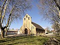
Saint-Michel church

protestant chapel Eau-Vive

Jean Bosco Church
Notre-Dame-du-Rosaire church


Town twinning
Partnerships exist with the French city of Vierzon and since 1982 with Bürstadt in the Hessian district of Bergstrasse .
literature
- Le Patrimoine des Communes du Haut-Rhin. Flohic Editions, Volume 1, Paris 1998, ISBN 2-84234-036-1 , pp. 176-181.