Potash district in Alsace

The potash district in Alsace near Mulhouse was established in 1904 when potash was first discovered.
When searching for usable minerals and rocks in the Upper Rhine Rift using the drill core method or seismic processes, one came across the large amounts of potash in the Wittelsheim basin. Tertiary formations on the edge of mountains and also in the Upper Rhine Graben suggest gravel , plaster , limestone and petroleum (in small quantities). The raw material potash could be mined in an area of 2,000 hectares at a depth of 460 to 1,000 meters. A similar but much smaller deposit was mined east of the Rhine between Buggingen and Heitersheim. The potash salt deposits in the southern Upper Rhine Graben originated in the Tertiary and are much younger than the potash salt deposits of the Upper Permian in northern Germany and south of the Harz Mountains. They are formed here from alternating layers of sylvin and halite (sylvinite), magnesium salts are missing (no carnallitite or hard salts containing magnesium salts). The extraction of potassium chloride from sylvinite was simple, but energy-intensive: hot, saturated aqueous sodium chloride solution dissolves potassium chloride from the ground sylvinite, but hardly any other sodium chloride. After separation of the remaining crude salt and cooling, potassium chloride crystallizes out.
Extraction in the salt mines became unprofitable in the Alsatian plants at the end of the 1990s, as potash salt could be mined much cheaper in Canada . Even with the transport from Canada to Alsace, the extraction of the salt was cheaper than the extraction on site.
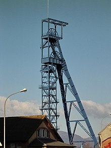
After the mining of potash was no longer worthwhile, attempts have been made and are still being tried to use the industrial wasteland for other purposes. For example, the Écomusée d'Alsace open-air museum was built on the industrial wasteland in Alsace in Ungersheim, right next to the former Rodolphe potash mine . A visit to the former Rodolphe and Joseph-Else collieries is occasionally possible. Numerous miners' settlements testify to the once large workforce. The large spoil heaps shape the landscape.
Otherwise, brownfield sites are also used as landfills or to set up new companies. In order to bring new jobs to the region, the vacant flat areas are sold cheaply for subsequent use by other industrial companies. Since 2002 and the global economic crisis in potash, the upheaval in Alsace has taken place with the cessation of potash mining.
The potash basin near Mulhouse and the salinisation of groundwater on the Upper Rhine
The spoil heaps at the large mines, not only in Wittelsheim and Pulversheim, formed grandiose, fascinating landscapes of erosion, but the local hills consist of up to 90% salt. The spoil dumps have been rehabilitated in recent years. The leaching of the "Kalimandscharos" in the south of Alsace caused by the rain salty large parts of the groundwater of the Alsatian Rhine Plain as far as the Sélestat area. In the settling basins on the Fessenheimer Rheininsel, over a million tons of salt seeped into the groundwater and also polluted the groundwater Hundred years of industrial history have meant that an important part of the groundwater on the Rhine plain can no longer be used for drinking water.
Web links
- http://kalivie.free.fr/
- https://www.carreau-rodolphe.com/
- http://www.bund-rvso.de/salz-grundinfo.html
Coordinates: 47 ° 50 ′ 0 ″ N , 7 ° 16 ′ 0 ″ E