
Rosbruck
| Rosbruck | ||
|---|---|---|

|
|
|
| region | Grand Est | |
| Department | Moselle | |
| Arrondissement | Forbach-Boulay-Moselle | |
| Canton | Forbach | |
| Community association | Forbach Porte de France | |
| Coordinates | 49 ° 10 ′ N , 6 ° 51 ′ E | |
| height | 198-320 m | |
| surface | 1.41 km 2 | |
| Residents | 764 (January 1, 2017) | |
| Population density | 542 inhabitants / km 2 | |
| Post Code | 57800 | |
| INSEE code | 57596 | |
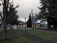
 Town hall Rosbruck |
||

Rosbruck (German Rossbrücken ) is a French commune with 764 inhabitants (as of January 1, 2017) in the Moselle department in the Grand Est region (until 2016 Lorraine ). It belongs to the Forbach-Boulay-Moselle arrondissement and the Forbach Porte de France municipal association .
geography
Rosbruck is located about five kilometers southwest of Forbach and 15 kilometers southwest of Saarbrücken at an altitude of 240 m above sea level on the southeastern edge of the Warndt and directly on the border with Saarland in Germany. The Rossel , a tributary of the Saar , flows east of the town center to the north. To the east of the Rossel, wooded hills ( Rothe Busch ) rise to heights of just over 300 m above sea level, in the north a small stream in front of the Gaensbacherwald borders the municipality, which in the south almost seamlessly into the miners' settlement Cité Belle Roche (to the municipality of Cocheren due) passes.
The area of the municipality of Rosbruck - with 1,410 hectares the smallest in the Moselle department - is characterized by dense development and large traffic areas (motorway, rail tracks), there is no arable land or meadow in the municipality. Alluvial forest remains have been preserved on the banks of the Rossel.
Neighboring communities of Rosbruck are Morsbach in the north, Folkling in the east (point of contact), Cocheren in the south and Großrosseln (Germany) in the west.
history
The place Rosbruck was on the Roman road from Divodurum ( Metz ) to (Civitas) Vangionum ( Worms ). The road crossed the river Rossel here. A first stone bridge gave the place its name, it is also the main element in the coat of arms of the municipality. Rosbruck was first mentioned by name in a Luxembourg document from 1300. Rosbruck and 24 other villages came into the possession of the bishops of Metz in 1365, later the place belonged to the county of Saarbrücken . The Counts of Saarbrücken set up a toll station in Rosbruck on the road from Saarbrücken to Metz.
For a long time Rosbruck was a farming village in the German-French border area, which lived from agriculture and forestry as well as from the numerous mills on the Rossel. In the middle of the 19th century, coal mining began on a large scale in the vicinity (seven shafts were built by 1867) and many Rosbruckers found work in the mines of Béning , Morsbach , Petite-Rosselle or in Großrosseln on the German side.
Coal production reached its peak in the middle of the 20th century, and an initially slow decline began in 1959. The oil crises in the 1970s brought another renaissance for coal. In 1984 the "Pacte Charbonnier National" heralded the end of hard coal mining. The Wendel mine closed in 1989, the Marienau mine in 1996 and the Simon mine in 1997. The mining area in Merlebach was closed in 2003 and the La Houve mine , the last French coal mine , closed in 2004.
The Saar Treaty stipulated that the Lorraine mines in Warndt could also mine coal under German territory. Coal was also mined under Rosbruck and the neighboring German town of Naßweiler . The charred shafts were partly filled with gravel, partly they ran full of water. In Naßweiler and Rosbruck the consequences of subsidence damage are still devastating today. In Rosbruck alone, 70 buildings collapsed due to pit damage or were irreparably damaged.
Since the beginning of the 21st century, the development of a common residential area along the border strip has been discussed between the neighboring and partner town of Naßweiler (since 1992) on the Saarland side and Rosbruck. This project involves the expansion of existing residential areas by one quarter each on the German and French sides, not least in order to stop the migration on both sides of the border, which the decline in coal mining and the vacant lots caused by mine damage. as well as creating a connecting element.
Population development
The rise and fall of hard coal mining in the Saarland-Lorraine district can also be seen in the population figures of smaller communities such as Rosbruck. Between 1806 and 1861 the population rose from 484 to 722; since the 1990s the number of inhabitants has decreased noticeably again. A similar development can be observed in the neighboring Saarland town of Naßweiler.
| year | 1962 | 1968 | 1975 | 1982 | 1990 | 1999 | 2006 | 2017 | |
| Residents | 1007 | 1011 | 1019 | 1016 | 1014 | 912 | 789 | 764 | |
| Sources: Cassini and INSEE | |||||||||
Attractions
- new church of St. Hubert ( Église Saint-Hubert ) from 1960
- preserved bell tower of the old church
St. Hubert Church

Bell tower of the old St. Hubert church


Economy and Infrastructure
Agriculture only plays a subordinate role in Rosbruck. There are a number of small craft and service businesses in the village itself. Even after the end of coal mining in northern Lorraine, many residents are commuting to the surrounding industrial and commercial areas in Forbach and Carling as well as to the German industrial locations Saarbrücken and Völklingen .
The busy D 603 (former RN3 ) from Metz to Saarbrücken runs through Rosbruck . Parallel to this, the A320 autoroute runs east from Freyming-Merlebach to the Goldene Bremm border crossing , which connects the French A4 with the German federal motorway 6 . Other roads connect Rosbruck with Naßweiler and Emmersweiler in Germany.
supporting documents
- ↑ Hard coal mining in Lorraine on geo.uni.lu (German) ( Memento from May 10, 2010 in the Internet Archive )
- ↑ without borders on igab-saar.de (German)
- ↑ Cross-border projects at www.warndt.eu (French) ( Memento from September 28, 2013 in the Internet Archive ) (PDF; 831 kB)
- ↑ Rosbruck on cassini.ehess.fr
- ↑ Rosbruck on insee.fr