Œting
| Œting | ||
|---|---|---|

|
|
|
| region | Grand Est | |
| Department | Moselle | |
| Arrondissement | Forbach-Boulay-Moselle | |
| Canton | Forbach | |
| Community association | Forbach Porte de France | |
| Coordinates | 49 ° 10 ′ N , 6 ° 55 ′ E | |
| height | 218-387 m | |
| surface | 4.39 km 2 | |
| Residents | 2,679 (January 1, 2017) | |
| Population density | 610 inhabitants / km 2 | |
| Post Code | 57600 | |
| INSEE code | 57521 | |
| Website | www.oeting.fr | |
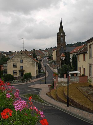
 Center of Œting |
||
Œting (German Ötingen ) is a French commune with 2,679 inhabitants (as of January 1, 2017) in the Moselle department in the Grand Est region (until 2015 Lorraine ). It belongs to the Forbach-Boulay-Moselle arrondissement .
geography
Œting is located immediately southeast of Forbach about three kilometers behind the German-French border at an altitude between 218 and 387 m above sea level. Saarbrücken is about six kilometers away. The municipal area covers 4.39 km².
Population development
| year | 1962 | 1968 | 1975 | 1982 | 1990 | 1999 | 2007 | 2017 |
| Residents | 1084 | 1262 | 1489 | 1670 | 1920 | 1865 | 2461 | 2679 |
Culture and sights
The official language is French , but German is very common among the population.
There was a castle in the village from 1737, but it burned down during the French Revolution .
Economy and Infrastructure
The unemployment rate in the place was 6.2% (as of 1999).
An old Roman road ran through the community. Today the place is opened up by the A320 motorway (European route E 50) and various other main roads. The Technopole Forbach-Sud is located south of the village .
Personalities
- Marc Lerandy (* 1981), German-French soccer player, lives in Œeting
- Alexander Bettendorff (* 1985), German actor
