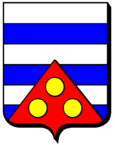
Hellimer
| Hellimer | ||
|---|---|---|

|
|
|
| region | Grand Est | |
| Department | Moselle | |
| Arrondissement | Forbach-Boulay-Moselle | |
| Canton | Sarralbe | |
| Community association | Saint-Avold synergy | |
| Coordinates | 49 ° 0 ′ N , 6 ° 50 ′ E | |
| height | 218–334 m | |
| surface | 10.43 km 2 | |
| Residents | 548 (January 1, 2017) | |
| Population density | 53 inhabitants / km 2 | |
| Post Code | 57660 | |
| INSEE code | 57311 | |
 La maison Bonert, a half-timbered house in Hellimer built in 1716 |
||
Hellimer is a French commune with 548 inhabitants (as of January 1, 2017) in the Moselle department in the Grand Est region (until 2015 Lorraine ). It belongs to the Arrondissement Forbach-Boulay-Moselle and the Canton of Sarralbe (until 2015: Canton Grostenquin ).
geography
The village is located in the northeast of the historic Lorraine region , around 17 kilometers south of the border town of Freyming-Merlebach .
history
The place was first mentioned in 1121 as Heylimer . Other names were Helgemer (1315), Helgenmöre (1509) and Helymer (1700).
See also: Hellimer Jewish Community
Population development
| year | 1962 | 1968 | 1975 | 1982 | 1990 | 1999 | 2009 |
| Residents | 428 | 461 | 470 | 521 | 537 | 486 | 632 |
Attractions
- Village church of St. Martin from 1740
- former chapel Sainte-Marguerite
- Saint-Antoine chapel in the Ackerbach district
Personalities
- Balthasar Alexis Henri Antoine von Schauenburg (1748–1831), French general
Web links
Commons : Hellimer - collection of pictures, videos and audio files


