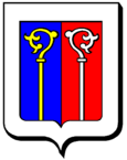
Maxstadt
| Maxstadt | ||
|---|---|---|

|
|
|
| region | Grand Est | |
| Department | Moselle | |
| Arrondissement | Forbach-Boulay-Moselle | |
| Canton | Sarralbe | |
| Community association | Saint-Avold synergy | |
| Coordinates | 49 ° 3 ' N , 6 ° 48' E | |
| height | 259-308 m | |
| surface | 7.91 km 2 | |
| Residents | 316 (January 1, 2017) | |
| Population density | 40 inhabitants / km 2 | |
| Post Code | 57660 | |
| INSEE code | 57453 | |
Maxstadt (1793 and 1801 still with the spellings Maxstat and Marcstatte ) is a French commune with 316 inhabitants (as of January 1, 2017) in the Moselle department in the Grand Est region (until 2015 Lorraine ). It belongs to the Arrondissement Forbach-Boulay-Moselle and the municipality association Saint-Avold Synergie .
geography
Maxstadt is about ten kilometers southeast of the former mining town of Saint-Avold and about 18 kilometers from the Saarland border. The municipal area of almost 8 km² is characterized by arable land and grassland, only in the east does the municipality have shares in small forest areas. The area is drained by the Langenbach and other small tributaries of the German Nied . To the south, the poorly structured terrain gradually rises to heights of over 300 m above sea level.
A large granary southeast of the town center is visible from afar.
Neighboring communities of Maxstadt are Biding in the north, Barst in the northeast, Hoste in the east, Altrippe in the southeast and Laning in the southwest.
Population development
| year | 1962 | 1968 | 1975 | 1982 | 1990 | 1999 | 2007 | 2017 | |
| Residents | 253 | 259 | 265 | 269 | 264 | 252 | 271 | 316 | |
| Sources: Cassini and INSEE | |||||||||
Attractions
- St. Odilie's Chapel, originally from 1267, rebuilt and restored several times, most recently from 1996 to 2004
- numerous farmhouses from the 18th and 19th centuries
- Saint-Jacques-le-Majeur church
Economy and Infrastructure
The inhabitants of Maxstadt live from agriculture, from small handicraft businesses or commute to the industrial plants around Saint-Avold. Eleven farms are located in the community (grain and fruit growing, cattle breeding).
Maxstadt is away from the national traffic flows. The trunk road D 22 to Saint-Avold runs in a north-south direction three kilometers west of Maxstadt. The closest connections to the A4 ( Paris - Strasbourg ) are in Farébersviller and Puttelange-aux-Lacs .
supporting documents
- ↑ toponym on cassini.ehess.fr
- ↑ Maxstadt on cassini.ehess.fr
- ↑ Maxstadt on insee.fr
- ↑ Farms on annuaire-mairie.fr (French)


