Behren-lès-Forbach
| Behren-lès-Forbach | ||
|---|---|---|

|
|
|
| region | Grand Est | |
| Department | Moselle | |
| Arrondissement | Forbach-Boulay-Moselle | |
| Canton | Stiring coil | |
| Community association | Forbach Porte de France | |
| Coordinates | 49 ° 10 ′ N , 6 ° 56 ′ E | |
| height | 243-382 m | |
| surface | 5.98 km 2 | |
| Residents | 6,562 (January 1, 2017) | |
| Population density | 1,097 inhabitants / km 2 | |
| Post Code | 57460 | |
| INSEE code | 57058 | |
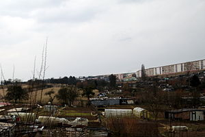
 View of the Plattensiedlung |
||
Behren-lès-Forbach (German Behren ) is a French commune with 6562 inhabitants (as of January 1, 2017) in the Moselle department in the Grand Est region (before 2016: Lorraine ). It belongs to the Forbach-Boulay-Moselle arrondissement and the Forbach Porte de France community association .
geography
The municipality of Behren-lès-Forbach is not far from the border with Germany , three kilometers southeast of the city of Forbach and about ten kilometers south of Saarbrücken .
Neighboring communities of Behren-lès-Forbach are Etzling in the northeast, Kerbach in the east, Bousbach in the south, Folkling in the southwest, Œting in the west and Forbach in the northwest.
history
The place called 884 and 1152 Berna was named in a document of the Teutonic Order of the Commandery Saarbrücken of July 8, 1301 Burne or Berne .
The municipality of Behren, which was founded at the time of the French Revolution, was part of the municipality of Kerbach from 1812 together with Etzling , before it became independent again in 1925 under the name Behren-lès-Forbach.
Population development
From the end of the 1950s, numerous prefabricated housing estates were built for the workers of the then flourishing coal and steel industry, including the suburban settlement in Behren northwest of the old village center , known as the banlieue . The population increased twenty-fold in a few years. Numerous workers were recruited from North Africa, especially from Algeria, whose descendants have not yet been integrated into society. The social tensions and problems came to light during the riots in 2005 , among other things . Since the decline of the coal and steel industry, the population has been falling.
| year | 1946 | 1954 | 1962 | 1968 | 1975 | 1982 | 1990 | 1999 | 2007 | 2017 |
| Residents | 429 | 534 | 10,486 | 12,512 | 12,015 | 11,152 | 10,291 | 10073 | 8781 | 6652 |
| Sources: Cassini and INSEE | ||||||||||
Attractions
The planned settlement has only a few sights. A mine locomotive as a symbol of coal mining is now on a roundabout island. The St. Blasius Church ( Église Saint-Blaise ) is located in the old village center .
Economy and Infrastructure
Immediately south-west of Behren lies the Technopôle Forbach-Sud , which extends over 1,500 hectares, and is one of the largest industrial areas in north-eastern France. There are 57 retail outlets in the city.
The trunk road D 31 from Forbach to Grosbliederstroff runs as a bypass road north around Behren-lès-Forbach. The motorway-like D 31BIS runs parallel to the D 31 south of Behren from Forbach to Sarreguemines . Forbach station, four kilometers from Behren, is on the Forbacher Bahn .
Town twinning
- Carbonia in Sardinia (Italy)
supporting documents
- ^ Roland WL Puhl: The districts and counties of the early Middle Ages in the Saar-Mosel area , Diss., Saarbrücken 1999, p. 258. ISBN 3-930843-48-X
- ↑ Bischmisheim history
- ↑ Saarbrücken Regesten Online 1301-07-08
- ↑ www.agglo-forbach / Behren ( Memento from October 26, 2010 in the Internet Archive )
- ↑ toponym on cassini.ehess.fr
- ↑ Behren-lès-Forbach on cassini.ehess.fr
- ↑ Behren-lès-Forbach on insee.fr
- ↑ Retail outlets on annuaire-mairie.fr (French)


