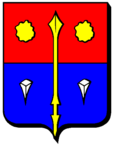
Bistroff
| Bistroff | ||
|---|---|---|

|
|
|
| region | Grand Est | |
| Department | Moselle | |
| Arrondissement | Forbach-Boulay-Moselle | |
| Canton | Sarralbe | |
| Community association | Saint-Avold synergy | |
| Coordinates | 49 ° 0 ′ N , 6 ° 43 ′ E | |
| height | 245-315 m | |
| surface | 19.28 km 2 | |
| Residents | 311 (January 1, 2017) | |
| Population density | 16 inhabitants / km 2 | |
| Post Code | 57660 | |
| INSEE code | 57088 | |
Bistroff (German Bischdorf ) is a French commune with 311 inhabitants (as of January 1, 2017) in the Moselle department in the Grand Est region (until 2015 Lorraine ). It belongs to the Forbach-Boulay-Moselle arrondissement .
geography
Bistroff is located about 15 kilometers south of Saint-Avold at an altitude between 245 and 315 m above sea level. The municipality covers 19.28 km².
To the north of the parish there is a large military compound that was a Royal Canadian Air Force (RCAF) station in the 1950s and 1960s .
history
When it was liberated in November 1944, the place was seriously affected. Among other things, the village school (which was also the town hall) was damaged, but lessons were able to start again in January 1945.
Population development
| year | 1962 | 1968 | 1975 | 1982 | 1990 | 1999 | 2007 |
| Residents | 322 | 294 | 273 | 268 | 276 | 299 | 336 |
Culture and sights
Sights include the 18th century church of Saint-Maurice. However, the church was considerably rebuilt after 1950.
partnership
On the basis of a private initiative, Bistroff maintains a partnership with Steinbach , a district of Ottweiler in Saarland.
