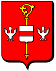
Lixing-lès-Saint-Avold
| Lixing-lès-Saint-Avold | ||
|---|---|---|

|
|
|
| region | Grand Est | |
| Department | Moselle | |
| Arrondissement | Forbach-Boulay-Moselle | |
| Community association | Saint-Avold synergy | |
| Coordinates | 49 ° 2 ′ N , 6 ° 45 ′ E | |
| height | 246-321 m | |
| surface | 6.32 km 2 | |
| Residents | 682 (January 1, 2017) | |
| Population density | 108 inhabitants / km 2 | |
| Post Code | 57660 | |
| INSEE code | 57409 | |
Lixing-lès-Saint-Avold ( German Lixingen ; 1801 still with the spelling Lixin ) is a French commune with 682 inhabitants (as of January 1, 2017) in the Moselle department in the Grand Est region (until 2015 Lorraine ). It belongs to the Arrondissement Forbach-Boulay-Moselle and the municipality association Saint-Avold Synergie .
geography
Lixing-lès-Saint-Avold is eight kilometers south of the former mining town of Saint-Avold and about 15 kilometers from the border with Saarland . Until the end of the feudal period it belonged to the Duchy of Lorraine , lordship of Bolchen (Boulay).
Two thirds of the 6.3 km² area of the municipality are dominated by arable and grassland areas as well as built-up land, one third in the southwest is covered by forest. The area around the municipality, which is situated on a ridge, slopes down to the west and south to the source streams that feed the Ruisseau du Bischwald, a small stream that flows into the German Nied . A water tower was built at the highest and northernmost point of the built-up area.
Southwest of Lixing-lès-Saint-Avold is the fallow land with a 2,500 m long runway of Base aérienne Grostenquin , an air base of the Royal Canadian Air Force , which existed from 1952 to 1964.
Neighboring municipalities of Lixing-lès-Saint-Avold are Vahl-Ebersing in the north, Laning in the east, Grostenquin and Bistroff in the south and Lelling in the west.
Population development
| year | 1875 | 1962 | 1968 | 1975 | 1982 | 1990 | 1999 | 2007 | 2017 |
| Residents | 450 | 435 | 566 | 682 | 695 | 672 | 720 | 721 | 682 |
| Sources: Cassini and INSEE | |||||||||
Attractions
- Saint-Barthélemy chapel with a statue from the 18th century
Economy and Infrastructure
The inhabitants of Lixing-lès-Saint-Avold live on small craft shops or commute to the industrial plants around Saint-Avold. In addition, there are four farms in the municipality (mainly grain cultivation).
Départementsstraße 22 from Dieuze to Saint-Avold leads in a north-south direction through Lixing. The nearest train station is in nearby Saint-Avold on the Metz - Forbach line .
Personalities
- Johann Michael Schang (1757–1842), important and saint-like venerated Catholic priest in the dioceses of Mainz and Speyer.
literature
- Ernest de Bouteiller: Dictionnaire topographique de l'ancien département de la Moselle , Paris, 1874, p. 146; (Digital view)
- EHTh. Chicken: German Lorraine: Landes-, Volks- und Ortskunde , Stuttgart, Cotta Verlag, 1875, p. 388; (Online view of the book)


