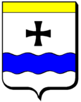
Narbéfontaine
| Narbéfontaine | ||
|---|---|---|

|
|
|
| region | Grand Est | |
| Department | Moselle | |
| Arrondissement | Forbach-Boulay-Moselle | |
| Canton | Boulay-Moselle | |
| Community association | Houve-Pays Boulageois | |
| Coordinates | 49 ° 9 ' N , 6 ° 33' E | |
| height | 284-376 m | |
| surface | 3.58 km 2 | |
| Residents | 118 (January 1, 2017) | |
| Population density | 33 inhabitants / km 2 | |
| Post Code | 57220 | |
| INSEE code | 57495 | |
 Saint-Georges church |
||
Narbéfontaine (German Memersbronn ) is a French commune with 118 inhabitants (as of January 1, 2017) in the Moselle department in the Grand Est region (until 2015 Lorraine ).
location
The municipality is located in the north of the historic Lorraine region , between Freyming-Merlebach and Metz on the A4 autoroute .
history
In 1181 the place was first mentioned as Maulbertfontaine . Then Memmesborn (1606).
Population development
| year | 1962 | 1968 | 1975 | 1982 | 1990 | 1999 | 2009 |
| Residents | 97 | 106 | 97 | 102 | 117 | 118 | 136 |
Attractions
- 19th century Saint-Georges church
- Remains of a Roman road
Web links
Commons : Narbéfontaine - Collection of images, videos and audio files
