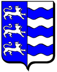
Tromborn
| Tromborn | ||
|---|---|---|

|
|
|
| region | Grand Est | |
| Department | Moselle | |
| Arrondissement | Forbach-Boulay-Moselle | |
| Canton | Bouzonville | |
| Community association | Houve-Pays Boulageois | |
| Coordinates | 49 ° 15 ′ N , 6 ° 35 ′ E | |
| height | 305-385 m | |
| surface | 6.13 km 2 | |
| Residents | 357 (January 1, 2017) | |
| Population density | 58 inhabitants / km 2 | |
| Post Code | 57320 | |
| INSEE code | 57681 | |
 Church of the Passage of St. Eligius ( Église de la Translation-de-Saint-Éloi ) |
||
Tromborn ( Tromborren in Lorraine ) is a French commune with 357 inhabitants (as of January 1, 2017) in the Moselle department in the Grand Est region ( Lorraine until 2015 ).
geography
The place is in the north of the historic Lorraine region , five kilometers southeast of Bouzonville and five kilometers from the German-French border.
history
The place was known as Fontaynes in 1299 . Other names were Troisfontaines (1333), Dreibrunnen (1400), Dreiborn (1429), Drensborn (1544), Tronsbouren (1633), Drinsborn (1681), Drimbouren (1701) and Trombourg (1715).
Population development
| year | 1968 | 1975 | 1982 | 1990 | 1999 | 2009 | 2017 |
| Residents | 280 | 268 | 306 | 288 | 296 | 334 | 357 |
Attractions
- Church Saint-Éloi from 1955
Web links
Commons : Tromborn - collection of images, videos and audio files
