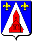
Menskirch
| Menskirch | ||
|---|---|---|

|
|
|
| region | Grand Est | |
| Department | Moselle | |
| Arrondissement | Forbach-Boulay-Moselle | |
| Canton | Bouzonville | |
| Community association | Bouzonvillois-Trois Frontières | |
| Coordinates | 49 ° 19 ′ N , 6 ° 26 ′ E | |
| height | 265-388 m | |
| surface | 4.48 km 2 | |
| Residents | 140 (January 1, 2017) | |
| Population density | 31 inhabitants / km 2 | |
| Post Code | 57320 | |
| INSEE code | 57457 | |
 St. Martin Menskirch Church |
||
Menskirch (German Menskirchen ) is a French commune with 140 inhabitants (status January 1, 2017) in the Moselle department in the Grand Est region (until 2015 Lorraine ).
geography
The municipality is located in the north of the historic Lorraine region , two kilometers northeast of Dalstein and 13 kilometers as the crow flies from the German-French border.
history
The community was destroyed in the Thirty Years War . In the 18th century it was called Manquery .
Population development
| year | 1962 | 1968 | 1975 | 1982 | 1990 | 1999 | 2006 |
| Residents | 122 | 84 | 80 | 97 | 133 | 144 | 160 |
Attractions
- Church Saint-Martin from 1732
traffic
The Dalstein-Menskirch station was on the Merzig – Bettelainville railway line, which has now been closed .
Web links
Commons : Menskirch - collection of images, videos and audio files
