
Sippersfeld
| coat of arms | Germany map | |
|---|---|---|

|
Coordinates: 49 ° 33 ' N , 7 ° 56' E |
|
| Basic data | ||
| State : | Rhineland-Palatinate | |
| County : | Donnersbergkreis | |
| Association municipality : | Winnweiler | |
| Height : | 302 m above sea level NHN | |
| Area : | 13.23 km 2 | |
| Residents: | 1096 (Dec. 31, 2019) | |
| Population density : | 83 inhabitants per km 2 | |
| Postal code : | 67729 | |
| Area code : | 06357 | |
| License plate : | KIB, ROK | |
| Community key : | 07 3 33 071 | |
| Association administration address: | Jakobstrasse 29 67722 Winnweiler |
|
| Website : | ||
| Mayoress : | Martina Lummel-Deutschle (FWG) | |
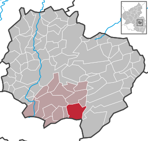
| Location of the local community Sippersfeld in the Donnersbergkreis | ||
  |
||


The local community Sippersfeld is located in the Donnersbergkreis in Rhineland-Palatinate . It belongs to the Verbandsgemeinde Winnweiler , within which it is the third largest local community in terms of population.
geography
location
The place is on the edge of the Palatinate Forest Nature Park , at the transition from the Palatinate Forest to the North Palatinate Bergland . Over 60 percent of the municipal area is forested. The Pfrimmerhof residential area belongs to Sippersfeld . Neighboring communities are - in clockwise direction - Börrstadt , Breunigweiler , Kerzenheim , Enkenbach-Alsenborn , Neuhemsbach , Gonbach and Winnweiler .
Elevations and waters
In the north-western area of the municipality, the 400.6 meter high Bocksrück extends on the boundary with Winnweiler and Börrstadt . The 377.1 meter high Pfrimmerberg rises to the east of the district on the border with Kerzenheim . The Pfrimm, which runs in a south-north direction in this area, has its source in the eastern municipality . A short time later it picks up the Bruchbach from the left and then flows through the crab pond. The Sippersfelder Bach rises to the east of the settlement area ; its confluence with the Pfrimm is already beyond the municipality marker.
history
Sippersfeld was first mentioned in 1019 as "Sipperadesvelt" (according to another source "Syperadesfeld") in a document from the Archbishop of Mainz, Erkanbald . Sippersfeld was assigned to the church in Münchweiler ("Minchwillera").
The name means field of Sintperath (Simprecht, Sindbert, Simper).
In 1190 Werner II von Bolanden had the entire forest belonging to Sippersfeld as a fiefdom from the Count of Saar Werden . Count Heinrich II. Von Zweibrücken , Herr zu Stauf , and his wife Agnes, donated their estate in Sippersfeld to the Rosenthal monastery in 1248 . Later the place belonged to the lordship of Kirchheim and Stauf until the end of the 18th century .
After 1792 French revolutionary troops occupied the region and annexed it after the Peace of Campo Formio (1797) . From 1798 to 1814 the village belonged to the French department of Donnersberg and was assigned to the canton of Winnweiler . Due to the agreements reached at the Congress of Vienna (1815) and an exchange contract with Austria , the region became part of the Kingdom of Bavaria in 1816 . From 1818 the municipality of Sippersfeld was part of the Kaiserslautern Land Commissioner in the Bavarian Rhine District, later assigned to the Kaiserslautern District Office, from which the Kaiserslautern District emerged in 1938 . After the Second World War , Sippersfeld was part of the French occupation zone and was incorporated into the newly formed state of Rhineland-Palatinate in 1946. In the course of the first Rhineland-Palatinate administrative reform , the place changed to the newly created Donnersbergkreis ; three years later, the community was incorporated into the also newly created community of Winnweiler .
population
Population development
The values of the development of the population of Sippersfeld from 1871 to 1987 are based on censuses:
|
|
religion
Together with Breunigweiler and Neuhemsbach, Sippersfeld forms a Protestant parish.
politics
Municipal council
The municipal council in Sippersfeld consists of 16 council members, who were elected in a personalized proportional representation in the local elections on May 26, 2019 , and the honorary local mayor as chairman.
The distribution of seats in the municipal council:
| choice | SPD | CDU | FWG | WMG | total |
|---|---|---|---|---|---|
| 2019 | - | - | 7th | 9 | 16 seats |
| 2014 | by majority vote | 16 seats | |||
| 2009 | 6th | - | 10 | - | 16 seats |
| 2004 | 5 | 2 | 9 | - | 16 seats |
- FWG = Free Voter Group Sippersfeld e. V.
- WMG = we.do.together. The voter community Sippersfeld e. V.
mayor
The local mayor is Martina Lummel-Deutschle (FWG). She was elected in the local elections on May 26, 2019 with a share of the vote of 53.74%, succeeding Uli Kolb (FWG), who did not run again after 15 years in office.
coat of arms
|
|
Blazon : “Divided by blue and red; above in the field sprinkled with golden shingles a golden lion, armed in red and tongued with red, below an upright golden arrow covered by a crossed golden sword and golden crook " |
Culture and sights
Cultural monuments

In Sippersfeld there are a total of 19 objects under monument protection . The Protestant parish church from 1768 with its Gothic choir tower from the 14th century is characteristic of the townscape.
nature
There are a total of three natural monuments on site . The Sippersfelder Weiher nature reserve with four ponds and the source of the Pfrimm, which was placed under protection in 1986, is located southeast of the village . On the latter is the knight stone 290 , which bears the inscription "Pfrimm-Ursprung 1927". There is a menhir to the west of the settlement area .
Economy and Infrastructure
economy
In the north of the district is the Bocksrück wind farm, which went into operation in 2014 and which is partially already in the district of Börrstadt.
traffic
The B 48 , which also leads to the A 63 ( Kaiserslautern - Mainz ), runs west of Sippersfeld . In Münchweiler an der Alsenz is a station of the alsenz valley railway . State road 394 , which connects it with Dannenfels and Enkenbach-Alsenborn, runs through the town itself . The circuit road 39 connects with Sippersfeld Winnweiler and the circuit road 40 with münchweiler an der alsenz. The district road 42 serves to connect the Pfrimmerhof and the district road 43 leads to Börrstadt.
Sons and daughters
- August Frölich (1877–1966), politician (SPD, SED)
- Jakob Neber (1891–1968), politician (CDU)
- Wolfgang Krolow (1950–2019), photographer
- Hans Illig (* 1959), graduate engineer, initiator of the Illig value
literature
- Literature about Sippersfeld in the Rhineland-Palatinate state bibliography
Web links
Individual evidence
- ↑ State Statistical Office of Rhineland-Palatinate - population status 2019, districts, communities, association communities ( help on this ).
- ↑ a b State Statistical Office Rhineland-Palatinate - regional data
- ↑ State Statistical Office Rhineland-Palatinate (ed.): Official directory of the municipalities and parts of the municipality. Status: January 1, 2017 [ Version 2020 is available. ] . S. 92 (PDF; 1.9 MB).
- ↑ a b Adolph Köllner: History of the rule Kirchheim-Boland and Stauf , Wiesbaden 1854, p. 261 ( Google Books )
- ^ Hermann Schreibmüller : Castle and Lordship of Stauf in the Palatinate , Volume 2, Kaiserslautern: Thieme, 1914. P. 16 ( www.dilibri.de )
- ^ The Regional Returning Officer RLP: Local council election 2019 Sippersfeld. Retrieved September 1, 2019 .
- ^ The Regional Returning Officer Rhineland-Palatinate: Municipal elections 2014, city and municipal council elections
- ↑ The Regional Returning Officer RLP: direct elections 2019. see Winnweiler, Verbandsgemeinde, tenth line of results. Retrieved September 1, 2019 .

Albisheim (Pfrimm) | Alsenz | Bayerfeld-Steckweiler | Bennhausen | Biedesheim | Bischheim | Bistiffer | Bolanden | Börrstadt | Breunigweiler | Bubenheim | Dannenfels | Dielkirchen | Dried mussel | Dreisen | Solitude | Eisenberg (Palatinate) | Falkenstein | Finkenbach-Gersweiler | Gauersheim | Gaugrehweiler | Gehrweiler | Gerbach | Göllheim | Gonbach | Gundersweiler | Höringen | Ilbesheim | Immesheim | Imsbach | Imsweiler | Jakobsweiler | Lime kiln | Katzenbach | Candle Home | Kirchheimbolanden | War field | Lautersheim | Pay field | Mannweiler-Cölln | Marnheim | Morschheim | Mörsfeld | Münchweiler an der Alsenz | Münsterappel | Niederhausen an der Appel | Niedermoschel | Oberhausen an der Appel | Upper Muschel | Oberndorf | Oberwiesen | Orbis | Ottersheim | Ramsen | Ransweiler | Rathskirchen | Reichsthal | Rittersheim | Rockenhausen | Ruppertsecken | Rüssingen | Saint Alban | Schiersfeld | Schönborn | Schweisweiler | Souls | Sippersfeld | Sitters | Stahlberg | Standenbühl | Steinbach am Donnersberg | Stetten | Teschenmoschel | Unkenbach | Waldgrehweiler | Wartenberg-Rohrbach | Weitersweiler | Winnweiler | Winterborn | Würzweiler | Zellertal