
Teschenmoschel
| coat of arms | Germany map | |
|---|---|---|

|
Coordinates: 49 ° 38 ' N , 7 ° 44' E |
|
| Basic data | ||
| State : | Rhineland-Palatinate | |
| County : | Donnersbergkreis | |
| Association municipality : | North Palatinate Country | |
| Height : | 332 m above sea level NHN | |
| Area : | 3.73 km 2 | |
| Residents: | 117 (Dec 31, 2019) | |
| Population density : | 31 inhabitants per km 2 | |
| Postal code : | 67806 | |
| Area code : | 06364 | |
| License plate : | KIB, ROK | |
| Community key : | 07 3 33 077 | |
| Association administration address: | Bezirksamtsstrasse 7 67806 Rockenhausen |
|
| Website : | ||
| Mayoress : | Sabine Küsters | |
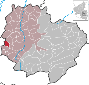
| Location of the local community Teschenmoschel in the Donnersbergkreis | ||
  |
||

Teschenmoschel is a municipality in the Donnersbergkreis in Rhineland-Palatinate . It belongs to the Nordpfälzer Land association.
Geographical location
The place is located at the Moschel in the North Palatinate Uplands west of the Donnersberg between Kaiserslautern and Bad Kreuznach . To the north-east is Bistigart , to the south-east is Dörrmoschel and to the south-west is Rathskirchen .
The Mausmühle residential area also belongs to the community .
history
After the French Revolution , the place was incorporated into the French Donnersberg department . As a result of the Congress of Vienna , he was Bavarian from 1816 to 1945 . After the Second World War , Teschenmoschel was part of the French occupation zone and was incorporated into the newly formed state of Rhineland-Palatinate in 1946.
Religions
On October 31, 2014, 68.9 percent of the population were Protestant and 13.4 percent Catholic . The rest belonged to another religion or were non-denominational.
politics
Municipal council
The municipal council in Teschenmoschel consists of six council members, who were elected by majority vote in the local elections on May 26, 2019 , and the honorary local mayor as chairman.
Local mayor
The local mayor is Sabine Küsters. She was elected by the local council in August 2019, succeeding Ernst Schulz, who no longer took office after 25 years.
coat of arms
|
|
Blazon : "Divided by gold and red, above a leaping black boar, below a silver shell, raised by three silver stones."
It was approved by the Neustadt district government in 1983 and goes back to a court seal from 1755. |
| Reasons for the coat of arms: The boar comes from the coat of arms of the Lords of Schorrenburg and the three stones in red come from the coat of arms of the Lords of Hunolstein . Both had feudal rights in Teschenmoschel. The Shell refers talking on the place name. |
Culture and sights
The structure of an old barn served as the basis for the community center. Every year there is a festival with exhibitions by artists.
In Teschenmoschel there is an old Jewish cemetery that dates from the 17th century. There used to be a synagogue in the village that was responsible for the area.
See also: List of cultural monuments in Teschenmoschel
traffic
The state road 379 runs through the village . The federal highway 48 runs to the east . There is a connection to long-distance traffic via the Autobahn 63 in the southeast. In Rockenhausen there is a train station of the Alsenz Valley Railway .
Web links
- Literature about Teschenmoschel in the Rhineland-Palatinate state bibliography
- Local community Teschenmoschel on the pages of the association Rockenhausen
Individual evidence
- ↑ State Statistical Office of Rhineland-Palatinate - population status 2019, districts, communities, association communities ( help on this ).
- ↑ State Statistical Office Rhineland-Palatinate (ed.): Official directory of the municipalities and parts of the municipality. Status: January 2018 [ Version 2020 is available. ] . S. 91 (PDF; 2.2 MB).
- ↑ Municipal statistics . In: KommWis. October 31, 2014, accessed November 30, 2014 .
- ^ The Regional Returning Officer RLP: City Council Election 2019 Teschenmoschel. Retrieved August 25, 2019 .
- ↑ The Rheinpfalz: Teschenmoschel: Sabine Küsters is the local mayor. August 18, 2019, accessed August 25, 2019 .
- ^ Karl Heinz Debus: The great book of arms of the Palatinate. Neustadt an der Weinstrasse 1988, ISBN 3-9801574-2-3 .

Albisheim (Pfrimm) | Alsenz | Bayerfeld-Steckweiler | Bennhausen | Biedesheim | Bischheim | Bistiffer | Bolanden | Börrstadt | Breunigweiler | Bubenheim | Dannenfels | Dielkirchen | Dried mussel | Dreisen | Solitude | Eisenberg (Palatinate) | Falkenstein | Finkenbach-Gersweiler | Gauersheim | Gaugrehweiler | Gehrweiler | Gerbach | Göllheim | Gonbach | Gundersweiler | Höringen | Ilbesheim | Immesheim | Imsbach | Imsweiler | Jakobsweiler | Lime kiln | Katzenbach | Candle Home | Kirchheimbolanden | War field | Lautersheim | Pay field | Mannweiler-Cölln | Marnheim | Morschheim | Mörsfeld | Münchweiler an der Alsenz | Münsterappel | Niederhausen an der Appel | Niedermoschel | Oberhausen an der Appel | Upper Muschel | Oberndorf | Oberwiesen | Orbis | Ottersheim | Ramsen | Ransweiler | Rathskirchen | Reichsthal | Rittersheim | Rockenhausen | Ruppertsecken | Rüssingen | Saint Alban | Schiersfeld | Schönborn | Schweisweiler | Souls | Sippersfeld | Sitters | Stahlberg | Standenbühl | Steinbach am Donnersberg | Stetten | Teschenmoschel | Unkenbach | Waldgrehweiler | Wartenberg-Rohrbach | Weitersweiler | Winnweiler | Winterborn | Würzweiler | Zellertal