Imsbach
| coat of arms | Germany map | |
|---|---|---|

|
Coordinates: 49 ° 35 ' N , 7 ° 53' E |
|
| Basic data | ||
| State : | Rhineland-Palatinate | |
| County : | Donnersbergkreis | |
| Association municipality : | Winnweiler | |
| Height : | 293 m above sea level NHN | |
| Area : | 8.92 km 2 | |
| Residents: | 870 (Dec. 31, 2019) | |
| Population density : | 98 inhabitants per km 2 | |
| Postal code : | 67817 | |
| Primaries : | 06302, 06357 | |
| License plate : | KIB, ROK | |
| Community key : | 07 3 33 033 | |
| Association administration address: | Jakobstrasse 29 67722 Winnweiler |
|
| Website : | ||
| Local Mayor : | Oliver Krupp ( CDU ) | |
| Location of the local community Imsbach in the Donnersbergkreis | ||
Imsbach is a municipality in the southern Donnersbergkreis in Rhineland-Palatinate . It belongs to the Winnweiler community .
geography
location
The place is located in the North Palatinate Bergland within the Falkensteiner Mountains sub-area between the Palatinate Forest in the south and the Donnersberg in the northeast, which is the highest mountain in the Palatinate at 687 m . Imsbach also includes the Langheckerhof and Röderhof residential areas . Neighboring communities are - clockwise - Rockenhausen , Börrstadt , Winnweiler and Falkenstein .
Elevations and waters
Immediately north of the settlement area is the Kupferberg and in the southeast of the municipality on the border with Winnweiler the 366.2 meter high Eichhübel . The 370.4 meter high Steinwald is located on the border with Börrstadt . In the northeast there is also a nameless, 546 meter nameless elevation. In the far north on the border with Falkenstein, the 559-meter-long Bickberg extends , which is a foothill of the Donnersberg.
The Imsbach, which gives it its name, runs through the middle of the settlement area in an east-west direction .
geology
The rocks lavendulan and safflorite occur in the municipal area .
history
Local history
The history of Imsbach is closely linked to mining. As archaeological finds show, iron and ore deposits attracted people as early as the Hallstatt period who settled in what is now the Imsbach district and - possibly with interruptions - lived here until the middle of the 4th century.
The first documentary mention was in 1019, but not yet as a separate village, but as a forest mark belonging to Albusheim - Sippersfeld . The name "Unnesbahc" was mentioned for the first time in a border description. In the course of the eleventh and twelfth centuries, this settlement of the Waldmark became the Imsbach settlement. The eastern part of the settlement belonged to the Prüm Abbey , the western part to the Counts of Saar Werden .
In 1128 Imsbach came as a fief into possession of Reichsministerialengeschlechts the Bolander , also from the 13th century, the lines Falkenstein and Hohenfels emerged. The village Imsbach was first mentioned in the fief books of Werner II von Bolanden with the name "Unnisbach".
After 1792 French revolutionary troops occupied the region and annexed it after the Peace of Campo Formio (1797) . From 1798 to 1814 the village belonged to the French department of Donnersberg and was assigned to the canton of Winnweiler . Due to the agreements reached at the Congress of Vienna (1815) and an exchange contract with Austria , the region became part of the Kingdom of Bavaria in 1816 . From 1818 the municipality of Imsbach was assigned to the Kaiserslautern Land Commissioner in the Bavarian Rhine District, and later to the Kaiserslautern District Office. On December 1, 1900, the community moved to the newly created district office Rockenhausen.
From 1939 the community was part of the Rockenhausen district . After the Second World War , the place became part of the then newly formed state of Rhineland-Palatinate within the French occupation zone . In 1961 the community had a total of 919 inhabitants. In the course of the first Rhineland-Palatinate administrative reform , Imsbach moved to the newly created Donnersbergkreis on June 7, 1969, together with most of the other places in the district . Three years later the place became part of the Verbandsgemeinde Winnweiler .
Place name
The name could be derived from the old German personal name Umin, which means Bach des Umin. From this the current place name developed (1220: Hunesbach, 1313: Unesbach, 1334, 1335: Unsbach, 1486: Umbsbach, 15th century: Vimbßbach, around 1600: Imschbach, 1726: Imbsbach, since 1824: Imsbach). Due to the division of the district into two parts, after the division of the Bolanden house, the western part of the Falkenstein line and the eastern part of the Hohenfels line belonged, which led to property disputes from the 18th century.
politics
Municipal council
The municipal council consists of twelve council members, who were elected in a personalized proportional representation in the local elections on May 26, 2019 , and the honorary local mayor as chairman.
The distribution of seats in the municipal council:
| choice | SPD | CDU | FWG | WGR | total |
|---|---|---|---|---|---|
| 2019 | - | 7th | 4th | 1 | 12 seats |
| 2014 | 5 | 4th | 3 | - | 12 seats |
| 2009 | 6th | 4th | 2 | - | 12 seats |
| 2004 | 6th | 4th | 2 | - | 12 seats |
- WGR: Voting group Ramos Gomes Oester
mayor
The local mayor is Oliver Krupp (CDU). In the local election on May 26, 2019, he was able to prevail against the previous incumbent Ingo Müller (FWG) with a share of 57.23% of the vote.
coat of arms
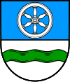
| Blazon : “Divided by blue and silver; above a silver six-spoke wheel, below a green wave bar. " | |
Culture and sights
Buildings
- Cultural monuments
The ruins of Hohenfels Castle are designated as a monument zone .
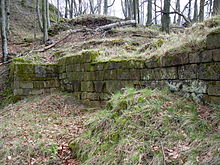
The historic silver and copper mine “ Weiße Grube” , located 2 km outside the village, has been a visitor mine since 1979 . The Palatinate Mining Museum is housed in the old school building from 1887 in the center of the village and shows the life and work of the former miners.
- Other structures
In 2006, a second show mine, the Maria mine, was opened to the public in the vicinity.
nature
There are a total of five natural monuments in the municipality . In addition, the Beutelfels nature reserve extends partially over the municipality.
Economy and Infrastructure
economy
In the Palatinate, mining can look back on a long tradition, in some areas verifiably dating back to the Celtic period. From 1521 to 1917 copper and silver were mined in the Imsbach mines. The numerous pits were mainly in the northern part of the parish.
traffic
State road 392 runs through Imsbach and connects the town with Schweisweiler and Alsenbrück-Langmeil . In the middle of the settlement area, the district road 38 branches off, which connects the White Pit to the road network. The B 48 , which also leads to the A 63 ( Kaiserslautern - Mainz ), runs west of Imsbach . In Winnweiler there is a train station of the Alsenz Valley Railway .
tourism
The Kupferberghütte, operated by the local group of the Palatinate Forest Association , is located within the boundaries of the municipality . Hiking trails such as the Pfälzer Höhenweg hiking trail , the Imsbacher Grubenrundwanderweg and the Gienanthweg lead past historic mining and industrial facilities. The Donnersberg-Donon long-distance hiking trail marked with a red bar runs through the west of the district and the Nahegau-Wasgau-Vosges long-distance hiking trail marked with a white cross runs through the far east . A hiking trail that is marked with a green-yellow bar runs through the middle of the settlement area .
Personalities
- Johann Georg Engisch (1668–1742), painter, was responsible for the gallery paintings of the local Protestant church
- Adam Flicker , 1792/93 member of the Rhine-German National Convention
Web links
- Official website of the Imsbach community
- Private homepage about Imsbach
- Literature about Imsbach in the Rhineland-Palatinate State Bibliography
Individual evidence
- ↑ State Statistical Office of Rhineland-Palatinate - population status 2019, districts, communities, association communities ( help on this ).
- ↑ State Statistical Office Rhineland-Palatinate - regional data
- ↑ State Statistical Office Rhineland-Palatinate (ed.): Official directory of the municipalities and parts of the municipality. Status: January 2019 [ Version 2020 is available. ] . S. 145 (PDF; 3 MB).
- ↑ a b c d History of the Imsbach community at www.imsbach.eu
- ^ The Regional Returning Officer Rhineland-Palatinate: Local elections 2019, city and municipal council elections
- ^ The Regional Returning Officer RLP: direct elections 2019. see Winnweiler, Verbandsgemeinde, sixth result line. Retrieved September 2, 2019 .


