
Katzenbach (Donnersbergkreis)
| coat of arms | Germany map | |
|---|---|---|

|
Coordinates: 49 ° 39 ' N , 7 ° 49' E |
|
| Basic data | ||
| State : | Rhineland-Palatinate | |
| County : | Donnersbergkreis | |
| Association municipality : | North Palatinate Country | |
| Height : | 220 m above sea level NHN | |
| Area : | 6.06 km 2 | |
| Residents: | 509 (Dec. 31, 2019) | |
| Population density : | 84 inhabitants per km 2 | |
| Postal code : | 67806 | |
| Area code : | 06361 | |
| License plate : | KIB, ROK | |
| Community key : | 07 3 33 037 | |
| Association administration address: | Bezirksamtsstrasse 7 67806 Rockenhausen |
|
| Website : | ||
| Local Mayor : | Volker Koehler | |
| Location of the local community Katzenbach in the Donnersbergkreis | ||
  |
||

Katzenbach is a municipality in the Donnersbergkreis in Rhineland-Palatinate . It belongs to the Verbandsgemeinde Nordpfälzer Land , within which it is the eighth largest local community in terms of population.
geography
location
The place is located in the North Palatinate Uplands west of the Donnersberg between Kaiserslautern and Bad Kreuznach . Katzenbach also includes the piston mill, Obermittweilerhof , Simonshof and Untermittweilerhof residential areas . Neighboring communities are - clockwise - Dielkirchen , Rockenhausen , Schönborn , Ransweiler and Stahlberg .
Elevations and waters
The 488.6 meter high Stahlberg extends to the north of the municipality on the border with the municipality .
The Alsenz forms the eastern boundary of the district. The Katzenbach , which flows through the middle of the settlement area, flows into this from the left ; further north it also takes on the Steinmannsgraben from the left , into which the Linsenbach previously flows from the right .
history
Katzenbach was first mentioned in a document on November 7, 1324.
After the French Revolution , when the Palatinate was part of the French Republic (until 1804) and then part of the Napoleonic Empire , the municipality was incorporated into the canton of Rockenhausen and the Donnersberg department . As a result of the Congress of Vienna , the place belonged again to Austria in 1815 . A year later it was slammed into Bavaria . From 1818 to 1862 Katzenbach was part of the Kirchheim Land Commissioner , which was then converted into a district office. On December 1, 1900, the community moved to the newly created district office Rockenhausen
From 1939 the place was part of the district of Rockenhausen . After the Second World War , Katzenbach was part of the French occupation zone and was incorporated into the newly formed state of Rhineland-Palatinate in 1946. In 1961 the community had a total of 490 inhabitants. In the course of the first Rhineland-Palatinate administrative reform , the community moved to the newly created Donnersbergkreis. In 1972 it was added to the newly formed community of Rockenhausen . Katzenbach has been part of the Nordpfälzer Land association since 2020 .
politics
Municipal council
The council in Katzenbach consists of twelve council members, who in the local elections on May 26, 2019 in a majority vote were elected, and the honorary mayor as chairman.
Local mayor
Local mayor is Volker Köhler. In the local election on May 26, 2019, he was re-elected in office with 89.89% of the vote.
coat of arms
|
|
Blazon : “In black on a silver, gold-armored and bridled horse with a gold saddlecloth, St. George in blue armor with a gold sword on his belt and a gold feather on his helmet, in his right hand a gold lance with which he lays the red-armored man on his back pierced green dragon, in the left a silver shield with a red cross. " |
Culture and sights
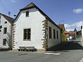
Townscape
The townscape is characterized by many old houses, which are built in the old half-timbered style.
Cultural monuments

Bell tower

Hauptstrasse 3, Dreiseithof

Hauptstrasse 29, Dreiseithof

Hauptstrasse 29, Dreiseithof residential building

Am Hofacker 11
Protestant Church

War memorial


There are a total of ten objects on site that are listed buildings. The local church contains a Kleuker organ, which was in the Clinic Church in Homburg until 2006 .
nature
There are two natural monuments in the municipality .
archeology
In the municipality there was once a Roman settlement, which has some foundation walls of one of the largest villas, a so-called villa rustica , of Roman times. In 1910 a Roman fountain was discovered on site, which is now in front of the North Palatinate Museum of Local History in Rockenhausen.
Economy and Infrastructure
traffic
The community is connected to the road network via Kreisstraße 13 . The B 48 passes close to the village . There is a connection to long-distance traffic via the Winnweiler junction of the A 63 in the southeast. In Rockenhausen there is a train station for the Alsenz Valley Railway . The 913 bus operated by Behles Bus , which runs north to Alsenz, leads to this from Katzenbach .
tourism
The Alsenz cycle path and a hiking path marked with a white and blue bar run through the east of the municipality . In addition, the Palatinate High Trail and the Nahegau-Wasgau-Vosges long-distance hiking trail marked with a white cross lead through the district of Katzenbach.
Personalities
Sons and daughters of the church
- Karl Laufer (1885–1962), politician, member of the Hessian state parliament (DVP)
People who worked on site
- Kurt Rocker , politician (CDU), attended the local elementary school
literature
- Ludwig Brandstettner: Attempt of a local history of Katzenbach, cantons and district office Rockenhausen . Thieme, Kirchheimbolanden 1908 ( dilibri.de ).
Web links
- Local community Katzenbach on the website of the Verbandsgemeinde Nordpfälzer Land
- Literature about Katzenbach in the Rhineland-Palatinate State Bibliography
Individual evidence
- ↑ State Statistical Office of Rhineland-Palatinate - population status 2019, districts, communities, association communities ( help on this ).
- ↑ State Statistical Office Rhineland-Palatinate (ed.): Official directory of the municipalities and parts of the municipality. Status: January 2019 [ Version 2020 is available. ] . S. 143 (PDF; 3 MB).
- ^ The Regional Returning Officer Rhineland-Palatinate: City Council Election 2019 Katzenbach. Retrieved August 25, 2019 .
- ↑ The State Returning Officer Rhineland-Palatinate: direct elections 2019. Retrieved on August 25, 2019 (see Nordpfälzer Land, Verbandsgemeinde, 14th row of results).

Albisheim (Pfrimm) | Alsenz | Bayerfeld-Steckweiler | Bennhausen | Biedesheim | Bischheim | Bistiffer | Bolanden | Börrstadt | Breunigweiler | Bubenheim | Dannenfels | Dielkirchen | Dried mussel | Dreisen | Solitude | Eisenberg (Palatinate) | Falkenstein | Finkenbach-Gersweiler | Gauersheim | Gaugrehweiler | Gehrweiler | Gerbach | Göllheim | Gonbach | Gundersweiler | Höringen | Ilbesheim | Immesheim | Imsbach | Imsweiler | Jakobsweiler | Lime kiln | Katzenbach | Candle Home | Kirchheimbolanden | War field | Lautersheim | Pay field | Mannweiler-Cölln | Marnheim | Morschheim | Mörsfeld | Münchweiler an der Alsenz | Münsterappel | Niederhausen an der Appel | Niedermoschel | Oberhausen an der Appel | Upper Muschel | Oberndorf | Oberwiesen | Orbis | Ottersheim | Ramsen | Ransweiler | Rathskirchen | Reichsthal | Rittersheim | Rockenhausen | Ruppertsecken | Rüssingen | Saint Alban | Schiersfeld | Schönborn | Schweisweiler | Souls | Sippersfeld | Sitters | Stahlberg | Standenbühl | Steinbach am Donnersberg | Stetten | Teschenmoschel | Unkenbach | Waldgrehweiler | Wartenberg-Rohrbach | Weitersweiler | Winnweiler | Winterborn | Würzweiler | Zellertal