
Reichsthal
| coat of arms | Germany map | |
|---|---|---|

|
Coordinates: 49 ° 36 ' N , 7 ° 44' E |
|
| Basic data | ||
| State : | Rhineland-Palatinate | |
| County : | Donnersbergkreis | |
| Association municipality : | North Palatinate Country | |
| Height : | 347 m above sea level NHN | |
| Area : | 2.17 km 2 | |
| Residents: | 104 (Dec. 31, 2019) | |
| Population density : | 48 inhabitants per km 2 | |
| Postal code : | 67759 | |
| Area code : | 06363 | |
| License plate : | KIB, ROK | |
| Community key : | 07 3 33 202 | |
| Association administration address: | Bezirksamtsstrasse 7 67806 Rockenhausen |
|
| Website : | ||
| Local Mayor : | Dirk Grill | |
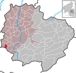
| Location of the local community Reichsthal in the Donnersbergkreis | ||
  |
||

Reichsthal is a municipality in the Donnersbergkreis in Rhineland-Palatinate . It belongs to the Nordpfälzer Land association.
geography
The place is on the Hahnenbach in the North Palatinate Uplands west of the Donnersberg between Kaiserslautern and Bad Kreuznach .
history
Reichsthal was first mentioned in a document in 1375. After the French Revolution , the place was incorporated into the French Donnersberg department . As a result of the Congress of Vienna , he was Bavarian from 1816 to 1945 . After the Second World War , Reichsthal was part of the French zone of occupation and was incorporated into the newly formed state of Rhineland-Palatinate in 1946. In 1967 Reichsthal won the federal winner's prize in the competition “ Our village should be more beautiful ”.
politics
Municipal council
The municipal council in Reichsthal consists of six council members, who were elected by a majority vote in the local elections on May 26, 2019 , and the honorary local mayor as chairman.
coat of arms
|
|
Blazon : “Split between gold and black; on the right a black thread, above it a red horse's head, below it a red post horn, on the left a golden serrated crown covered with red gemstones encompassing a golden scepter with a lily crown. " |
| Justification of the coat of arms: the horse's head and post horn are reminiscent of the former post office, the crown and scepter of the official seat of the immediate imperial rule in Reipoltskirchen. |
Economy and Infrastructure
There is a connection to long-distance traffic via the A 63 in the southeast. In Rockenhausen there is a train station of the Alsenz Valley Railway .
See also
Web links
- Local community Reichsthal on the pages of the collective community Rockenhausen
- Literature about Reichsthal in the Rhineland-Palatinate state bibliography
Individual evidence
- ↑ State Statistical Office of Rhineland-Palatinate - population status 2019, districts, communities, association communities ( help on this ).
- ^ The Regional Returning Officer RLP: City Council Election 2019 Reichsthal. Retrieved August 25, 2019 .

Albisheim (Pfrimm) | Alsenz | Bayerfeld-Steckweiler | Bennhausen | Biedesheim | Bischheim | Bistiffer | Bolanden | Börrstadt | Breunigweiler | Bubenheim | Dannenfels | Dielkirchen | Dried mussel | Dreisen | Solitude | Eisenberg (Palatinate) | Falkenstein | Finkenbach-Gersweiler | Gauersheim | Gaugrehweiler | Gehrweiler | Gerbach | Göllheim | Gonbach | Gundersweiler | Höringen | Ilbesheim | Immesheim | Imsbach | Imsweiler | Jakobsweiler | Lime kiln | Katzenbach | Candle Home | Kirchheimbolanden | War field | Lautersheim | Pay field | Mannweiler-Cölln | Marnheim | Morschheim | Mörsfeld | Münchweiler an der Alsenz | Münsterappel | Niederhausen an der Appel | Niedermoschel | Oberhausen an der Appel | Upper Muschel | Oberndorf | Oberwiesen | Orbis | Ottersheim | Ramsen | Ransweiler | Rathskirchen | Reichsthal | Rittersheim | Rockenhausen | Ruppertsecken | Rüssingen | Saint Alban | Schiersfeld | Schönborn | Schweisweiler | Souls | Sippersfeld | Sitters | Stahlberg | Standenbühl | Steinbach am Donnersberg | Stetten | Teschenmoschel | Unkenbach | Waldgrehweiler | Wartenberg-Rohrbach | Weitersweiler | Winnweiler | Winterborn | Würzweiler | Zellertal