
Reichenthal
|
market community Reichenthal
|
||
|---|---|---|
| coat of arms | Austria map | |
 |
|
|
| Basic data | ||
| Country: | Austria | |
| State : | Upper Austria | |
| Political District : | Urfahr environment | |
| License plate : | UU | |
| Surface: | 18.89 km² | |
| Coordinates : | 48 ° 33 ' N , 14 ° 23' E | |
| Height : | 683 m above sea level A. | |
| Residents : | 1,491 (January 1, 2020) | |
| Population density : | 79 inhabitants per km² | |
| Postal code : | 4193 | |
| Area code : | 0 72 14 | |
| Community code : | 4 16 20 | |
| NUTS region | AT313 | |
| UN / LOCODE | AT RTL | |
| Address of the municipal administration: |
Upper Market 11 4193 Reichenthal |
|
| Website: | ||
| politics | ||
| Mayoress : | Karin Kampelmüller ( ÖVP ) | |
|
Municipal Council : (2015) (19 members) |
||
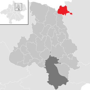
| Location of Reichenthal in the Urfahr-Umgebung district | ||
  |
||
 Place view |
||
| Source: Municipal data from Statistics Austria | ||

Reichenthal is a market town in Upper Austria in the Urfahr-Umgebung district in the upper Mühlviertel with 1491 inhabitants (as of January 1, 2020).
geography
Reichenthal lies at an altitude of 683 m in the upper Mühlviertel. The community belonged to the judicial district of Leonfelden until 2012 and has been part of the judicial district of Freistadt since January 1, 2013 . The extension is 5.4 km from north to south and 7.3 km from west to east. The total area is 18.8 km². The Kettenbach flows through the village and does not flow to the Danube , as is usual in the Mühlviertel , but to the Vltava to the Czech Republic .
Community structure
The municipality includes the following localities (population in brackets as of January 1, 2020):
- All Hat (34)
- Böhmdorf (55) including Altmühle
- Hayrl (58)
- Kohlgrub (18)
- Liebenthal (71)
- Miesenbach (41)
- Niederreichenthal (50)
- Reichenthal (912)
- Schwarzenbach (69)
- Foundation (130)
- Vierhof (53)
Area distribution:

Neighboring communities
| Vyšší Brod ( CZ ) | Rainbach | |
.svg)
|
||
| Schenkenfelden | Forest castle |
Population development
| year | Residents | change | percentage change |
|---|---|---|---|
| 2018 | 1,513 | +42 | + 2.9% |
| 2011 | 1,471 | +86 | + 6.2% |
| 2001 | 1,385 | +121 | + 9.6% |
| 1991 | 1,264 | -39 | -3.0% |
| 1981 | 1,303 |
From 1981 to 1991 the population decreased because the migration balance was very negative. In the following decades, emigration decreased and the birth balance became more positive, so that the population rose.
coat of arms
Official description of the municipal coat of arms:
- Split; on the right, in red, on the raised central dome of a green three-hill, a silver, inward-turned falcon, on the left, split three times by silver and red .
The hunting falcon from the family coat of arms of Count Grundemann von Falkenberg , who have owned Waldenfels Castle since 1636, symbolizes the close historical ties between the young market town and the manorial power at the time. The state colors white and red indicate the modern award of the coat of arms in 1950 by the Upper Austrian state government.
history
Originally located in the eastern part of the Duchy of Bavaria, the place has belonged to the Duchy of Austria since the 12th century and to the Principality of Austria ob der Enns since 1490 .
In 1357 the place was first mentioned as Reychenthal , the place name being derived from a rich, productive valley.
For centuries, salt was transported to Bohemia via the “ Hellmonsödt - Schenkenfelden - Reichenthal - Oberhaid ” mule track , a variant of the Linzer Steig .
Attractions
See also: List of listed objects in Reichenthal
- Reichenthal parish church : built in the 19th century, also called 'Mühlviertler Dom', as it is the largest church in the Mühlviertel. The pulpit of seven deadly sins is well worth seeing. The pulpit is supported by a tree trunk, around which a giant serpent with seven human heads, symbolizing the seven deadly sins, winds.
- Waldenfels Castle : The castle was built around 1300. In 1636 Konstantin Grundemann acquired it, who received the right of patronage over Reichenthal and Waldburg as a reward for his work in the Counter Reformation.
- Mühlenmuseum Reichenthal-Hayrl : The Mühlenmuseum Reichenthal-Hayrl is located at the beginning of the 10-Mühlen-Wanderweg. In the center of the museum is the house mill with the miller's room, which allows a glimpse into the former handicraft and miller's life.
- 10-Mühlen-Wanderweg: The 10-Mühlen-Wanderweg is 15.5 km long and leads past a large number of mills.
- Waldkapelle Liebenthal: The forest chapel was built on a hill in 1936. A way of the cross consisting of 14 wayside shrines leads around the chapel.

Reichenthal parish church

Seven Deadly Sins Pulpit - Anger

Waldenfels Castle

Mill museum in Reichenthal with house mill and Venetian saw (right)

Venetian saw in the mill museum

Mill Museum - general plan

Forest Chapel Liebenthal

Reichenthal municipal office


Sons and daughters of the church
- Helmuth Pree (* 1950), Roman Catholic canon lawyer
- Bernd Preinfalk (* 1966), composer and musician
Web links
- Community website
- 41620 - Reichenthal. Community data, Statistics Austria .
- Further information about the municipality of Reichenthal on the geo-information system of the federal state of Upper Austria .
- Map in the Digital Upper Austrian Room Information System ( DORIS )
- Literature on Reichenthal in the forum OoeGeschichte.at
Individual evidence
- ↑ Statistics Austria: Population on January 1st, 2020 by locality (area status on January 1st, 2020) , ( CSV )
- ↑ Statistics Austria, A look at the community of Reichenthal, population development. Retrieved May 12, 2019 .
- ^ State of Upper Austria, history and geography, coat of arms. Retrieved May 12, 2019 .
- ↑ Karl Hohensinner , Peter Wiesinger : Place Name Book of the Province of Upper Austria 10. The place names of the political district Urfahr-Umgebung (Middle Mühlviertel). Publishing house of the Austrian Academy of Sciences. Vienna 2006.
- ↑ 10-Mühlen-Wanderweg on muehlenverein.at.

Alberndorf in the Riedmark | Altenberg near Linz | Bad Leonfelden | Eidenberg | Engerwitzdorf | Feldkirchen an der Donau | Gallneukirchen | Goldwörth | Gramastetten | Haibach im Mühlkreis | Hellmonsödt | Herzogsdorf | Kirchschlag near Linz | Lichtenberg | Oberneukirchen | Ottenschlag in the Mühlkreis | Ottensheim | Puchenau | Reichenau im Mühlkreis | Reichenthal | Schenkenfelden | Sonnberg in the Mühlkreis | St. Gotthard in the Mühlkreis | Steyregg | Vorderweißbach | Walding | Zwettl on the Rodl