
Waldburg (Upper Austria)
|
Forest castle
|
||
|---|---|---|
| coat of arms | Austria map | |
 |
|
|
| Basic data | ||
| Country: | Austria | |
| State : | Upper Austria | |
| Political District : | Free City | |
| License plate : | FR | |
| Surface: | 26.53 km² | |
| Coordinates : | 48 ° 30 ' N , 14 ° 26' E | |
| Height : | 685 m above sea level A. | |
| Residents : | 1,404 (January 1, 2020) | |
| Population density : | 53 inhabitants per km² | |
| Postal code : | 4240 | |
| Area code : | 07942 | |
| Community code : | 4 06 23 | |
| NUTS region | AT313 | |
| Address of the municipal administration: |
Waldburg 38 4240 Waldburg |
|
| Website: | ||
| politics | ||
| Mayor : | Michael Hirtl ( ÖVP ) | |
|
Municipal Council : (2015) (19 members) |
||
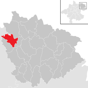
| Location of Waldburg in the Freistadt district | ||
  |
||
 Place view |
||
| Source: Municipal data from Statistics Austria | ||

Waldburg is a municipality in Upper Austria in the district of Freistadt in the Mühlviertel with 1404 inhabitants (as of January 1, 2020). The community is located in the judicial district of Freistadt .
geography
Waldburg lies at around 685 m above sea level. A. Höhe in the Mühlviertel. The extension is from north to south 8.6 km, from west to east 7 km. The total area is 26.6 km². 6.7% of the area is forested, 18.4% of the area is used for agriculture.
Community structure
The municipality includes the following 11 localities (population in brackets as of January 1, 2020):
- Freudenthal (90)
- Harruck (49)
- Lahrndorf (121) including Solberg
- Marreith (233) including Marreither and Marreithersiedlung
- Mitterreith (53)
- Oberschwandt (58)
- Prechtleinschlag (18)
- St. Peter (178) including Jaunitz and Steinkellner
- Schondorf (180)
- Unterwandt (75)
- Waldburg (349)
The community consists of the cadastral communities Schwandt and Waldburg.
Neighboring communities
| Reichenthal | Rainbach | |
| Schenkenfelden |
.svg)
|
Free City |
| Hirschbach | Neumarkt |
history
A Maierhof was built in Waldburg around 1200 and the parish church was built around 1220. During this time there was also mention of a knight dynasty dominus hezelo de Waldpurch . In 1251 the church was founded in the St. Peter district. From 1397 Waldburg belonged to the Starhemberg patronage and the parish church was rebuilt. Around 1474, Bohemian hordes besieged Waldenfels Castle, which was owned by Waldburg. In 1476 it belonged to the Freistadt parish, between 1517 and 1523 the three winged altars were built. Since 1490 the place was assigned to the Principality of Austria ob der Enns .
The Upper Austrian Peasants' War also had an impact in Waldburg. Schooling began in 1754, for which the first schoolhouse was built in 1787. In 1784 Waldburg was incorporated into the Reichenthal parish and lost its independence. During the Napoleonic Wars , the place was occupied several times. The Linz Budweis horse-drawn railway (1832) and the Summerauer Bahn (1873) passed through what is now the Waldburg municipality. In 1875 the communities of Waldburg and Schwandt merged, and in 1879 the first brass band was founded. In 1890 the community area expanded again when Harruck was ceded by the Hirschbach community. The school building, which was too small, was replaced by the new elementary school in 1900/02. 1904 led to the founding of the volunteer fire Waldenburg and St. Peter, 1912 was followed by the volunteer fire department Schwandt. After the First World War , emergency money was introduced by the community in Waldburg, and in 1924 the Waldburg gendarmerie was closed. Two major fires in 1927 destroyed parts of Waldburg. In 1934 the Waldburg water cooperative was founded and the water pipeline from Harruck to Waldburg was built.
After the annexation of Austria to the German Reich on March 13, 1938, the place belonged to the Gau Oberdonau . After 1945 Waldburg was in the Soviet zone of occupation . In December 1947 the electric current was introduced to Waldburg. 1951 followed the construction of the Sternwald-Bundesstraße (today: B38) on the northern edge of the municipality. A year later the new office building was built and in 1955 the parish hall was built.
In 1962 the water supply was expanded, in 1968 the Sportunion Waldburg and the beautification club were founded. The church was also renovated that year. In 1971 the state of Upper Austria awarded the municipal coat of arms. In 1979 the Raiffeisenbank opened and the music hall was built. In 1985 the community renovated the school house and rebuilt the kindergarten. In 1986 the fistball players of the Sportunion made it to the top Austrian league. In 1989 the district music festival took place in Waldburg. In 1994 the volunteer fire brigade moved into a new fire station ; the Jaunitztal aqueduct was built. In 2002 Waldburg celebrated the 800th anniversary of the place.
population
| year | Residents | year | Residents | |
|---|---|---|---|---|
| 1869 | 1,134 | 1951 | 1,195 | |
| 1880 | 1,162 | 1961 | 1,227 | |
| 1890 | 1,131 | 1971 | 1,227 | |
| 1900 | 1,152 | 1981 | 1,250 | |
| 1910 | 1,165 | 1991 | 1,328 | |
| 1923 | 1,237 | 2001 | 1,357 | |
| 1934 | 1,228 | 2011 | 1,371 | |
| 1939 | 1,122 | 2018 | 1,375 |
Development and structure
In 1869, 1,134 people lived in the municipality. By 2001 the population rose to 1,357, the highest level ever. In 1991 the municipality had 1,328 inhabitants, in the 2001 census it had already 1,357, which corresponds to a loss of 2.2%. On January 1st, 2008 the community had 1,346 inhabitants.
In the 2001 census, the proportion of residents aged 60 and over was 19.6%; 20.3% were under 15 years old. The proportion of the female population was 49.4%.
Of the 1081 residents of Waldburg, who were over 15 years old in 2001, 3.3% had graduated from a university , technical college or academy . A further 7.6% had completed a Matura , 44% had completed an apprenticeship or a vocational middle school and 45.1% of all Waldburgers had compulsory school as the highest qualification.
Origin and language
The German dialect, which is generally spoken in the Waldburg area and in Upper Austria, is Middle Bavarian . In 2001, 98.6% of Waldburgers gave German as a colloquial language. Another 0.3% spoke mainly Turkish , 0.2% Czech , the rest spoke other languages.
The proportion of Waldburgers with foreign citizenship was 0.8% in 2001, far below the average in Upper Austria. 0.1% of the Waldburg population had citizenship from Germany and 0.7% were other citizens. In 2001, around 2.4% of Waldburgers were born in a country other than Austria.
politics
Community representation
The municipal council and mayoral elections take place every six years, at the same time as the state elections. From 1945 the ÖVP always achieved an absolute majority. The second strongest party was the SPÖ . The FPÖ only ran for candidates in 1991 and 1997 and again in 2009, otherwise no other parties play a role in community politics. In 2003 the ÖVP became the party with the strongest vote with 66.5%. In the 2009 election, the ÖVP was able to maintain its absolute majority with 62.5% despite losses. The FPÖ ran again for this election and achieved a seat in the local council with 9%.
Mayor of the community is Michael Hirtl from the ÖVP. The municipal council consists of 19 members.
The 2015 municipal council election with a turnout of 87.3% gave the following result:
| Party / political grouping |
voting share |
Verän- alteration |
Seats on the local council |
Verän- alteration |
|---|---|---|---|---|
| ÖVP | 51.5% | −11.4% | 10 | -3 |
| SPÖ | 35.3% | + 6.8% | 7th | +2 |
| FPÖ | 13.7% | + 4.6% | 2 | +1 |
Partnerships
There has been a relationship with the eponymous community of Waldburg in Baden-Württemberg since 1979 , when a delegation from Waldburg in Württemberg, consisting of community representatives, was invited on the occasion of the 100th anniversary of the founding of the local traditional music band. In 1994 the partnership was officially sealed.
coat of arms
The municipal coat of arms shows :
- A golden, continuous bridge with two green, arched passages, in silver four green, trunkless forest trees adjoining the upper edge of the shield .
The community colors are green-yellow-green.
The bridge shows the viaduct of the Linz-Budweis horse-drawn railway, built in 1830/32, in the municipality. This viaduct has remained almost unchanged to this day and is an imposing, technical-historical, listed building over the Kronbach. The forest trees refer to the place name.
The municipal coat of arms and colors were awarded on August 16, 1971.
Economy and Infrastructure
traffic
The Böhmerwald Straße (B38) leads north of the main town through the municipality.
The small Freistadt airfield is located in the north-east of the municipality . This has a grass runway with a length of 595 meters and has the IACO identification LOLF.
Public institutions and education
A kindergarten and a primary school are available in the village . There is also a library .
There are three volunteer fire brigades in the municipality: Waldburg, St. Peter and Schwandt-Freudenthal.
Culture and sights
Buildings
- Waldburg parish church : from 1517 with three late Gothic winged altars
- Horse-drawn railway viaduct at the Bodenmühle (see municipal coat of arms)
- Church and chapel in St. Peter : First mentioned in a document around 1241, rebuilt in late Gothic style after the Hussite Wars.
- Burgstall Waldburg , a lost hilltop castle
Museums
- Mini-Agrimundus Museum: miniatures from everyday farming life
Regular events
The Waldburger Advent and Waldburger Musiksommer festivals take place regularly.
In autumn (end of November), the autumn concert of the Waldburg Trachtenmusikkapelle has been taking place since 1986. The motto of the concert is: brass music with a new sound .
Personalities
- Theodor Berger (1875–1956): politician
- P. Alois Handlbauer SM (1912–1978) from Freudenthal 13: Provincial of the Marianists, high school director in Vienna
literature
- Historical bibliography in the forum OoeGeschichte.at
Web links
- Community website
- 40623 - Waldburg. Community data, Statistics Austria .
- Entry on Waldburg in the Austria Forum (in the AEIOU Austria Lexicon )
- Further information about the community of Waldburg can be found on the geographic information system of the federal state of Upper Austria .
- Waldburg Net - through the municipality, Kabel TV Waldburg association
Individual evidence
- ↑ Statistics Austria: Population on January 1st, 2020 by locality (area status on January 1st, 2020) , ( CSV )
- ↑ a b Statistics Austria: Population and components of population development (download as pdf; 35 kB)
- ↑ a b c 2001 census: demographic data , statistik.at (pdf; 10 kB)
- ↑ Municipal council elections Percentages: Waldburg municipal elections ( page no longer available , search in web archives ) Info: The link was automatically marked as defective. Please check the link according to the instructions and then remove this notice. (accessed on October 28, 2008)
- ↑ http://www.waldburg.at/GR2009 election results, here those from 2009, on the community's homepage. Retrieved June 6, 2017.
- ^ Province of Upper Austria, results of the 2015 elections. Accessed on May 13, 2019 .
- ↑ Waldburg community, partner community. Retrieved May 13, 2019 .
- ^ Province of Upper Austria, regional history: coat of arms of the municipality of Waldburg (accessed on October 28, 2008)
- ↑ : Freistadt Airfield , riscompany.at, accessed on May 11, 2008
- ↑ Trachtenmusikkapelle Waldburg

Bad Zell | Free City | Grünbach | Gutau | Hagenberg im Mühlkreis | Hirschbach im Mühlkreis | Kaltenberg | Kefermarkt | Königswiesen | Lasberg | Leopoldschlag | Liebenau | Neumarkt im Mühlkreis | Pierbach | Pregarten | Rainbach im Mühlkreis | Sandl | St. Leonhard near Freistadt | St. Oswald near Freistadt | Schönau im Mühlkreis | Tragwein | Unterweißbach | Unterweitersdorf | Waldburg | Wartberg ob der Aist | Weitersfelden | Windhaag near Freistadt
Cadastral communities: Schwandt | Forest castle
Locations: Freudenthal | Harruck | Lahrndorf | Marreith | Mitterreith | Oberschwandt | Prechtleinschlag | Saint Peter | Schondorf | Unterwandt | Forest castle
Villages: Harruck • Oberschwandt • Sankt Peter • Schöndorf • Waldburg | Hamlet: Marreither | Rotten: Freudenthal • Lahrndorf • Mitterreith • Prechtleinschlag • Unterschwandt • Prandl | Settlements: Marreithersiedlung | Scattered houses: Marreith • Jaunitz • Solberg • Steinkellner
Counting district: Waldburg