
Hirschbach in the Mühlkreis
|
Hirschbach in the Mühlkreis
|
||
|---|---|---|
| coat of arms | Austria map | |
 |
|
|
| Basic data | ||
| Country: | Austria | |
| State : | Upper Austria | |
| Political District : | Free City | |
| License plate : | FR | |
| Surface: | 23.63 km² | |
| Coordinates : | 48 ° 29 ' N , 14 ° 25' E | |
| Height : | 640 m above sea level A. | |
| Residents : | 1,180 (January 1, 2020) | |
| Population density : | 50 inhabitants per km² | |
| Postal code : | 4242 | |
| Area code : | 07948 | |
| Community code : | 4 06 05 | |
| NUTS region | AT313 | |
| Address of the municipal administration: |
Museumsweg 5 4242 Hirschbach im Mühlkreis |
|
| Website: | ||
| politics | ||
| Mayor : | Wolfgang Schartmüller ( ÖVP ) | |
|
Municipal Council : (2015) (19 members) |
||
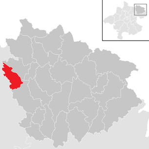
| Location of Hirschbach in the Mühlkreis in the Freistadt district | ||
  |
||
 Place view |
||
| Source: Municipal data from Statistics Austria | ||

Hirschbach im Mühlkreis is a municipality in Upper Austria in the Freistadt district in Mühlviertel with 1180 inhabitants (as of January 1, 2020). The responsible judicial district is Freistadt .
geography
Hirschbach im Mühlkreis lies at an altitude of 640 m in the Mühlviertel. The extension is 6.4 km from north to south, and 8.4 km from west to east. The total area is 23.6 km². 29.7% of the area is forested, 65.7% of the area is used for agriculture.
Community structure
The municipal area comprises the following 14 localities (population in brackets as of January 1, 2020):
- Auerbach (148)
- Mountain (33)
- Gossenreith (40) including Haid
- Guttenbrunn (109)
- Hirschbach im Mühlkreis (371)
- Hofreith (60)
- Kirchberg (75)
- Oberdorf (35)
- Oberhirschgraben (32)
- Pemsedt (36)
- Thierberg (91) including management
- Tischberg (41)
- Unterhirschgraben (82)
- Forest (27)
The community consists of the cadastral communities Guttenbrunn and Hirschbach.
Neighboring communities
| Reichenthal | ||
| Schenkenfelden |
.svg)
|
Forest castle |
| Ottenschlag | Neumarkt |
history
Originally located in the eastern part of the Duchy of Bavaria, the place belonged to the Duchy of Austria since the 12th century. The first written mention of Hirschbach comes from the year 1150. In 1374 the parish Hirschbach was mentioned as a newly founded parish. The church was consecrated to the Holy Mother of God. Since 1490 it has been assigned to the country 'Austria ob der Enns '. During this time, the new building of the church of the parish also falls, the structure of which hardly changed in the following 500 years. Kernegg Castle existed in the 13th and 14th centuries .
During the Napoleonic Wars , the place was occupied several times. Since 1918 the place belongs to the federal state of Upper Austria. After Austria was annexed to the German Reich on March 13, 1938, the place belonged to the "Gau Oberdonau". After 1945 Hirschbach was in the Soviet zone of occupation . After 1955 the infrastructure was expanded and rebuilt.
population
| Population development | ||||
|---|---|---|---|---|
| year | Residents | year | Residents | |
| 1869 | 1,146 | 1951 | 1,092 | |
| 1880 | 1,119 | 1961 | 1,163 | |
| 1890 | 1,079 | 1971 | 1,186 | |
| 1900 | 1,085 | 1981 | 1,152 | |
| 1910 | 1,190 | 1991 | 1,162 | |
| 1923 | 1,188 | 2001 | 1,186 | |
| 1934 | 1.110 | 2011 | 1,127 | |
| 1939 | 1,056 | 2018 | 1,194 | |
Development and structure
In 1869, 1146 people lived in the municipality. Until 2001 the population fluctuated around the value of 1869 and in 2001 it reached 1186 people, the highest level in history. In 1991 the municipality had 1,162 inhabitants, in the 2001 census it had already 1,186, which corresponds to an increase of 2%. On January 1st, 2008 the community had 1,124 inhabitants, a decrease.
In the 2001 census, the proportion of residents who were 60 years of age or older was 18.9%; 20.7% were under 15 years old. The proportion of the female population was 50.4%.
Of the 1081 residents of Hirschbach who were over 15 years old in 2001, 2.6% had graduated from a university , technical college or academy . A further 8.9% had completed a Matura , 45.7% had completed an apprenticeship or a vocational middle school and 43% of all Hirschbachers had compulsory school as the highest degree.

Origin and language
The German dialect, which is generally spoken in the Hirschbach area and in Upper Austria, is Middle Bavarian . In 2001, 98.3% of Hirschbach residents stated German as a colloquial language. Another 0.7% spoke mainly Turkish , 0.5% Czech , the rest spoke other languages.
The proportion of Hirschbach residents with foreign citizenship was 1.1% in 2001, well below the average in Upper Austria. 0.8% of the Hirschbach population had a citizenship of Turkey , 0.1% one from Germany and 0.2% other citizens. In 2001, around 2.3% of the Hirschbachers were born in a country other than Austria.
politics
The municipal council and mayoral elections take place every six years, at the same time as the state elections. Since 1945 the ÖVP has always achieved an absolute majority. The second strongest party was usually the SPÖ . In 2015, the ÖVP became the party with the highest number of votes with 66.3%. The SPÖ reached 33.7%.
Wolfgang Schartmüller was elected mayor of the municipality by the ÖVP with 91.3% of the vote. The municipal council consists of 19 members, 13 of them ÖVP and 6 SPÖ.
coat of arms
The municipal coat of arms shows a red, jumping deer in silver over a blue, lowered wavy bar. This makes the place name clear and also honors a local legend. The legend tells that the first settlers who came along the Gusental frightened the grazing deer. The deer fled over a stream, hence the name Hirschbach .
The municipal coat of arms and colors were awarded on September 27, 1971.
Culture and sights
.JPG)
- Parish church Hirschbach in the Mühlkreis : listed ; the Roman Catholic parish church of Hirschbach was built at the end of the 15th century and stands on an elevated point in the center of the village.
- Rustic Furniture Museum Hirschbach : There are exhibited from the time of 1780 and 1860 old and arty folk furniture that "Hirschbacher country furniture," a room of the museum is the painter Franz von Zülow dedicated. The museum also hosts several special exhibitions throughout the year.
- In Hirschbach Zülow and his time: Franz von Zülow was a painter at the beginning of the 20th century and lived in the village for a few years.
Culinary specialties
- Hirschbach is the capital of the Austrian Region of Delight Mühlviertler mountain herbs .
education
A kindergarten and a primary school are available in the village .
Economy and Infrastructure
A 38,200 m² INKOBA (intermunicipal business settlement ) building area is available.
- Voluntary fire brigade : In the community area, the 'Hirschbach volunteer fire brigade' provides fire protection and general help.
traffic
- Freistadt- Waldburg airfield : built in 1965
Personalities
- Seraphin Johann Wiesinger (1918–2002), friar of the Capuchin Order
Honorary citizen:
- Franz von Zülow (1883–1963), Austrian painter and graphic artist, lived from 1928 to 1963 for the most part in his adopted home Hirschbach
- Gossenreiter Josef, Dipl.-Ing. Mayor a. D.
- Wiesinger Stefan, retired mayor D.
literature
- Historical bibliography in the forum OoeGeschichte.at
Web links
- Hirschbach herbal power source
- More information about the municipality of Hirschbach im Mühlkreis on the geographic information system of the federal state of Upper Austria .
Individual evidence
- ↑ Statistics Austria: Population on January 1st, 2020 by locality (area status on January 1st, 2020) , ( CSV )
- ↑ a b Statistics Austria: Population and components of population development (download as pdf; 35 kB)
- ↑ a b c 2001 census: demographic data (download as pdf; 10 kB)
- ^ Province of Upper Austria, results of the 2015 elections. Accessed on May 13, 2019 .
- ^ Province of Upper Austria, regional history: coat of arms of the Hirschbach community (accessed on October 28, 2008)

Bad Zell | Free City | Grünbach | Gutau | Hagenberg im Mühlkreis | Hirschbach im Mühlkreis | Kaltenberg | Kefermarkt | Königswiesen | Lasberg | Leopoldschlag | Liebenau | Neumarkt im Mühlkreis | Pierbach | Pregarten | Rainbach im Mühlkreis | Sandl | St. Leonhard near Freistadt | St. Oswald near Freistadt | Schönau im Mühlkreis | Tragwein | Unterweißbach | Unterweitersdorf | Waldburg | Wartberg ob der Aist | Weitersfelden | Windhaag near Freistadt