
Ottenschlag in the Mühlkreis
|
Ottenschlag in the Mühlkreis
|
||
|---|---|---|
| coat of arms | Austria map | |
 |
|
|
| Basic data | ||
| Country: | Austria | |
| State : | Upper Austria | |
| Political District : | Urfahr environment | |
| License plate : | UU | |
| Surface: | 13.14 km² | |
| Coordinates : | 48 ° 28 ' N , 14 ° 23' E | |
| Height : | 806 m above sea level A. | |
| Residents : | 561 (January 1, 2020) | |
| Postal code : | 4204 | |
| Area code : | 07211 | |
| Community code : | 4 16 16 | |
| NUTS region | AT313 | |
| Address of the municipal administration: |
Marktplatz 2 4204 Reichenau im Mühlkreis |
|
| Website: | ||
| politics | ||
| Mayoress : | Katharina Kaltenberger ( ÖVP ) | |
|
Municipal Council : (2015) (13 members) |
||
| Location of Ottenschlag in the Mühlkreis in the Urfahr-Umgebung district | ||
  |
||
| Source: Municipal data from Statistics Austria | ||


Ottenschlag im Mühlkreis is an Austrian municipality in Upper Austria in the Urfahr-Umgebung district in the upper Mühlviertel with 561 inhabitants (as of January 1, 2020).
geography
Ottenschlag in the Mühlkreis is 806 m above sea level in the upper Mühlviertel . The community belonged to the judicial district of Leonfelden until 2012 and has been part of the judicial district of Freistadt since 2013 . The extension is from north to south 6.0 km, from west to east 5.1 km. The total area is 13.14 km².
Community structure
The municipality consists of the only cadastral municipality Ottenschlag and is divided into six localities (residents as of January 1, 2020):
- Hadersdorf (0)
- Helmetzedt (37) including overland
- Ottenschlag in the Mühlkreis (173) including Brunnfeld
- Puchberg (14)
- Rohrbach (104) including Herndlsberg
- Wintersdorf (233) including Eggerling, Haid and Zollerberg
Neighboring communities
| Schenkenfelden | Hirschbach in the Mühlkreis | |
| Reichenau in the Mühlkreis |
.svg)
|
Neumarkt in the Mühlkreis |
| Haibach in the Mühlkreis | Alberndorf in the Riedmark |
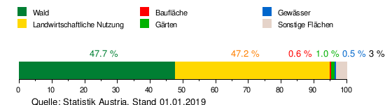
Area distribution
history
The eastern part, to which the area of today's Ottenschlag also belongs, was given a fiefdom in 1235 by Regensburg Cathedral Bailiff Otto von Lengbach. The founding year was calculated from documents to approximately the year 1240. The first settlers came from Franconia , there were a total of 13 families. Around 1270 as well as in 1277 the place was first mentioned as Ottenslage . Ottenschlag, like all new foundations in the Riedmark of Passau, was part of Otto von Lengbach's tithing and after his death passed to Duke Friedrich II , who gave Ottenschlag to the Lobensteiner as a princely fief in 1240 . Originally located in the eastern part of the Duchy of Bavaria, the place has belonged to the Duchy of Austria since the 12th century and to the Principality of Austria ob der Enns since 1490 .
The name of Ottenschlag should not come from Otto von Lengbach, but from another Otto, the clearing manager at the time. After the Lobensteiners died out, Ottenschlag became the property of the Starhembergers in 1375 . After 1411, the Starhemberg family united Ottenschlag with other possessions in the near and far vicinity to form an office of Ottenschlag and gave it to the Riedegg rulership . During the Napoleonic Wars (1792–1815), the place was occupied several times and has since returned to Upper Austria. On St. Peter's Day 1799, almost the entire village was cremated by fire. Only two houses did not fall victim to the fire. The villagers then promised to make an annual pilgrimage to Altenberg so that they would be spared from such fires in the future. Very few historical documents have survived from the very turbulent times of the 16th, 17th and 18th centuries.
After the revolution of 1848, political communities were formed from the cadastral communities. The municipality of Ottenschlag belonged to the judicial district of Bad Leonfelden from the beginning and with this until 1903 to the district administration of Freistadt. Then the district authority Urfahr-Umgebung was established. In 1905 the voluntary fire brigade Ottenschlag was founded. From 1850 to April 1938 the municipalities appointed their own mayors. Then from April 1938 to November 3, 1949, a so-called mayor's office was formed in the communities of Ottenschlag, Haibach and Reichenau, which meant that there was only one mayor for the three communities, but the communities remained economically separate. After Austria was annexed to the German Reich on March 13, 1938, Upper Austria became the Gau Oberdonau . In 1945 Upper Austria was restored. Since November 4, 1949, the Ottenschlag community has had its own mayor again. The communities Haibach , Ottenschlag and Reichenau form an administrative community based in Reichenau.
The dismantling of the local stream with bridges true to the original and the erection of dry stone walls are the reasons that Ottenschlag was awarded the environmental protection prize of the Province of Upper Austria in 1998 and 1999.
Population development


coat of arms
Blazon :
- "In green a silver, curved tip, inside an upright blueberry branch with green leaves and blue fruits, right and left a silver ax placed inwards."
The municipality colors are green-white-blue.
politics
The municipal council has a total of 13 members. With the municipal council and mayoral elections in Upper Austria in 2015 , the municipal council has the following distribution: 8 ÖVP, 3 SPÖ and 2 FPÖ.
- mayor
- 2005–2020 Franz Beirl (ÖVP)
- since 2020 Katharina Kaltenberger (ÖVP)
Web links
- Official community website
- 41616 - Ottenschlag in the Mühlkreis. Community data, Statistics Austria .
- Further information about the municipality of Ottenschlag in the Mühlkreis can be found on the geographic information system of the federal state of Upper Austria .
- Map in the Digital Upper Austrian Room Information System ( DORIS )
Individual evidence
- ↑ Statistics Austria: Population on January 1st, 2020 by locality (area status on January 1st, 2020) , ( CSV )
- ↑ a b c d Settlement and historical development of the localities and the community of Ottenschlag in the Mühlkreis. In: ottenschlag.at. Retrieved July 7, 2019 (Austrian German).
- ↑ Karl Hohensinner , Peter Wiesinger : Place Name Book of the Province of Upper Austria 10. The place names of the political district Urfahr-Umgebung (Middle Mühlviertel). Vienna 2006.
- ↑ Historical local dictionary. Retrieved July 7, 2019 .
- ^ State of Upper Austria, history and geography, coat of arms. Retrieved May 9, 2019 .

Alberndorf in the Riedmark | Altenberg near Linz | Bad Leonfelden | Eidenberg | Engerwitzdorf | Feldkirchen an der Donau | Gallneukirchen | Goldwörth | Gramastetten | Haibach im Mühlkreis | Hellmonsödt | Herzogsdorf | Kirchschlag near Linz | Lichtenberg | Oberneukirchen | Ottenschlag in the Mühlkreis | Ottensheim | Puchenau | Reichenau im Mühlkreis | Reichenthal | Schenkenfelden | Sonnberg in the Mühlkreis | St. Gotthard in the Mühlkreis | Steyregg | Vorderweißbach | Walding | Zwettl on the Rodl