
Unkenbach
| coat of arms | Germany map | |
|---|---|---|

|
Coordinates: 49 ° 43 ' N , 7 ° 45' E |
|
| Basic data | ||
| State : | Rhineland-Palatinate | |
| County : | Donnersbergkreis | |
| Association municipality : | North Palatinate Country | |
| Height : | 229 m above sea level NHN | |
| Area : | 5.13 km 2 | |
| Residents: | 204 (Dec. 31, 2019) | |
| Population density : | 40 inhabitants per km 2 | |
| Postal code : | 67823 | |
| Area code : | 06362 | |
| License plate : | KIB, ROK | |
| Community key : | 07 3 33 078 | |
| Association administration address: | Schulstrasse 16 67821 Alsenz |
|
| Website : | ||
| Local Mayor : | Frank Mueller | |
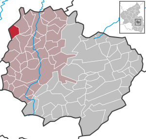
| Location of the local community Unkenbach in the Donnersbergkreis | ||
  |
||

Unkenbach is a municipality in the Donnersbergkreis in Rhineland-Palatinate . It belongs to the Verbandsgemeinde Nordpfälzer Land , which has its administrative headquarters in the municipality of Rockenhausen and an additional administrative office in Alsenz .
geography
Unkenbach is located in the North Palatinate Mountains north of the Palatinate Forest . To the northeast is Obermoschel , to the southwest is Callbach .
politics
Municipal council
The council in Unkenbach consists of six council members, who in the local elections on May 26, 2019 in a majority vote were elected, and the honorary mayor as chairman.
Local mayor
The local mayor is Frank Müller. In the local election on May 26, 2019, he was elected with 60.15% of the vote. He is the successor to Anke Schamaitis.
coat of arms
|
|
Blazon : “In a wavy cut divided by silver and black; above a growing blue lion, armored, tongued and crowned with red, below a golden, red tongued snake. " |
Economy and Infrastructure
Although 68.4% of the district area is used for agriculture, agriculture has been on the decline for decades. In 2005 there were still six farms, two of which were full-time.
The B 420 runs through the village . There is a connection to long-distance traffic via the A 63 in the southeast and the A 61 in the northeast. Closest train station is Alsenz at the alsenz valley railway .

See also
literature
- Werner Müller, Claus Bensing: The Unkenbacher Ortschronik . Unkenbach 2007.
- Literature about Unkenbach in the Rhineland-Palatinate State Bibliography
Web links
Individual evidence
- ↑ State Statistical Office of Rhineland-Palatinate - population status 2019, districts, communities, association communities ( help on this ).
- ^ The regional returning officer RLP: Municipal council election 2019 Unkenbach. Retrieved August 28, 2019 .
- ^ The regional returning officer RLP: direct elections 2019. see Nordpfälzer Land, Verbandsgemeinde, 30th line of results. Retrieved August 28, 2019 .
- ^ The Rhine Palatinate: Unkenbach: Arno Mohr is first alderman. August 26, 2019. Retrieved August 28, 2019 .

Albisheim (Pfrimm) | Alsenz | Bayerfeld-Steckweiler | Bennhausen | Biedesheim | Bischheim | Bistiffer | Bolanden | Börrstadt | Breunigweiler | Bubenheim | Dannenfels | Dielkirchen | Dried mussel | Dreisen | Solitude | Eisenberg (Palatinate) | Falkenstein | Finkenbach-Gersweiler | Gauersheim | Gaugrehweiler | Gehrweiler | Gerbach | Göllheim | Gonbach | Gundersweiler | Höringen | Ilbesheim | Immesheim | Imsbach | Imsweiler | Jakobsweiler | Lime kiln | Katzenbach | Candle Home | Kirchheimbolanden | War field | Lautersheim | Pay field | Mannweiler-Cölln | Marnheim | Morschheim | Mörsfeld | Münchweiler an der Alsenz | Münsterappel | Niederhausen an der Appel | Niedermoschel | Oberhausen an der Appel | Upper Muschel | Oberndorf | Oberwiesen | Orbis | Ottersheim | Ramsen | Ransweiler | Rathskirchen | Reichsthal | Rittersheim | Rockenhausen | Ruppertsecken | Rüssingen | Saint Alban | Schiersfeld | Schönborn | Schweisweiler | Souls | Sippersfeld | Sitters | Stahlberg | Standenbühl | Steinbach am Donnersberg | Stetten | Teschenmoschel | Unkenbach | Waldgrehweiler | Wartenberg-Rohrbach | Weitersweiler | Winnweiler | Winterborn | Würzweiler | Zellertal